5.7Km
5.7Km
Note
 11.2Km
12.1Km
13.9Km
14.5Km
14.5Km
14.9Km
15.5Km
16Km
16.3Km
11.2Km
12.1Km
13.9Km
14.5Km
14.5Km
14.9Km
15.5Km
16Km
16.3Km
5.7Km
6.7Km
6.9Km
7.2Km
7.4Km
7.6Km
7.9Km
8.1Km
8.3Km
8.7Km
Attrezzato in maniera molto speditiva, necessario integrare punti mancanti per mancorrenti e alcune calate.
L'acqua è gelida tutto l'anno data la quota, l'esposizione e le alte vette da cui nasce il Vogna.
Anche in piena estate è possibile trovare un nevaio all'interno della forra.
Avvicinamento
L'acqua è gelida tutto l'anno data la quota, l'esposizione e le alte vette da cui nasce il Vogna.
Anche in piena estate è possibile trovare un nevaio all'interno della forra.
In macchina: da Riva Valdobbia salire per la strada della Val Vogna fino a Ca di Janzo, qui parcheggiare.
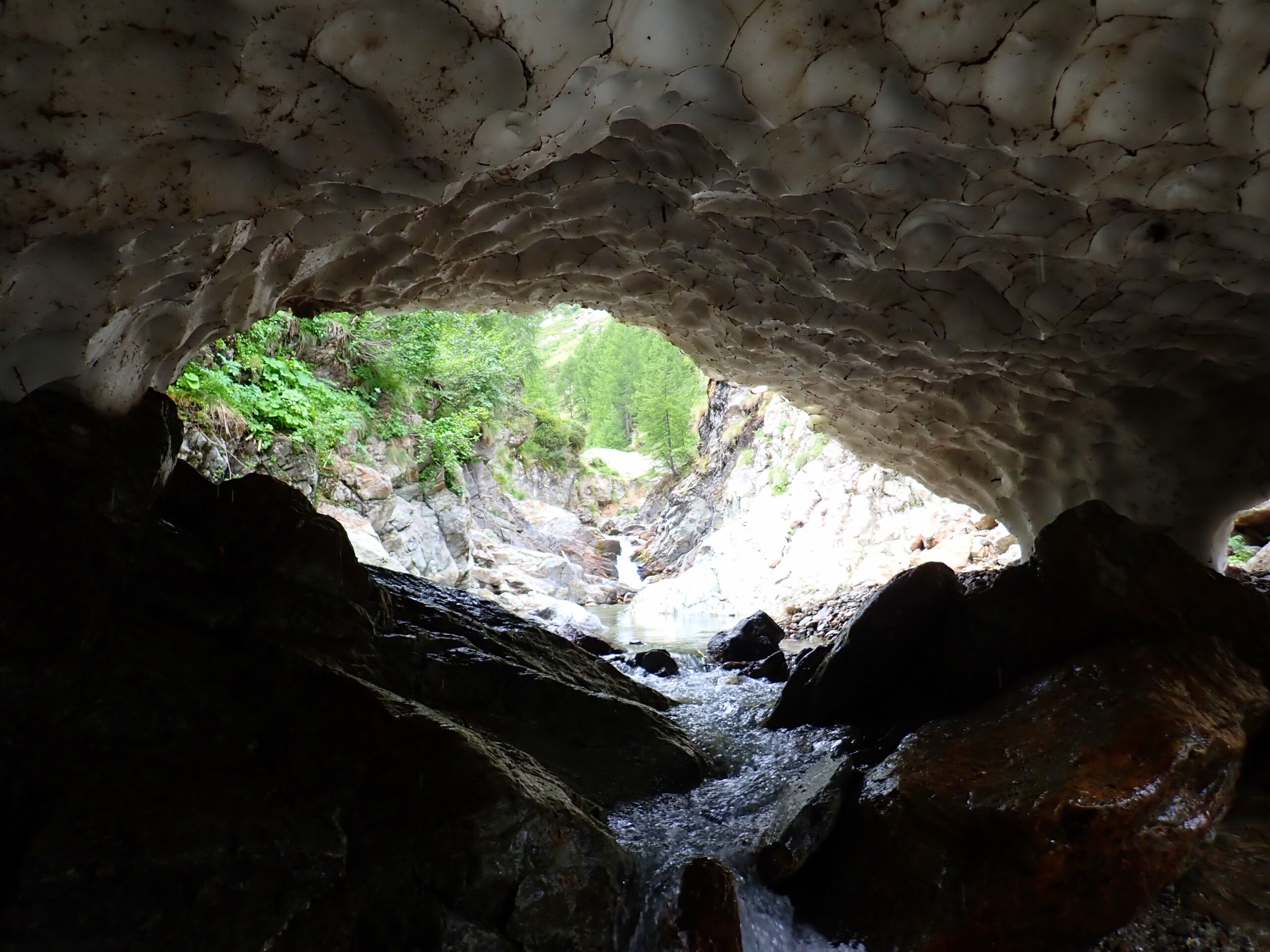
A piedi: proseguire sulla strada prima asfaltata, poi sterrata fino a Peccia. Qui prendere il sentiero 201, poi al ponte napoleonico prendere il sentiero 205 per il passo del Maccagno (gta), seguirlo fino all'alpe Buzzo inferiore. Poco più avanti si passa sopra alla forra da percorrere (corridoio ben visibile), quindi proseguire poche decine di metri ed entrare nel torrente appena possibile.
Descrizione
A piedi: proseguire sulla strada prima asfaltata, poi sterrata fino a Peccia. Qui prendere il sentiero 201, poi al ponte napoleonico prendere il sentiero 205 per il passo del Maccagno (gta), seguirlo fino all'alpe Buzzo inferiore. Poco più avanti si passa sopra alla forra da percorrere (corridoio ben visibile), quindi proseguire poche decine di metri ed entrare nel torrente appena possibile.
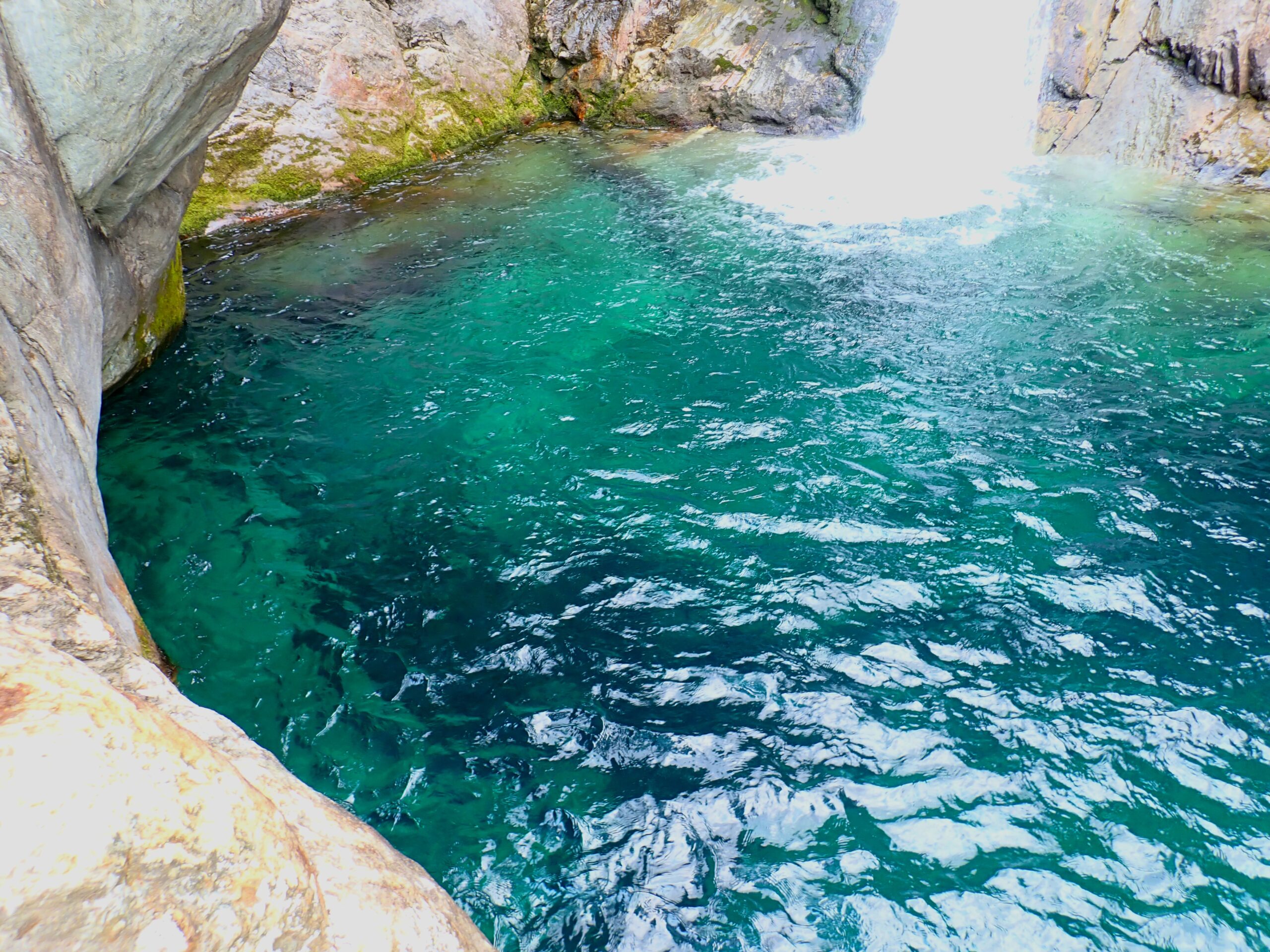
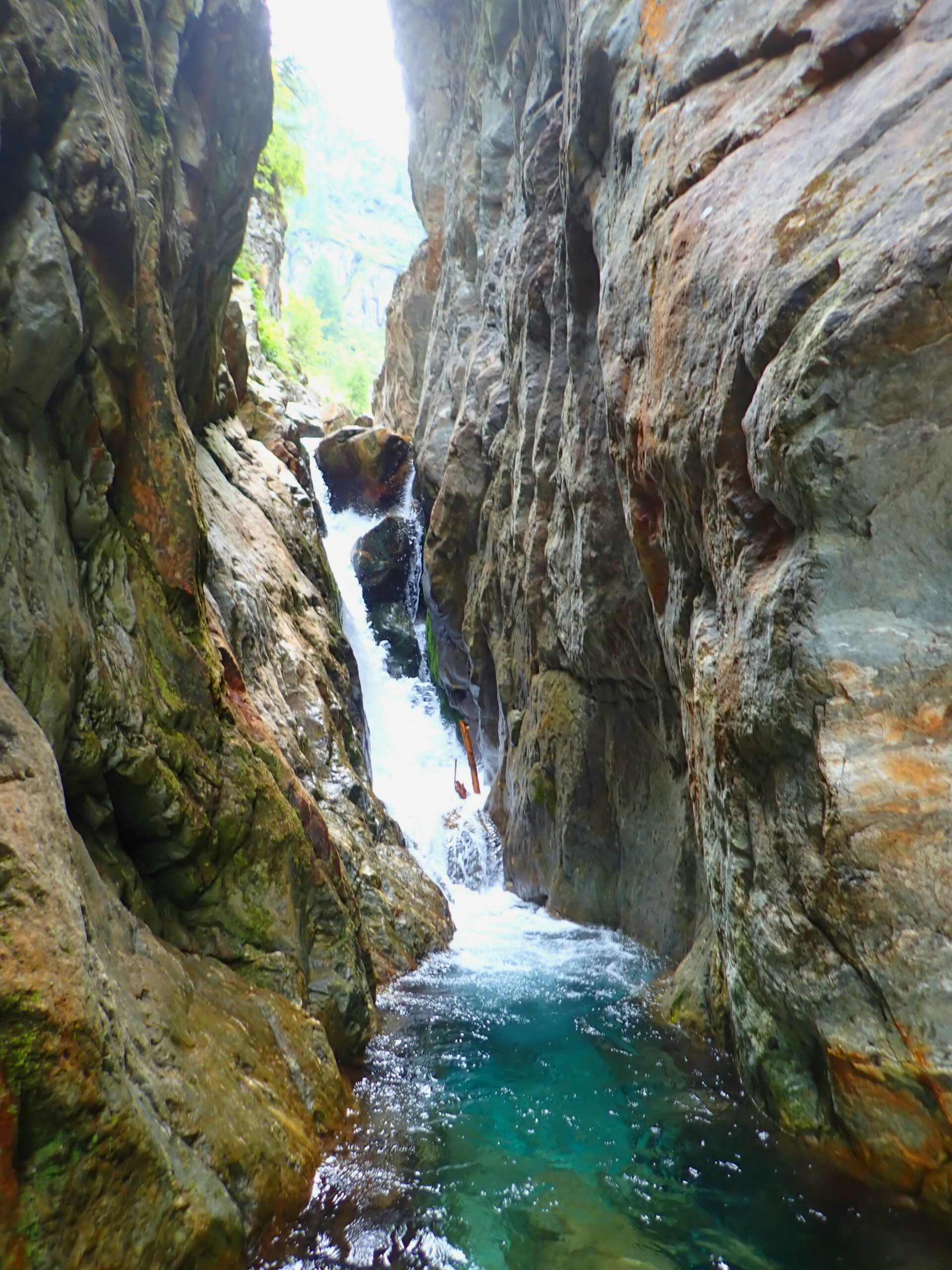
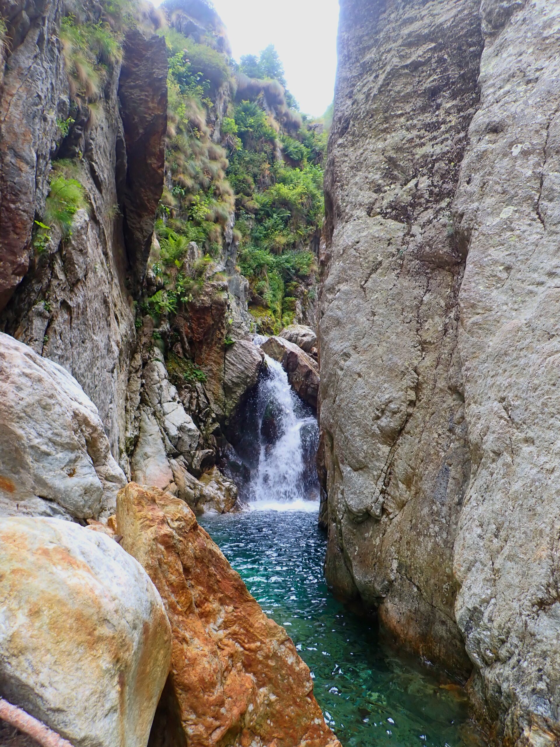
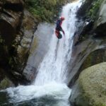
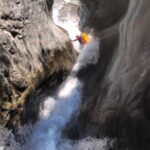
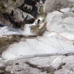
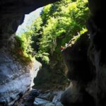
Si comincia con qualche semplice disarrampicata fino a una marcata svolta a sinistra (qui spesso si deposita una grossa valanga), si trova la prima C5 (non attrezzata) e subito C7sx (singolo), sotto la forra è molto stretta.
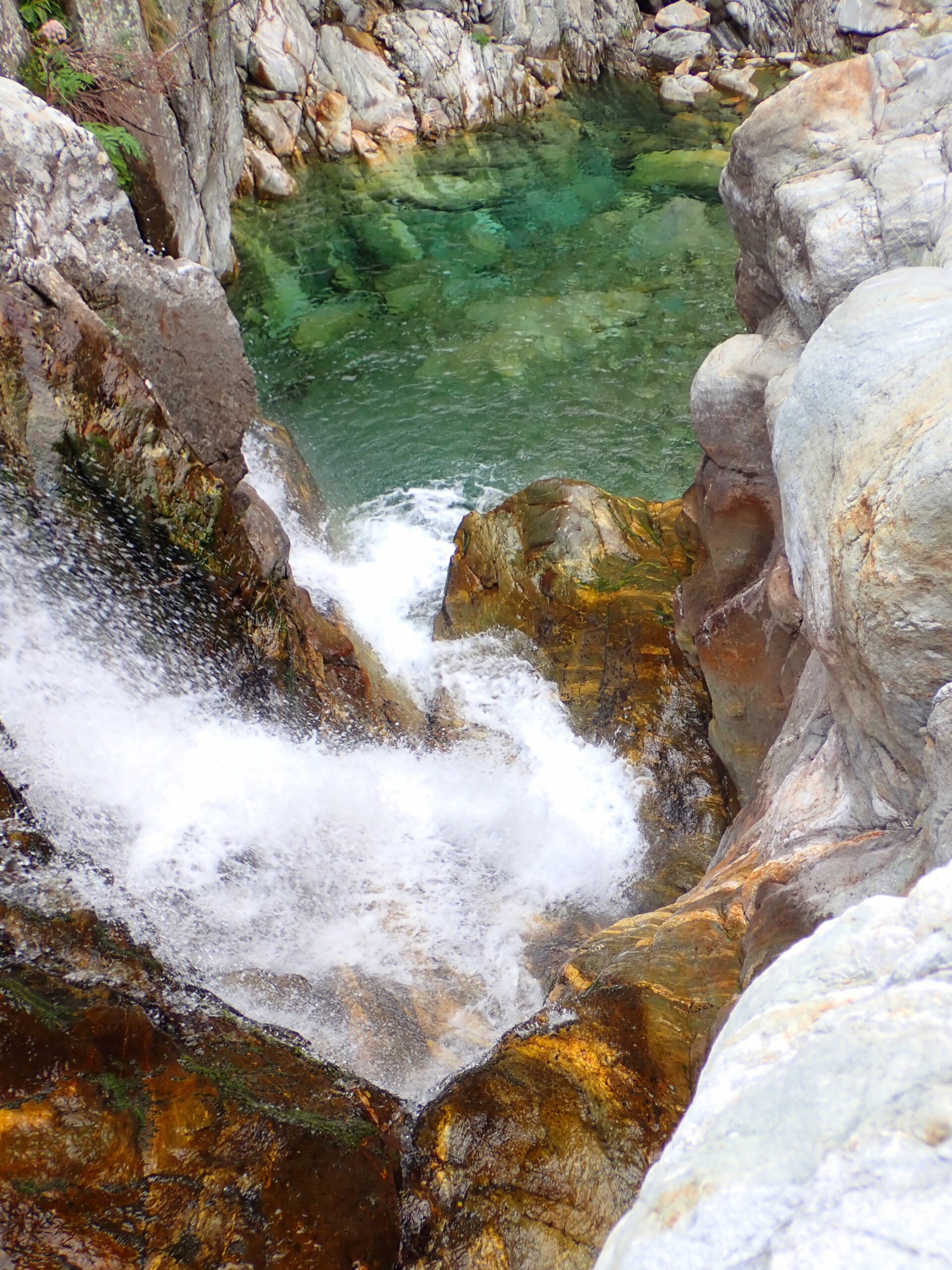
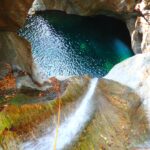
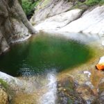
Due belle pozze portano a C12dx (singolo, possibile tuffo nella fantastica pozza sottostante), poi C7 (non attrezzata, possibile tuffo preciso), C3 (non attrezzata, anche qui è possibile trovare un nevaio).
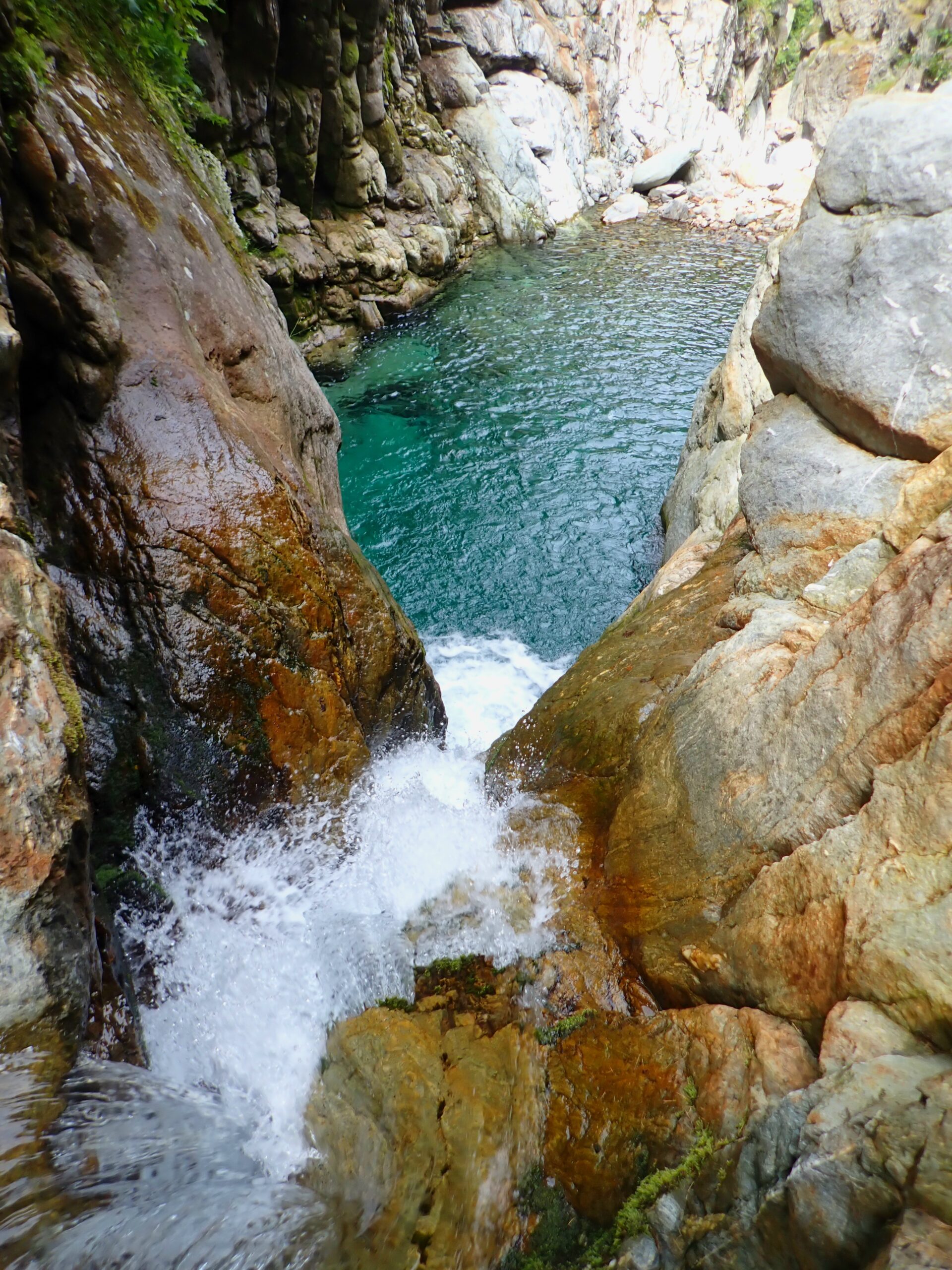
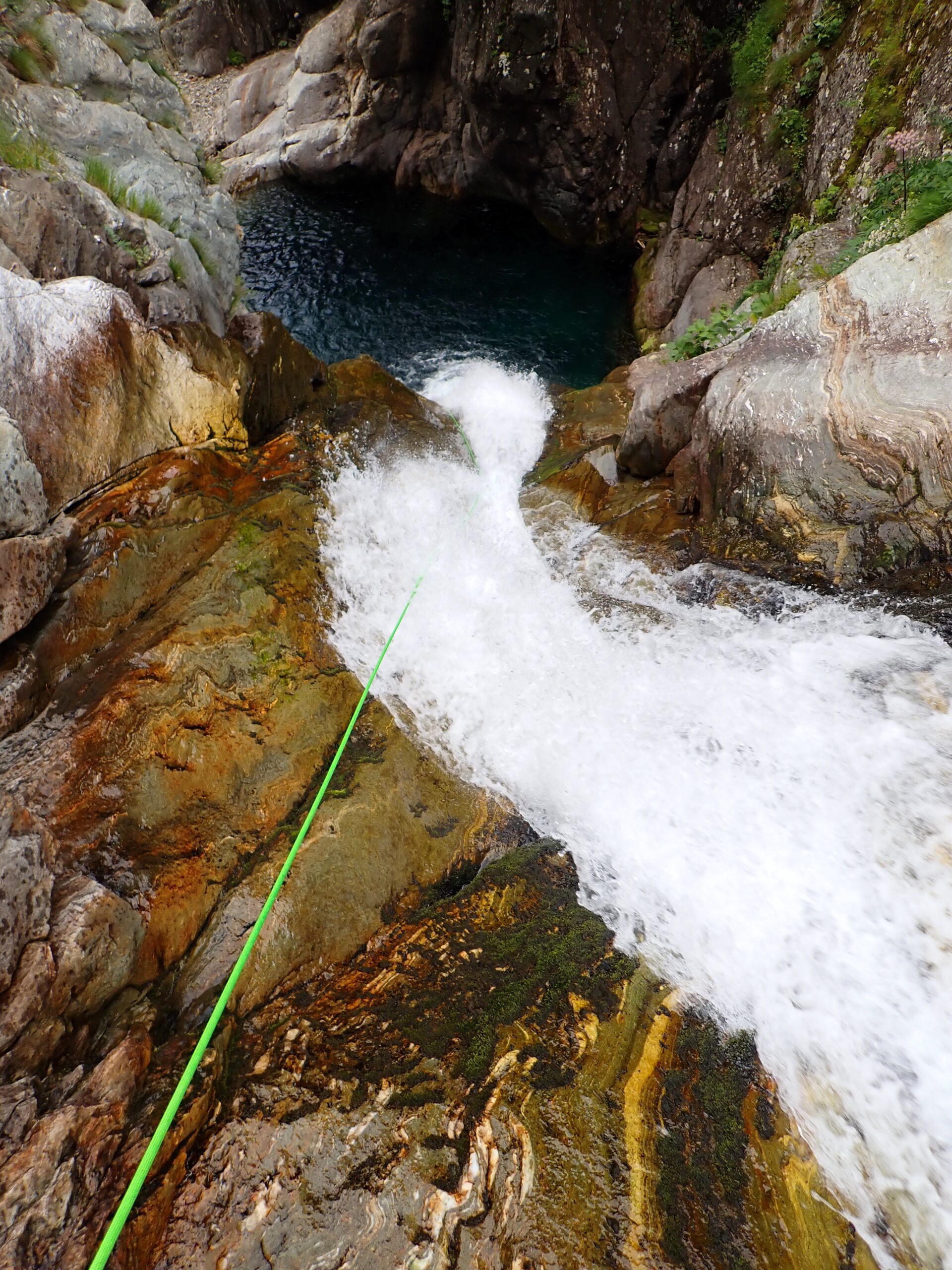
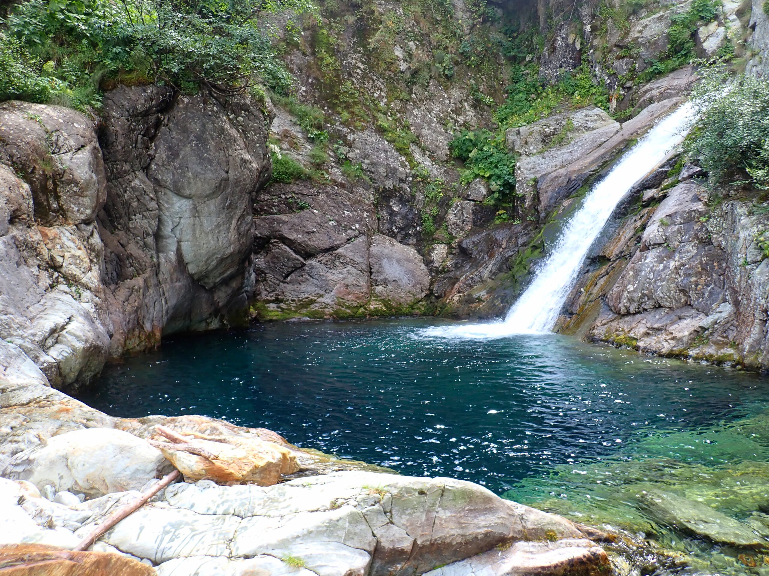
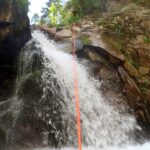
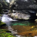
Si giunge alla cascata più alta C25sx (singolo, per raggiungerlo passaggio esposto, servirebbe un mancorrente).
La pozza sottostante è spettacolare e permette vari tuffi anche molto alti.
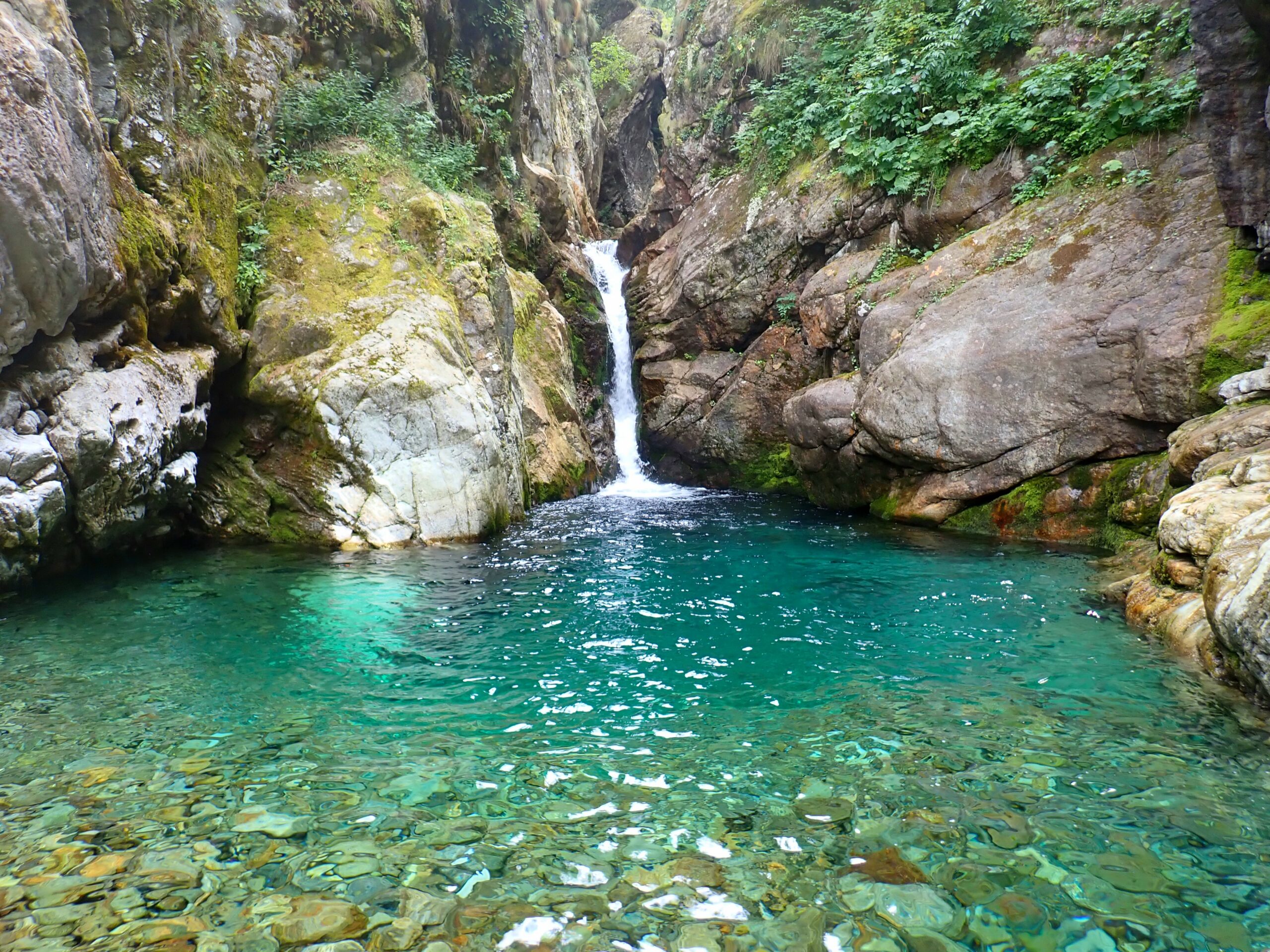
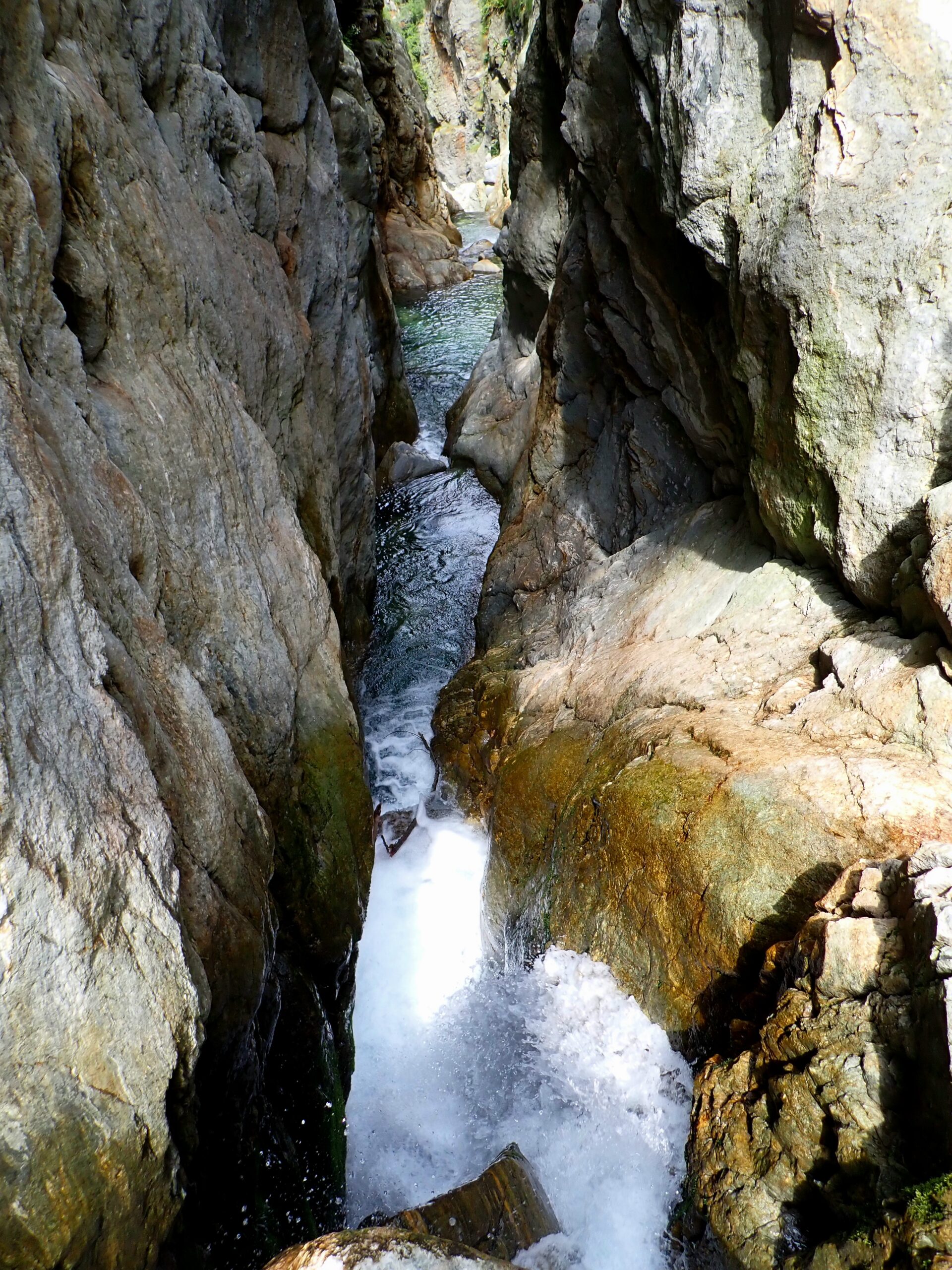
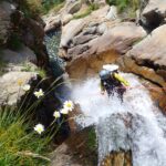
In seguito C18dx che porta al termine del canyon, bisogna camminare 10 min. circa per raggiungere un punto in cui è facile salire al sentiero a dx.
- Cartografia:
- Carta della Valsesia 1:25.000, quadrante sud-ovest
Nelle vicinanze Mappa
Itinerari
17/07/2025 VC, Rassa 0.4 Km II, V3, A3 Nord-Est
Sorba Superiore (Torrente)
 11.2Km
10/08/2025 VC, Alagna Valsesia 1 Km III, V4, A3 Sud
Acqua Bianca (Canyon)
 12.1Km
05/10/2025 VC, Riva Valdobbia 1.5 Km V, V5, A2 Sud
Valpiana (Rio di)
13.2Km
10/09/2024 VC, Alagna Valsesia II, V4, A2 Est
Rio Laghetto
 13.9Km
17/08/2024 VC, Alagna Valsesia III, V4, A4 Varie
Artogna
 14.5Km
30/05/2025 VC, Mollia II, V4, A2 Sud
Sauros
 14.5Km
18/08/2025 AO, Fontainemore II, V3, A3
Pacoulla
 14.9Km
02/08/2025 VC, Piode 1 Km II, V3, A5 Nord-Est
Sorba inferiore
 15.5Km
02/07/2025 VC, Campertogno 0.7 Km II, V3, A2 Varie
Croso del Basaleto
 16Km
16Km
06/10/2023 VC, Rima San Giuseppe 0.7 Km II, V2, A3 Nord-Est
Nonaj (Rio)
 16.3Km
Servizi
5.7Km
6.7Km
Alpe Salei Rifugio
Rassa
6.9Km
Bìerfall Ristorante
Gressoney-Saint-Jean
7.2Km
La Gruba B&B
Gaby
7.4Km
Zar Senni Rifugio
Alagna Valsesia
7.6Km
Mologna Albergo
Gaby
7.9Km
Des Alpes Bar
Gaby
8.1Km
Flying brasserie (Paul Verlaine) Ristorante
Gressoney-Saint-Jean
8.3Km
Gran Baita Albergo
Gressoney-Saint-Jean
8.7Km