1.8Km
1.8Km
Scarica l'APP per l'outdoor nelle valli del Grand Combin
Grand Combin Outdoor è una app mobile con oltre 100 itinerari con cartografia completa (anche offline), descrizioni e aggiornamenti.
Note
 0m
750m
750m
750m
750m
750m
3Km
0m
750m
750m
750m
750m
750m
3Km
1.8Km
2.3Km
3Km
5Km
5.3Km
5.3Km
5.3Km
5.7Km
6.1Km
6.8Km
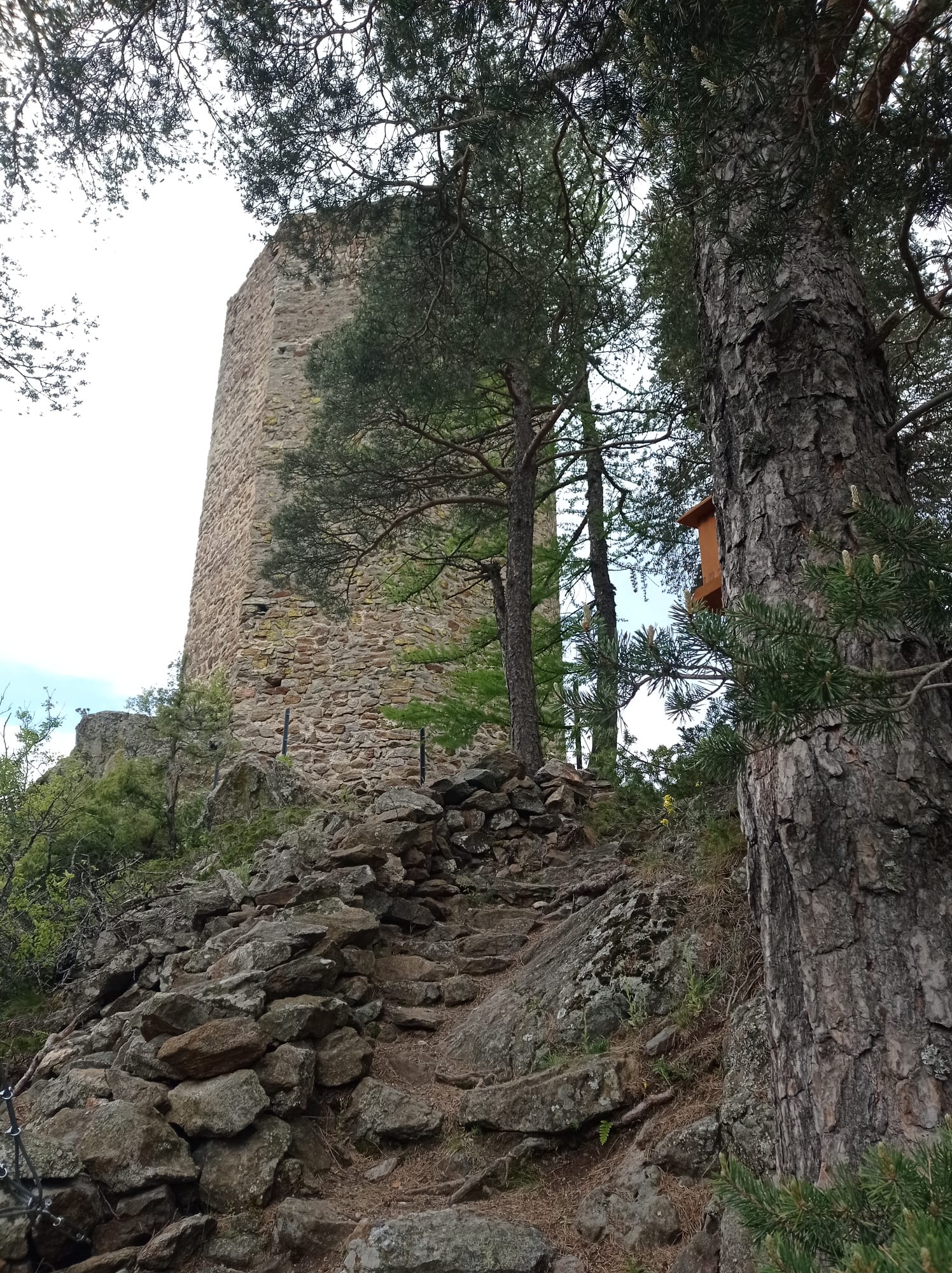
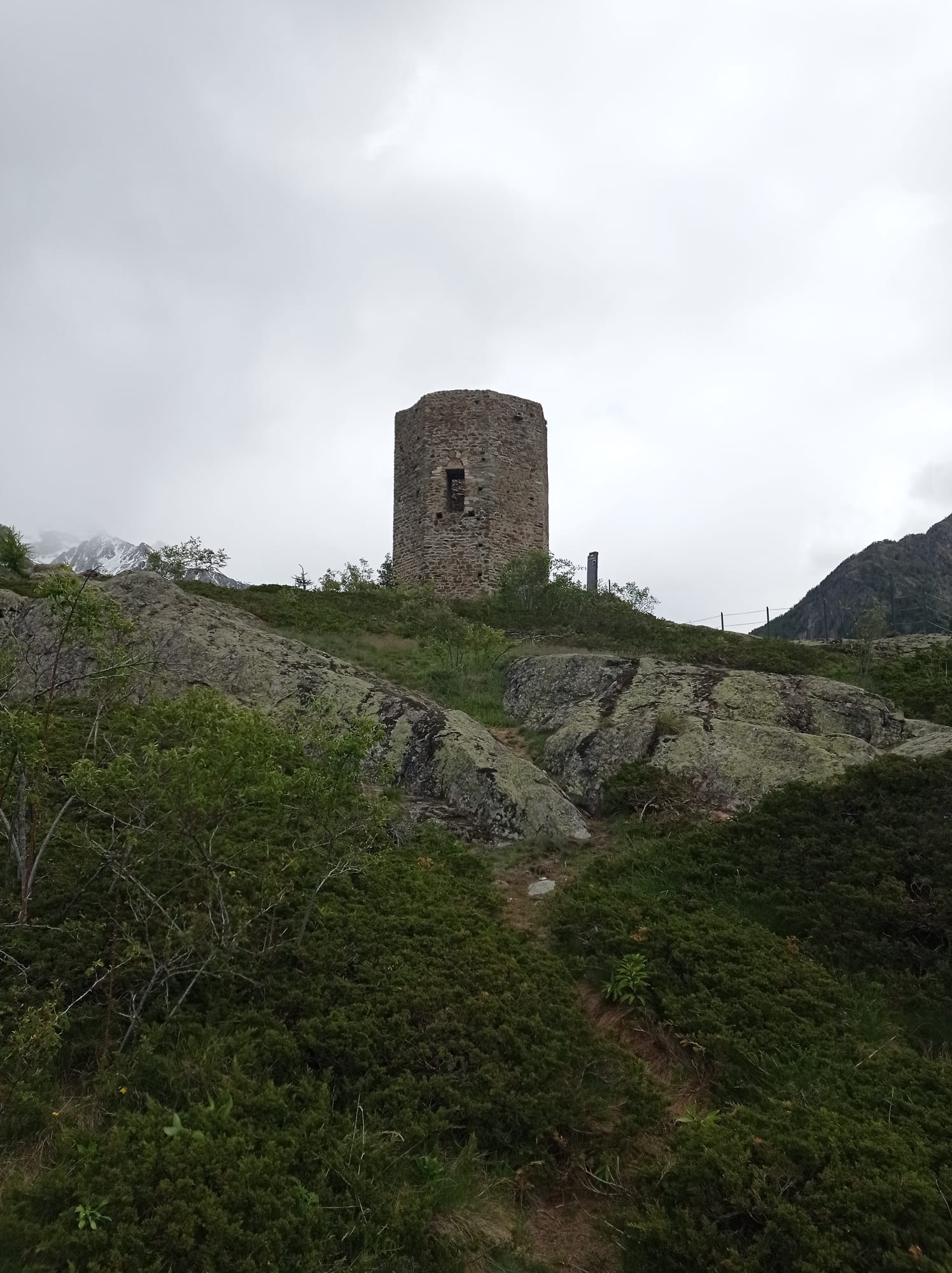
La Tornalla (o Tour d’Oyace) è una torre d’epoca medievale a forma ottagonale. E’ stata costruita al di sopra di un promontorio roccioso che domina dall’alto il piccolo comune di Oyace.
Unico esempio in Valle d’Aosta di una costruzione del genere, ha un diametro interno di 3,5 m esterno di 7,5 m ed un’ altezza di 11,7 m. La sua sagoma è stata inserita nel gonfalone del comune. Alla torre è collocato un pannello informativo con la storia della Tornalla.
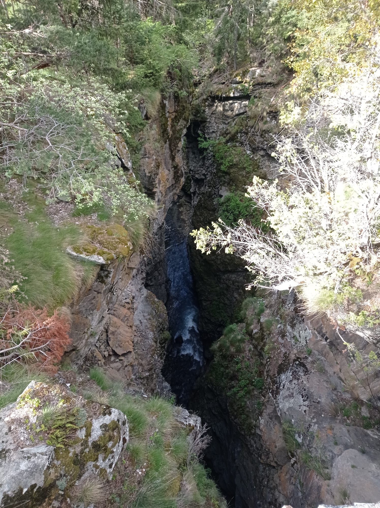
Il percorso, un giro ad anello, è una piacevole escursione adatta a tutti, poco faticosa e dal dislivello contenuto ma molto varia, con belle vedute sulle cime dell’alta Valpelline, alternata e splendidi boschi con l’aggiunta del suggestivo orrido che si attraversa grazie al Ponte della Betenda sul torrente Buthier, risalente al 1688.
Avvicinamento
Unico esempio in Valle d’Aosta di una costruzione del genere, ha un diametro interno di 3,5 m esterno di 7,5 m ed un’ altezza di 11,7 m. La sua sagoma è stata inserita nel gonfalone del comune. Alla torre è collocato un pannello informativo con la storia della Tornalla.
Il percorso, un giro ad anello, è una piacevole escursione adatta a tutti, poco faticosa e dal dislivello contenuto ma molto varia, con belle vedute sulle cime dell’alta Valpelline, alternata e splendidi boschi con l’aggiunta del suggestivo orrido che si attraversa grazie al Ponte della Betenda sul torrente Buthier, risalente al 1688.
Dal casello di Aosta Est imboccare la galleria lungo la strada E27 che conduce nella valle del Gran San Bernardo, al cui termine si incontra la SS27 proveniente dal centro di Aosta. Appena prima di Gignod, subito dopo l’ultima galleria, si procede a destra seguendo la SR28 della Valpelline, raggiungendo il capoluogo.
Proseguire in direzione Bionaz ancora per 8 km lungo la SR28 fino al centro di Oyace, appena superato l’edificio comunale sulla sinistra si incontra un posteggio.
Descrizione
Proseguire in direzione Bionaz ancora per 8 km lungo la SR28 fino al centro di Oyace, appena superato l’edificio comunale sulla sinistra si incontra un posteggio.
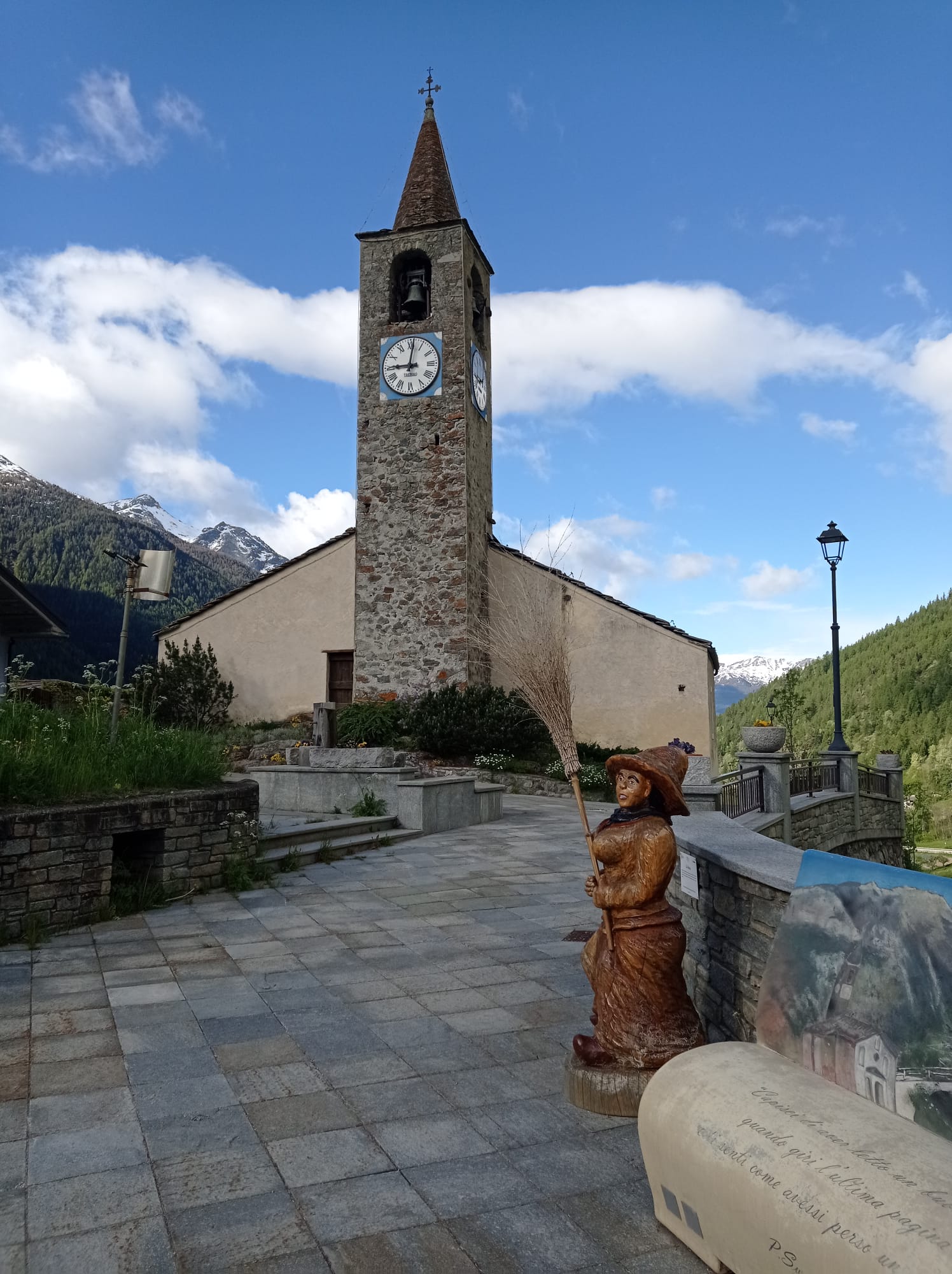
Dal parcheggio si scende lungo la strada regionale per pochi metri fino a raggiungere la bella Chiesa di Oyace dedicata a San Michele, dalla quale si gode di un vasto panorama sulla bassa Valpelline. Si segue il sentiero n.3 a fianco dell’edificio e si scende lungo una bella mulattiera lastricata a fianco di un prato che termina sulla strada provinciale della Valpelline. Seguendola per pochi metri in discesa si arriva alle frazioni Grenier e Vernosse.
Si attraversano le case percorrendo una stradina asfaltata fino a raggiungere un ponte sul Torrente Buthier che va oltrepassato; subito dopo si incontra il cartello segnaletico per il Ponte della Betenda, segnavia n.5 ed il sentiero sulla sinistra.
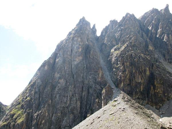
Il sentiero pianeggiante fiancheggia un prato, mentre, se si volge lo sguardo in alto verso nord si può vedere la sagoma della Tornalla. Si arriva all’inizio di un bel bosco di conifere e larici con una fontana; il sentiero prosegue, sempre pianeggiante, tappezzato di aghi di larice nel fresco bosco fino a raggiungere il caratteristico ponte in pietra a schiena d’asino Betenda, che permette di attraversare l’orrido nel suo punto più stretto e profondo 54 m! La presenza di cavi rende sicuro il passaggio anche ai bambini.
Si prosegue a ritroso rispetto al percorso seguito finora ma sul lato opposto del solco del torrente, fino ad incontrare un bivio dove si mantiene il sentiero più basso n.3 che prosegue in piano raggiungendo una radura, alle pendici della Tornalla, con le baite in pietra di Betenda 1356 m dove scorre un torrente.
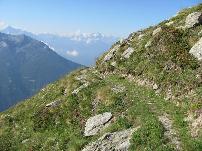
Passando fra le case si segue il sentiero che adesso inizia a salire in direzione nord all’interno del fitto bosco con buona pendenza; affrontati alcuni tornanti il percorso torna più comodo e si aprono scorci panoramici anche sul versante nord della Valpelline.
Raggiunto un colletto nel bosco si continua dritti seguendo il facile sentiero che con alcuni saliscendi raggiunge la base del promontorio su cui si erge la torre: si supera un brevissimo gradino di pietra grazie ad un mancorrente, ed ecco la torre Tornalla.
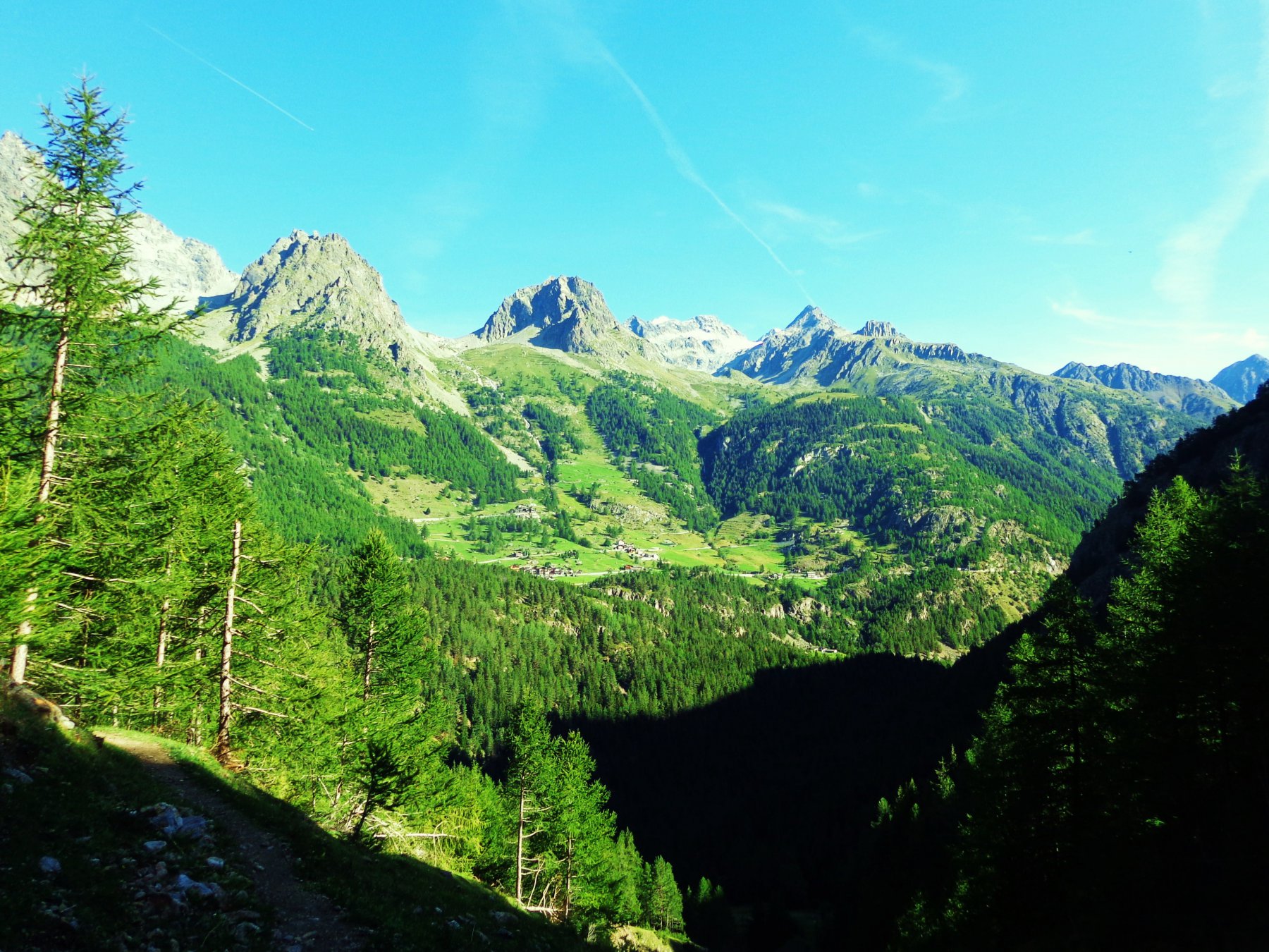
Qui affacciandosi sul versante più soleggiato, privo di vegetazione, si potrà ammirare un panorama a 360° della media e alta Valpelline, nonché una suggestiva veduta dall’alto del borgo di Oyace.
Per il rientro ad Oyace si fa ritorno al precedente colletto boscoso, dove occorre proseguire sulla sinistra in discesa, seguendo l’ampia mulattiera che rapidamente scende sul versante ovest del promontorio. Con una piccola deviazione si può raggiungere un’area giochi per bambini sulla sinistra, mentre continuando il percorso si arriva ad una abitazione circondata da un prato. Si prosegue a sinistra tra due muretti raggiungendo la strada provinciale, che si attraversa per continuare sul sentiero n.3, una bella mulattiera che corre parallela alla strada. Raggiunto velocemente il centro di Oyace percorrendo la via principale si fa ritorno al parcheggio del municipio.
Nelle vicinanze Mappa
Itinerari
16/07/2019 AO, Oyace D+ 1200 m E Sud-Est
Breson (Col de) da Oyace
 0m
0m
12/08/2003 AO, Oyace D+ 1600 m EE Sud
Berrio (Colle) da Oyace per il versante sud
50m
20/08/2021 AO, Oyace D+ 1600 m E Nord
Vessona (Colle di) da Closè
 750m
750m
08/09/2014 AO, Oyace D+ 1830 m EE/F Nord
Vessona (Dente Settentrionale di) da Closè
 750m
750m
24/02/2025 AO, Oyace D+ 1057 m E Nord-Ovest
Verdonaz (Cappella di) da Oyace
750m
19/06/2024 AO, Oyace D+ 1436 m EE Varie
Morion (Becca) da Oyace per il Vallone di Verdona e il Col de l’Arpeyssaou
750m
13/08/2017 AO, Oyace D+ 1395 m EE Varie
Coteau du Fond (Col du) da Oyace
 750m
750m
12/09/2021 AO, Oyace D+ 1330 m EE Nord
Vamea (Colle di) da Oyace, anello per valloni di Verdona e Vessona
 750m
750m
15/08/2022 AO, Oyace D+ 3050 m EE Tutte
Livournea (Colle di) da Oyace, giro della Becca di Luseney per i colli Terray, Chaleby, Vessonaz
 750m
750m
22/08/2010 AO, Bionaz D+ 1009 m EE/F Est
Duc (Col) da Ruz
 3Km
3Km
Servizi
1.8Km
2.3Km
Lac Lexert Campeggio
Bionaz
3Km
Crête Sèche Rifugio
Bionaz
5Km
Vecchio Suisse Ristorante
Valpelline
5.3Km
Clé du Paradis B&B
Bionaz
5.3Km
Valentino Albergo
Bionaz
5.3Km
Betemps B&B
Bionaz
5.7Km
Lievre Amoureux Albergo
Valpelline
6.1Km
Alpe Rebelle B&B
Bionaz 6.8Km
6.8Km