100m
100m


Note
 0m
0m
0m
0m
0m
0m
0m
0m
0m
0m
0m
0m
0m
0m
0m
0m
0m
0m
0m
0m
100m
200m
2.5Km
4.2Km
6.4Km
7.2Km
7.8Km
8.1Km
8.4Km
9.9Km
Utile il casco per la parte finale, anche per la presenza di stambecchi stanziali.
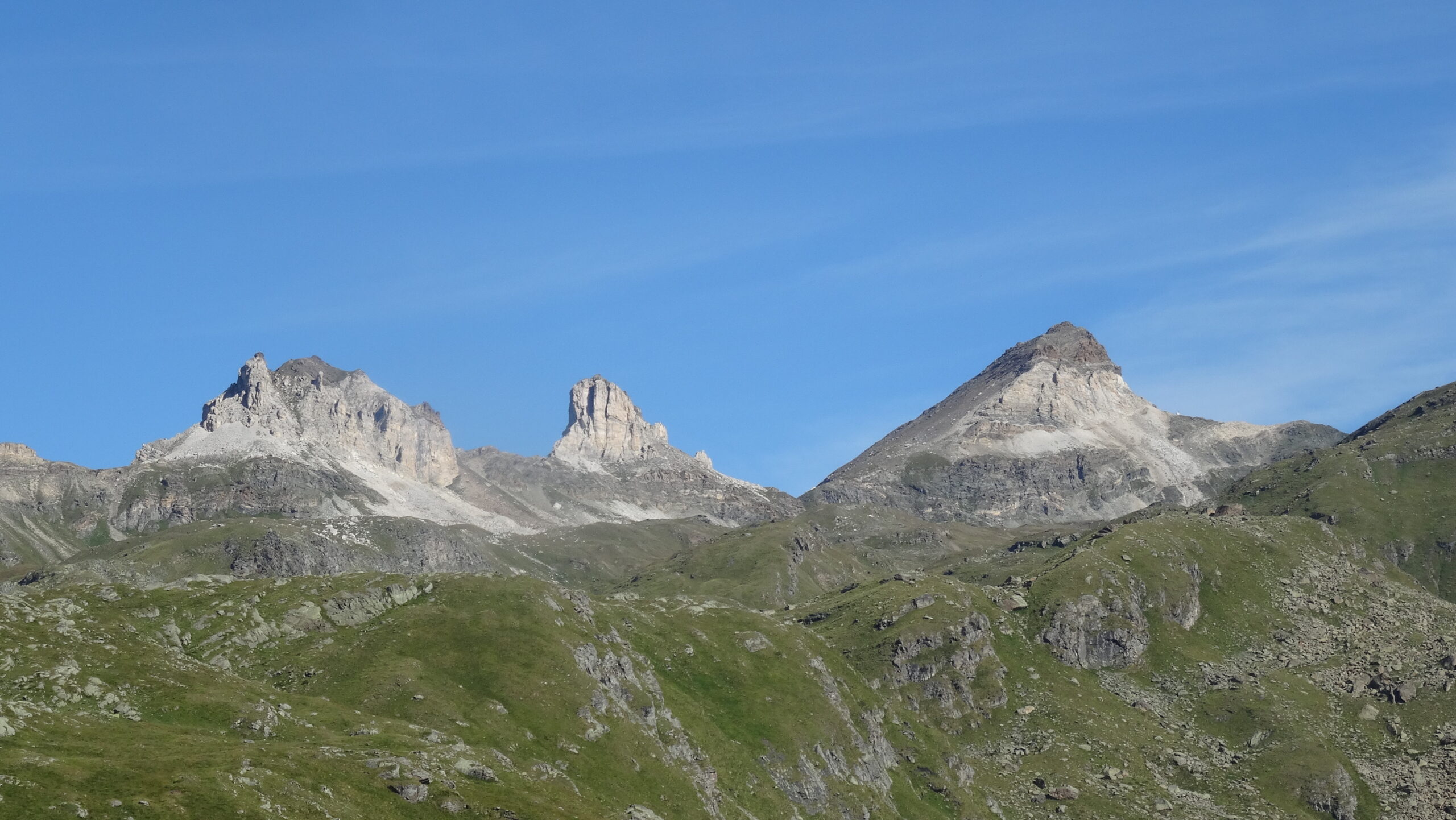
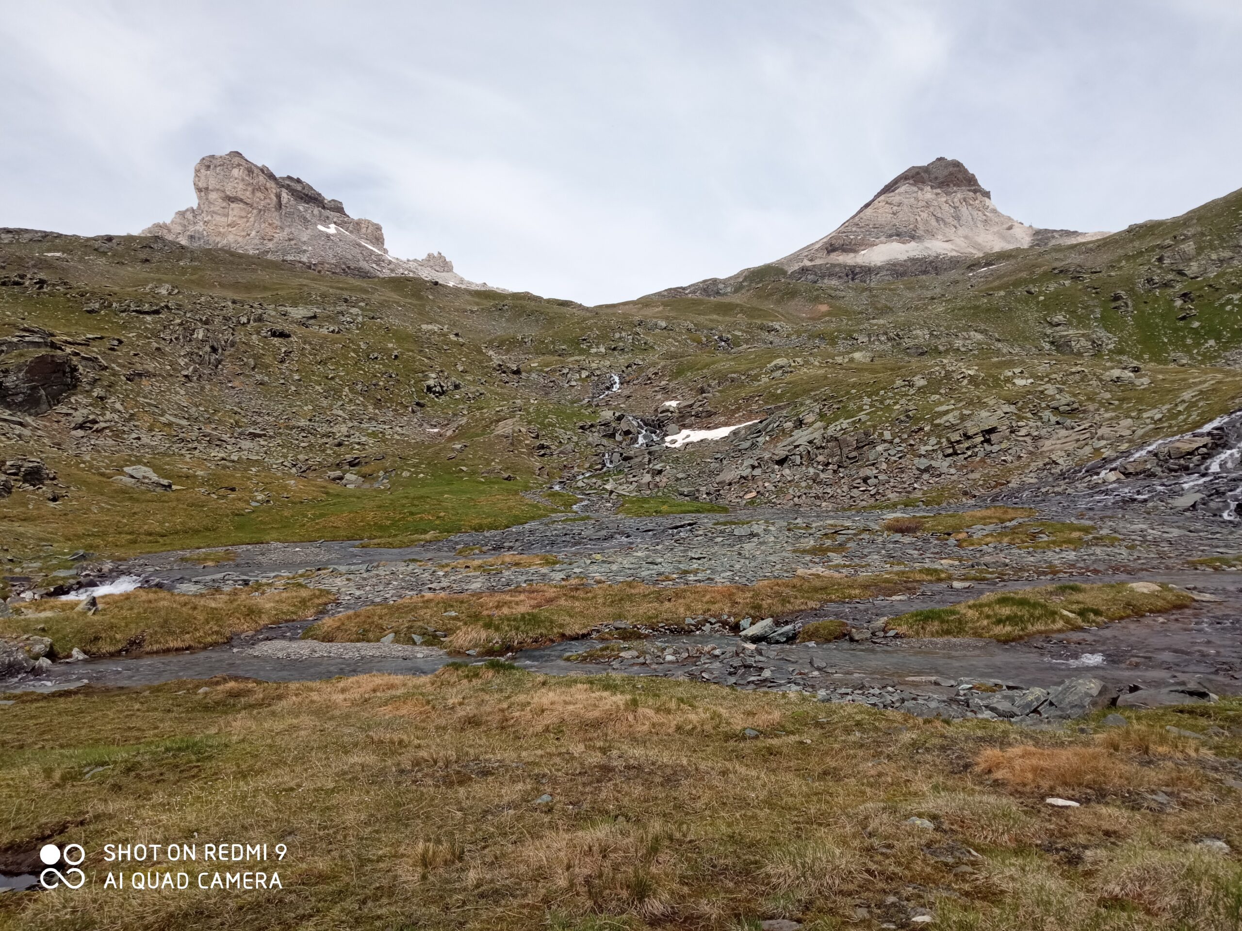
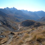
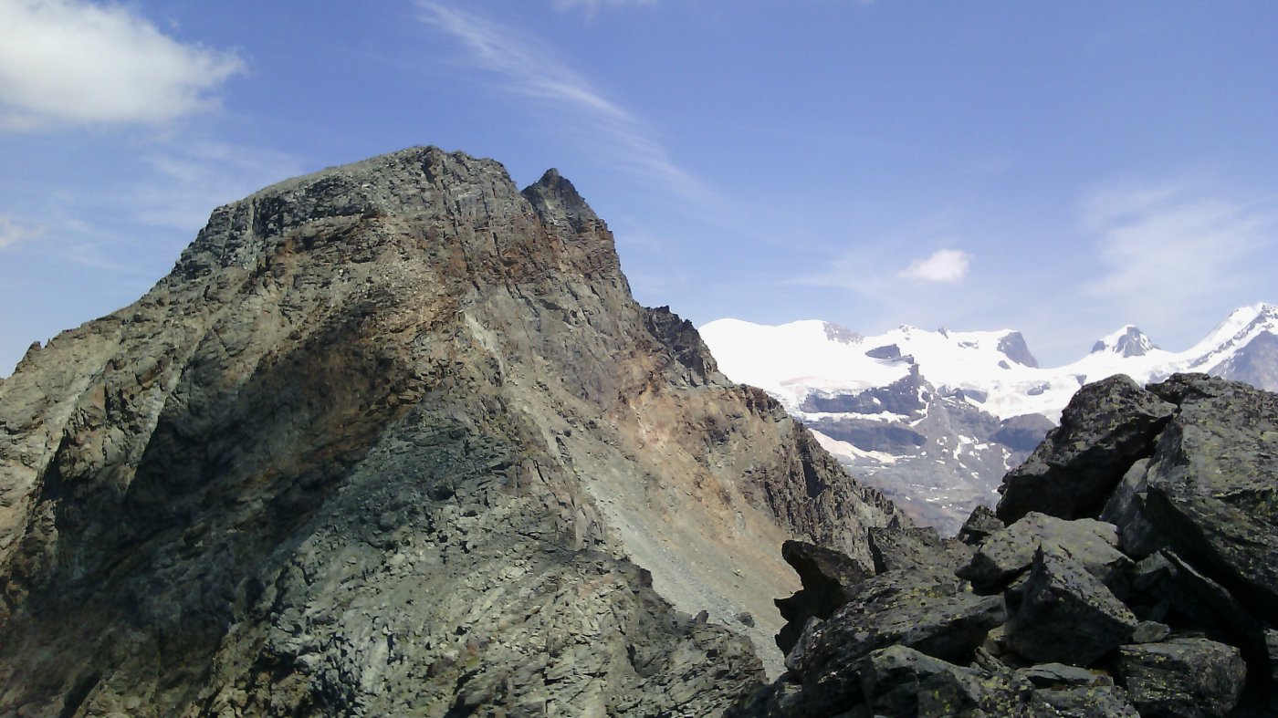
L’itinerario proposto attraversa il meraviglioso vallone delle Cime Bianche, con i suoi stupendi pianori erbosi e i ruscelli di acqua glaciale che nella luce pomeridiana assumono una colorazione turchese intenso. Per questa ragione è decisamente preferibile a quello di salita dalla Valtournanche, pur essendo più lungo (18 km circa). Le Cime Bianche (Gran Sometta, Bec Carré e Punta Sud) sono così chiamate per il colore degli affioramenti calcarei che le compongono. Somigliano alle Dolomiti e sono montagne piuttosto inconsuete in VdA
Avvicinamento
L’itinerario proposto attraversa il meraviglioso vallone delle Cime Bianche, con i suoi stupendi pianori erbosi e i ruscelli di acqua glaciale che nella luce pomeridiana assumono una colorazione turchese intenso. Per questa ragione è decisamente preferibile a quello di salita dalla Valtournanche, pur essendo più lungo (18 km circa). Le Cime Bianche (Gran Sometta, Bec Carré e Punta Sud) sono così chiamate per il colore degli affioramenti calcarei che le compongono. Somigliano alle Dolomiti e sono montagne piuttosto inconsuete in VdA
Si risale la Val d'Ayas (uscita Verres autostrada Torino-Aosta) fino al termine a Saint Jacques
Descrizione
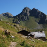
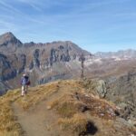
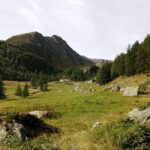
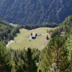
Dalla piazza dell’abitato di Saint Jacques si sale seguendo la strada, si supera il bar Fior di Roccia e si segue il sentiero 6 per il Colle Nord delle Cime Bianche. Il sentiero s’innalza subito a gradoni lastricati, poi si inoltra nel bosco fino al primo bivio, dove ci si tiene a sinistra (si trascura il ramo a destra per il Lago Blu, pian di Verra) e si raggiunge la borgata di Fiery (1878 m). Si attraversa un ponte e si prosegue nel bosco di conifere, fino a quota 2100 m circa, seguendo il sentiero principale (segnavia 6); usciti dal bosco il sentiero sale per tornanti, passando a destra di alcuni ruderi di alpeggi.
Si approda quindi a un vasto pianoro, si ignora il bivio a destra per il Bivacco Città di Mariano e si percorre il vallone, attraversando alcuni tratti paludosi e raggiungendo l’Alpe Mase (2300 m). Si sale quindi a sinistra, con ripide svolte e si arriva ad un altro altopiano, dove il sentiero, sempre evidente e segnato anche da frecce gialle, guada il ruscello più volte e prosegue per tutto il vallone, tenendosi poi sulla destra. A quota 2735 m si abbandona il sentiero finora seguito, e conviene guadare il torrente seguendo le indicazioni per il sentiero 5A e una volta raggiunta la sponda opposta, si svolta a dx proseguendo su una traccia a volte più evidente a volte più inerbita, ma sempre indicata da ometti e da qualche raro segno giallo (sentiero 6A-6B).
In breve si guada un altro rio, poi si passano alcuni dossi e vallette erbose finché a q. 2800 circa la traccia confluisce in altro sentiero che a sx si dirige verso il colle Roisetta (o della Punta Sud delle Cime Bianche) e a dx continua per il Colle Inferiore (Sud) delle Cime Bianche (questo punto è segnalato da due ometti nelle due direzioni).
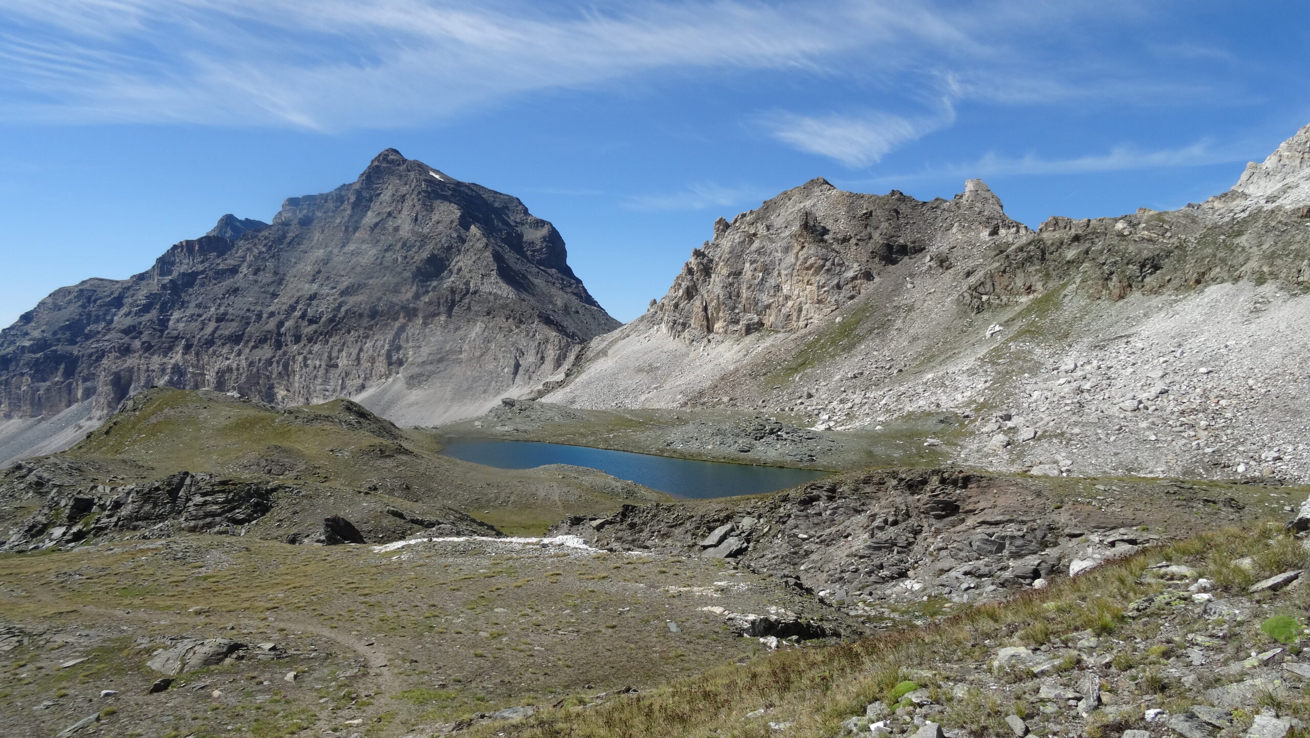
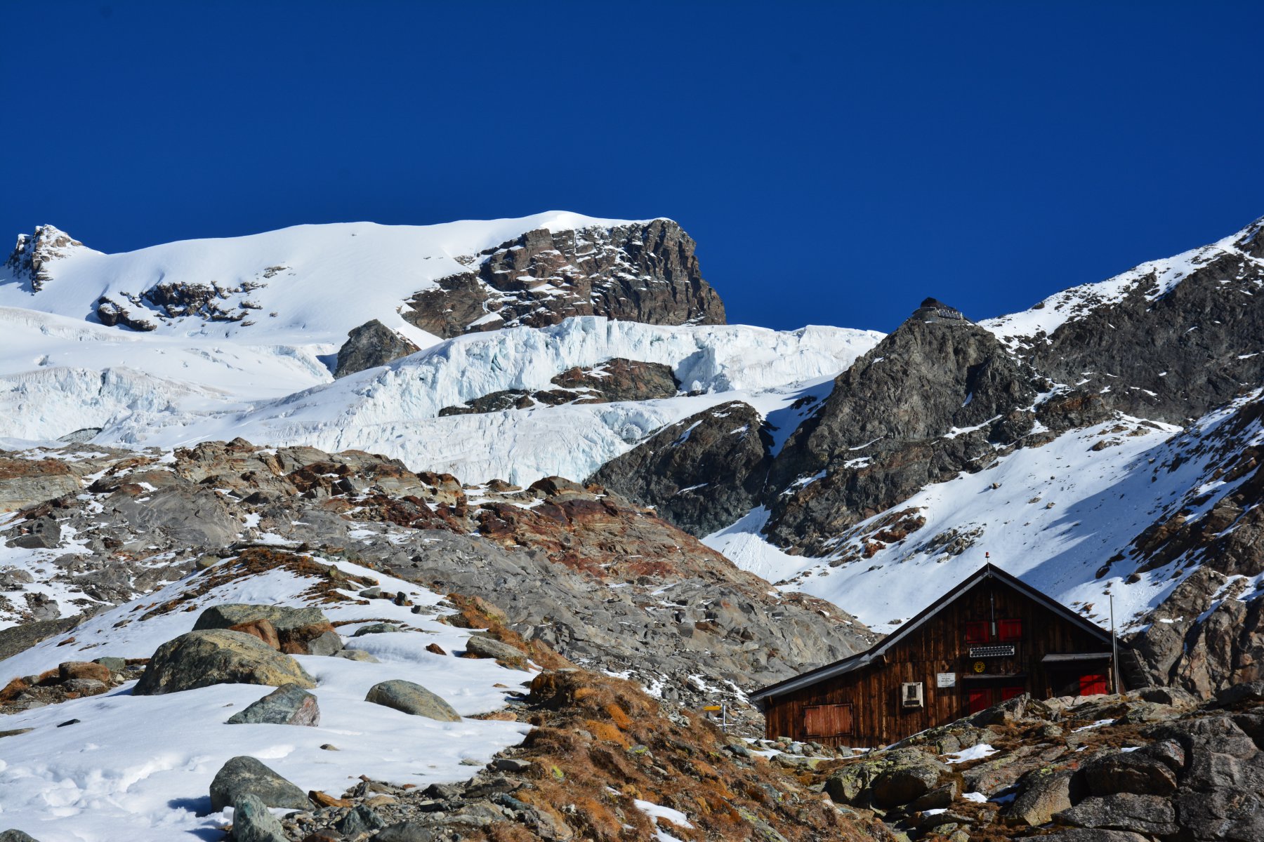
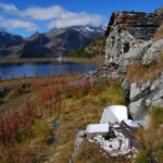
Si prosegue a dx e di lì a poco si giunge in prossimità del lago Rollin, che si costeggia in alto, e si notano le costruzioni dell’impianto di risalita “Bec Carré” al colle Inferiore delle Cime Bianche. Ancora qualche saliscendi e arrivati ad un grande ometto a torre, si continua risalendo l’ultimo tratto sulla strada di servizio degli impianti.
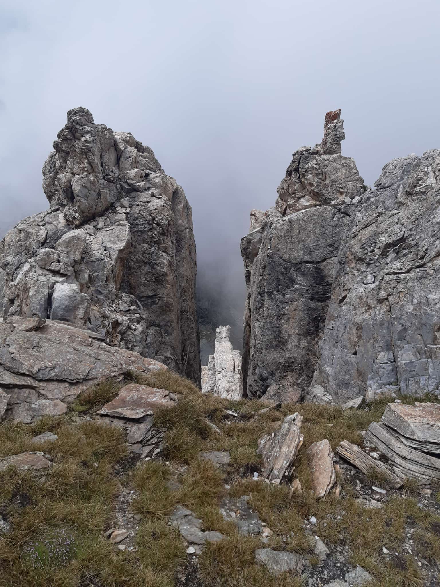
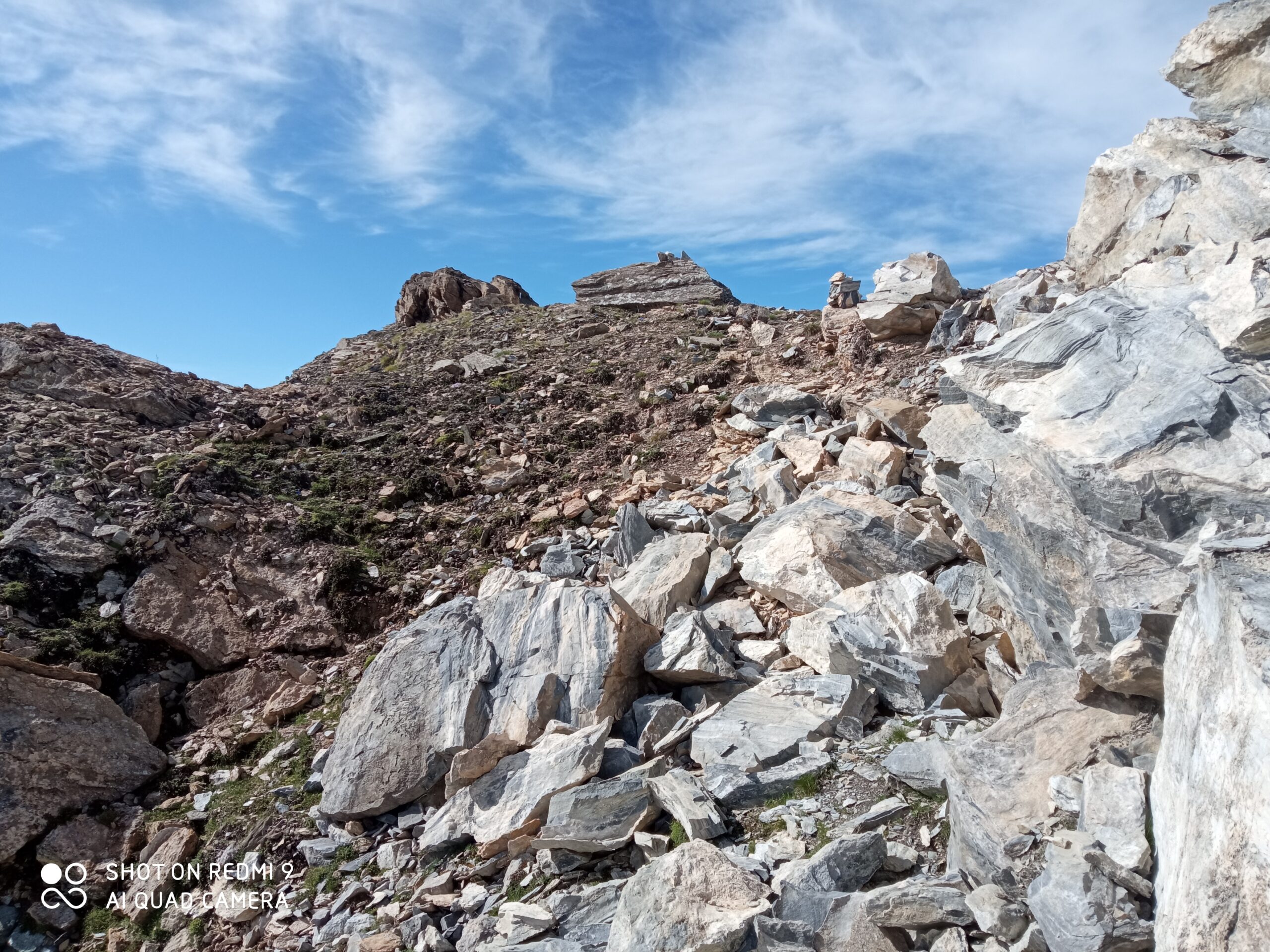
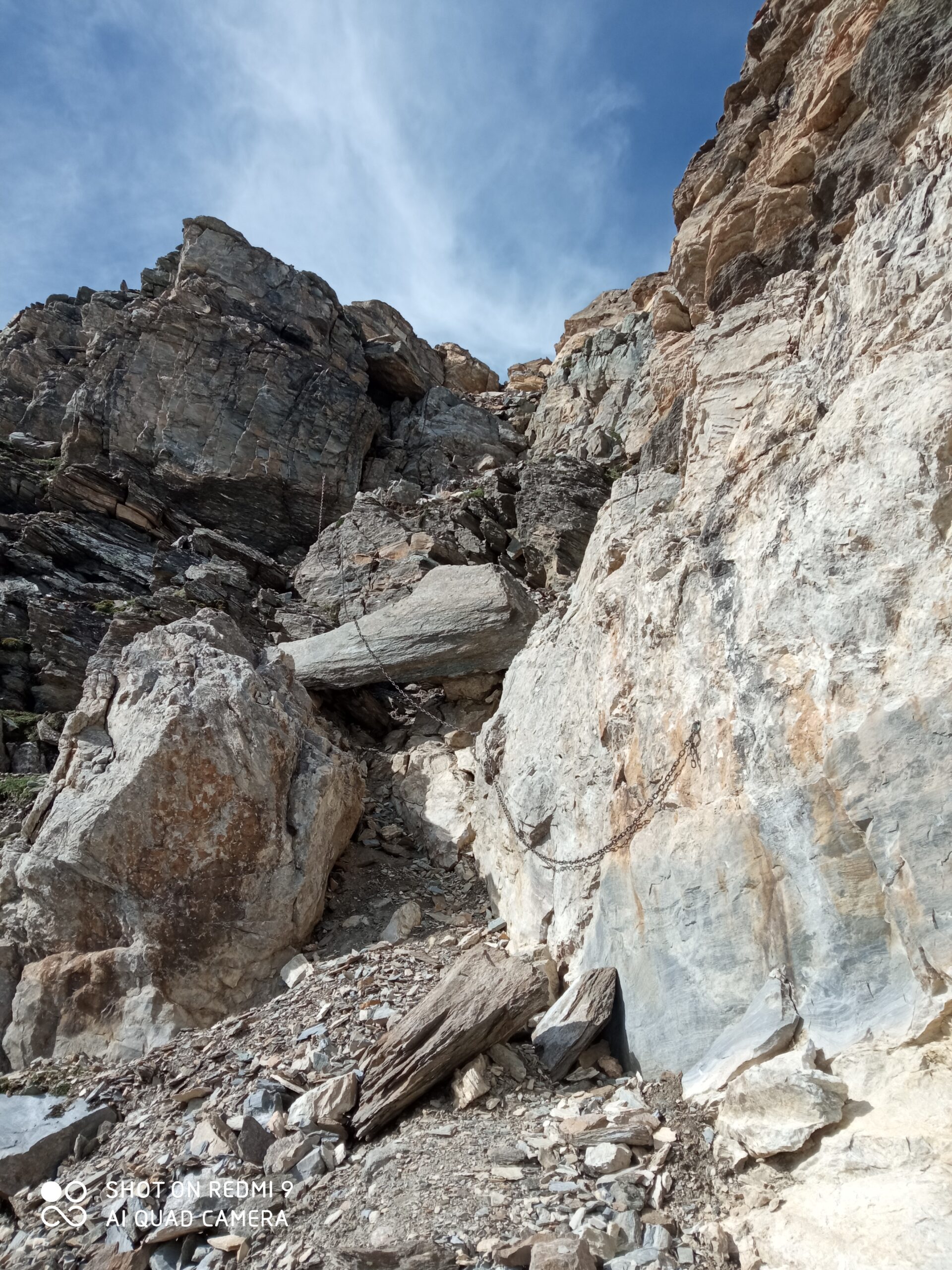
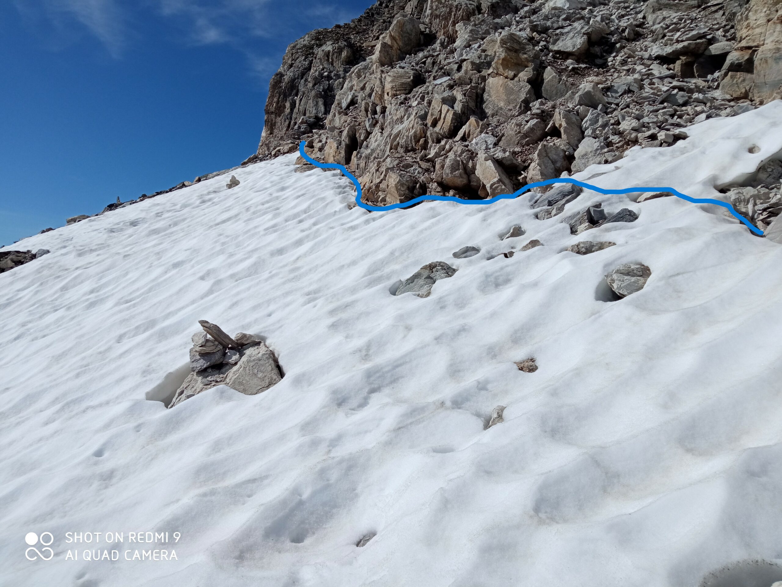
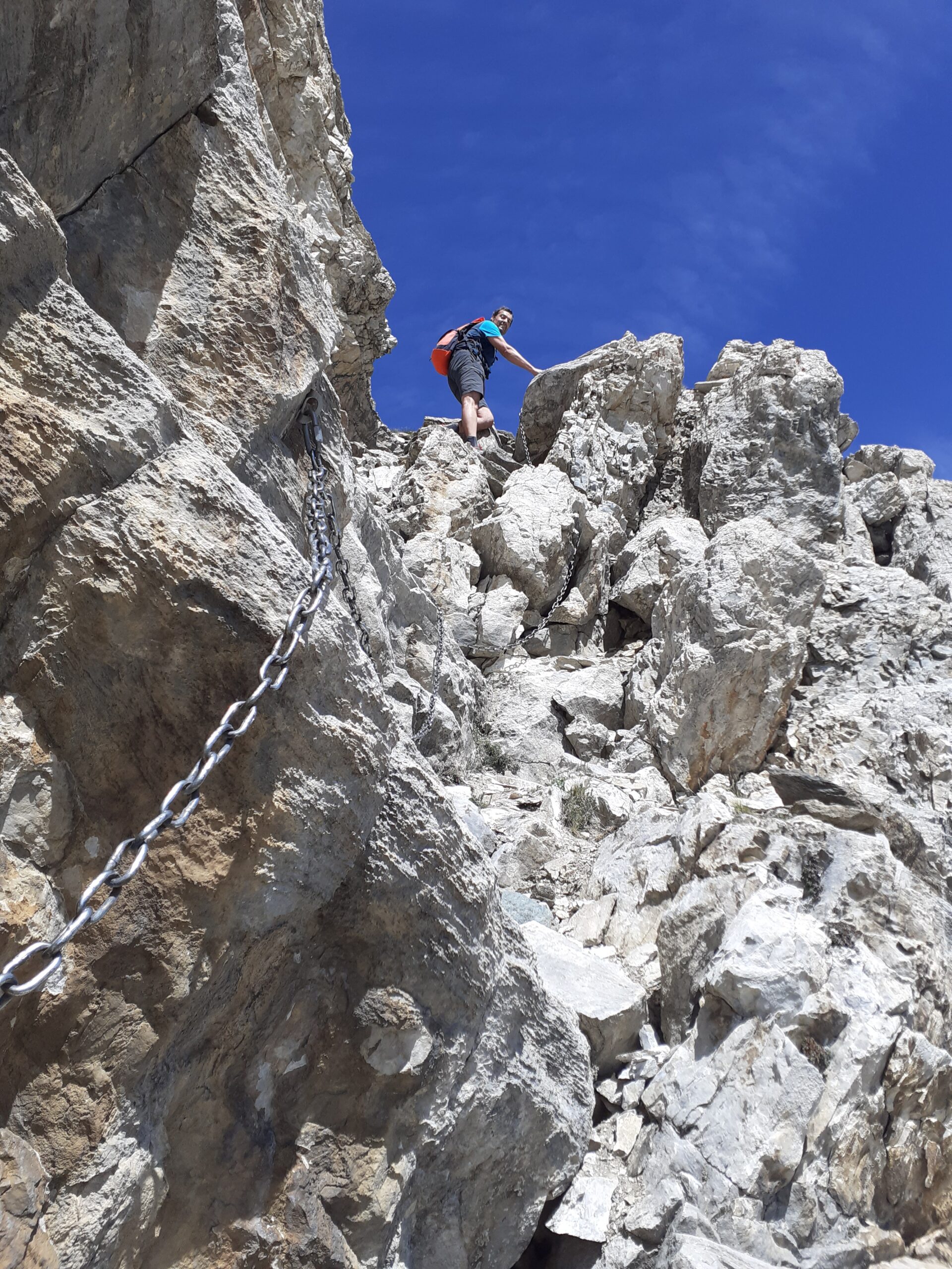
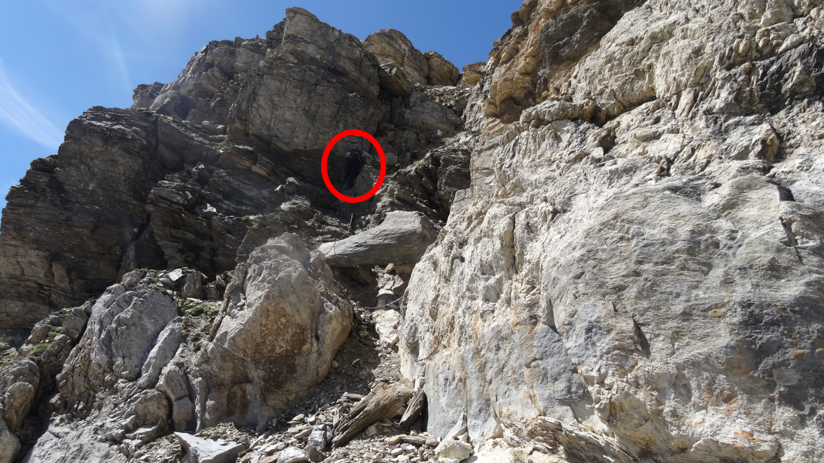
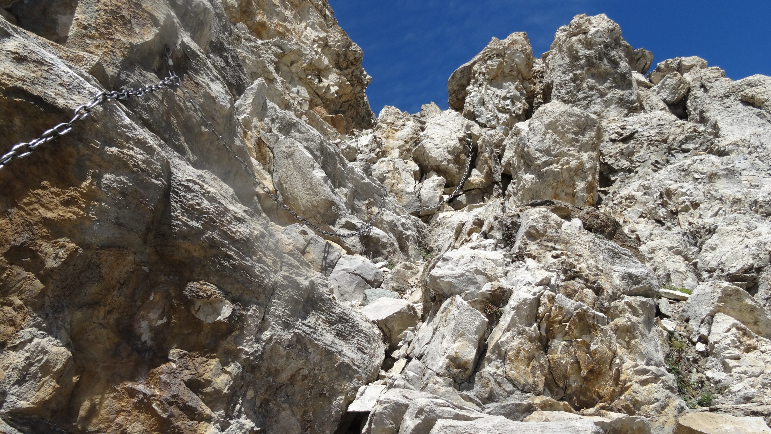
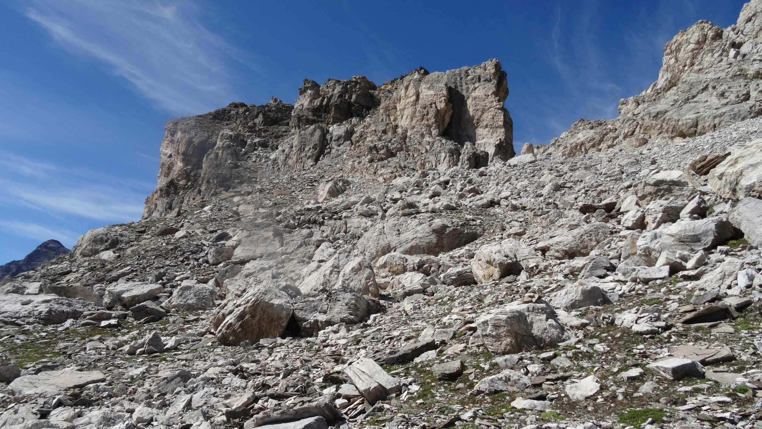
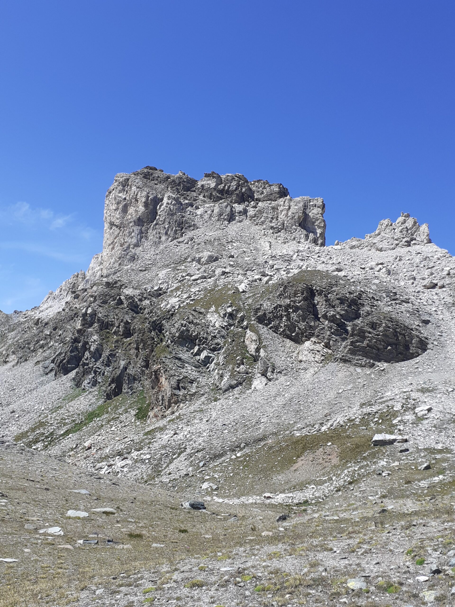
Da qui in avanti non ci sono sentieri. Sulla destra del colle si trova la stazione di arrivo della seggiovia Du Col, aggirarla e portarsi sul versante est della montagna, (omino in lontananza indica la direzione) mantenendo inizialmente più o meno la stessa quota contornare la parete (in questo tratto parecchi sfasciumi) per poi risalire il pendio quando questo diventa meno ripido e portarsi alla base della parete, continuare verso sud sino a quando si avvista la prima catena che ci aiuta nel superare la parete nel suo punto più debole.
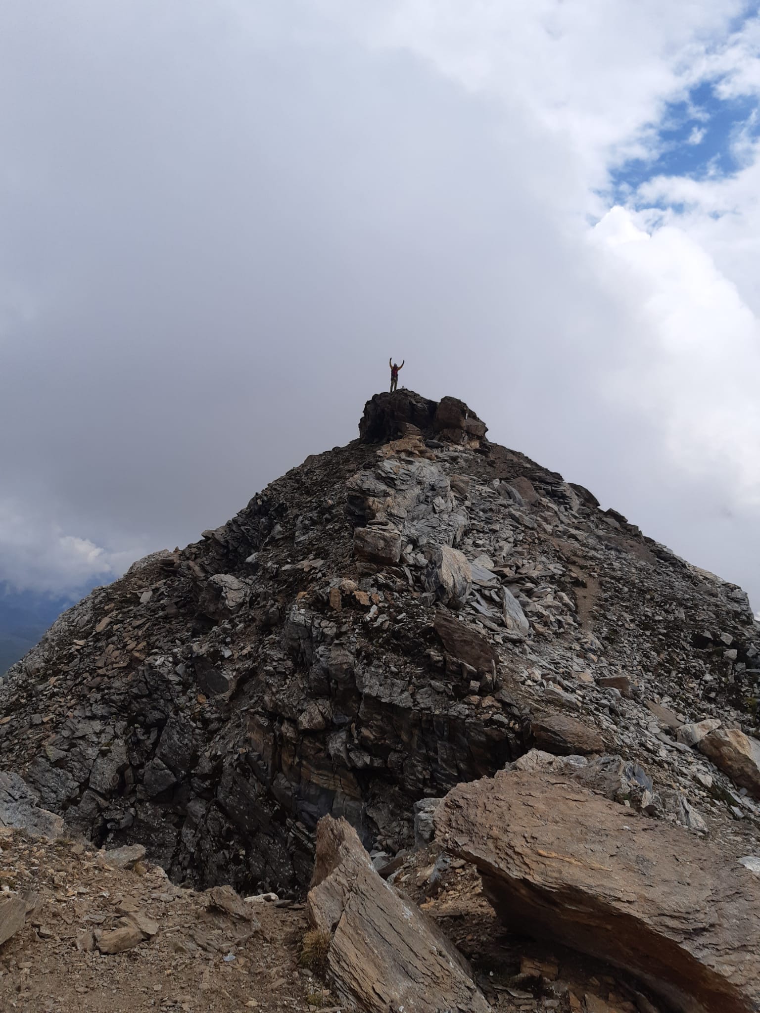
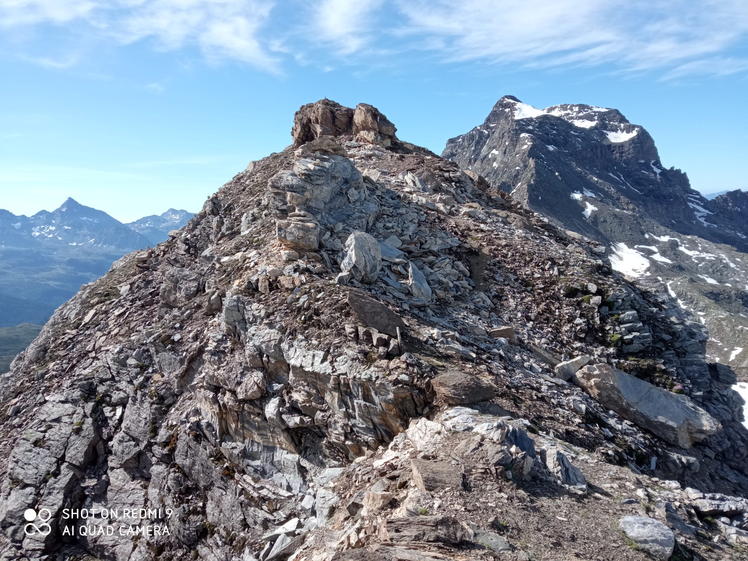
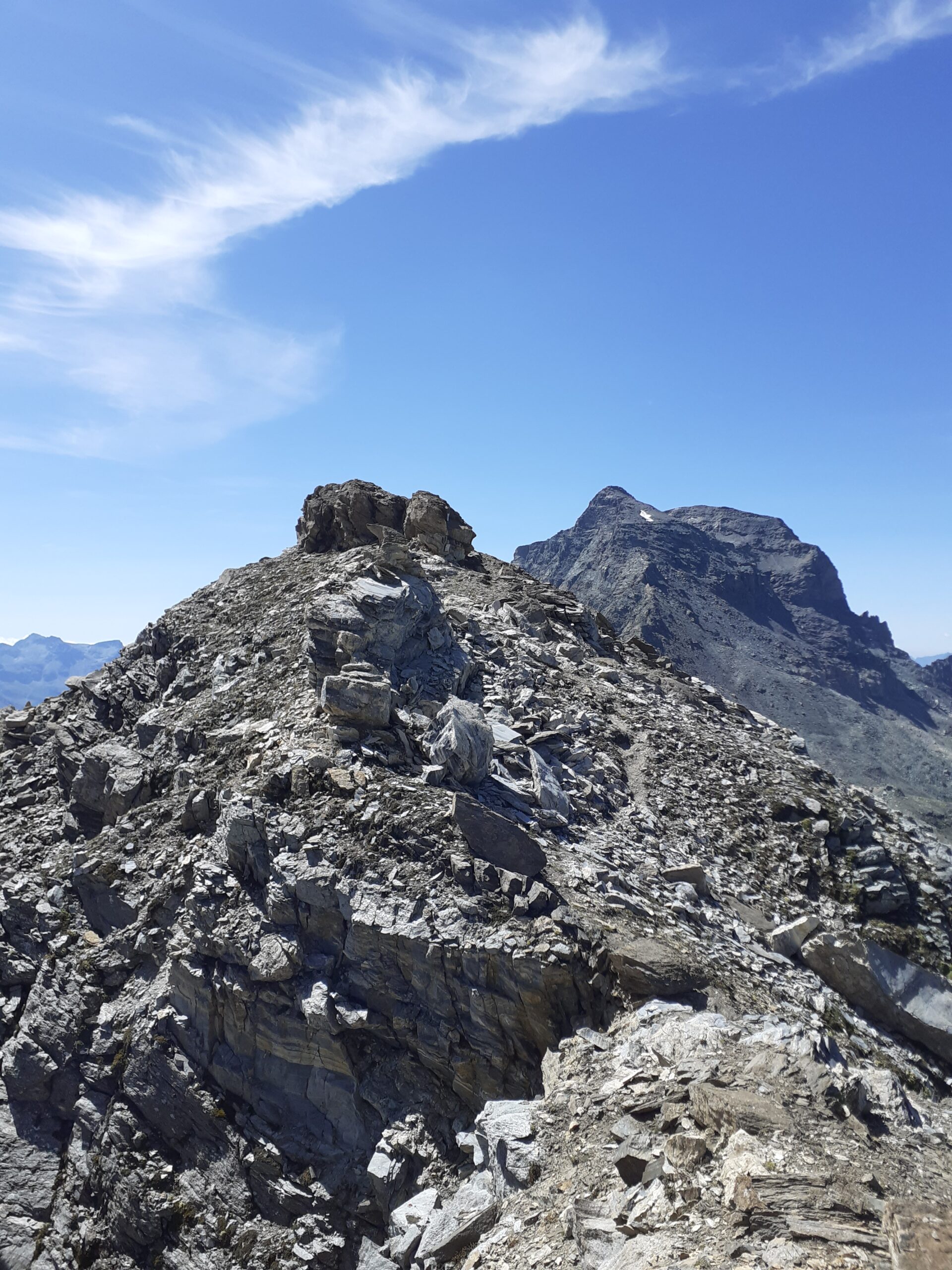
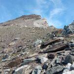
Siamo ora in cresta, si prosegue facilmente in piano per poi affrontare un ripido camino con masso incastrato (altra catena) che ci deposita sulla facile cresta sommitale che conduce in vetta. Omino più targa commemorativa e cassetta del quaderno
Nelle vicinanze Mappa
Itinerari
17/08/2025 AO, Ayas D+ 1500 m EE Sud-Est
Gran Sometta da Saint Jacques per il Colle Inferiore delle Cime Bianche
 0m
0m
23/08/2025 AO, Ayas D+ 1635 m EE Sud-Est
Roisetta (Mont, Punta Nord) da Saint Jacques per il Rifugio Grand Tournalin
 0m
0m
26/10/2021 AO, Ayas D+ 982 m EE Ovest
Tzére o Tsére (Palon di) da Saint Jacques
 0m
0m
01/06/2026 AO, Ayas D+ 1350 m E Sud-Ovest
Mezzalama Ottorino (Rifugio) da Saint Jacques
 0m
0m
03/07/2025 AO, Ayas D+ 1300 m E Nord
Bettolina (Punta) da Saint Jacques per il Colle Bettaforca
 0m
0m
11/08/2018 AO, Ayas D+ 1470 m EE/F Sud-Ovest
Petit Tournalin da Saint Jacques per il Colle di Nana
 0m
0m
12/08/2024 AO, Ayas D+ 1450 m EE Sud
Verra (Monte Rosso di) da Saint Jacques per il Palon di Resy
 0m
0m
11/10/2025 AO, Ayas D+ 1000 m E Sud
Resy (Palon di) da Saint Jacques
 0m
0m
26/10/2023 AO, Ayas D+ 1215 m E Varie
Croce o Brun (Monte) da Saint Jacques e il Rifugio Grand Tournalin
 0m
0m
10/09/2024 AO, Ayas D+ 1300 m EE Varie
Bettaforca (Monte) da Saint Jacques
 0m
0m
Servizi
100m
200m
Ferraro Rifugio
Ayas
2.5Km
Le Petit Coq Ristorante
Ayas
4.2Km
Grand Tournalin Rifugio
Ayas
6.4Km
Mezzalama Rifugio
Ayas
7.2Km
Le Solitaire Ristorante
Ayas
7.8Km
Guide di Ayas Rifugio
Ayas
8.1Km
Le petit monde Ristorante
Ayas
8.4Km
Guide del cervino Rifugio
Valtournenche
9.9Km