 3.3Km
3.3Km

Note
 400m
750m
5.1Km
7.2Km
8.3Km
8.3Km
400m
750m
5.1Km
7.2Km
8.3Km
8.3Km
Attenzione alla stabilità del manto nevoso a monte.
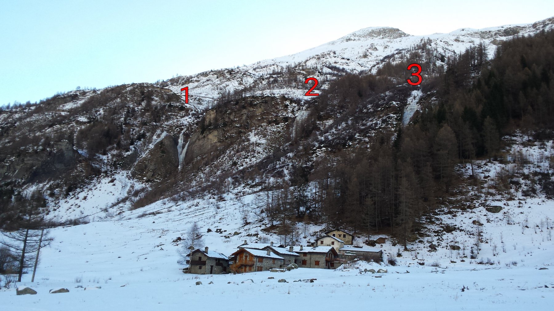
Avvicinamento
Da Courmayeur risalire la Val Ferret fino alla Loc. Planpincieux . In alta stagione e in giorni festivi, in base agli orari, l'accesso alla Val Ferret è consentito solo alla navetta (pulman di linea).
Descrizione
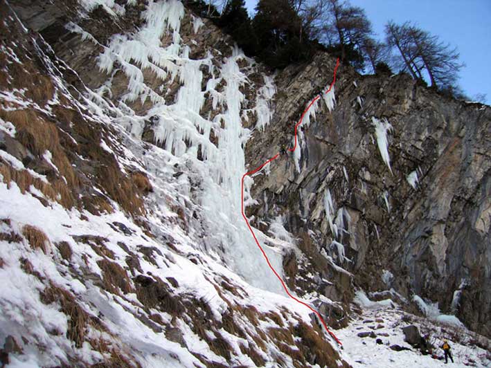
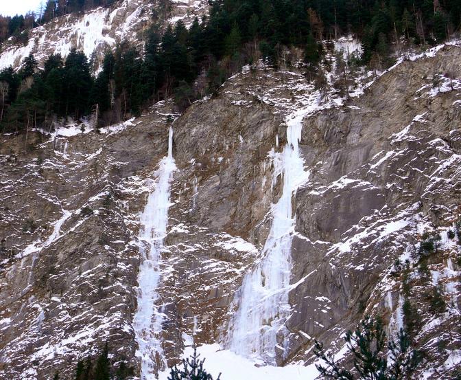
Da Planpincieux risalire la pista pedonale che si inoltra nel vallone fino al ponticello situato poco sotto una piccola cappella. Attraversare il torrente e dirigersi verso il piccolo gruppo di case. La Tapa Ice (non conoscendone il nome, così l’abbiamo chiamata) rimane proprio a ridosso del villaggio, la cascata a Y si trova qualche centinaio di metri a sinistra.
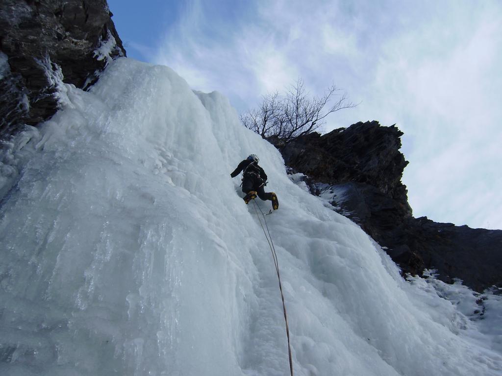
Si sale in 4/5 tiri arrampicando sul facile flusso ghiacciato dove si incontrano un paio di brevi risalti più verticali. Nessun materiale il loco. La discesa avviene comodamente su sentiero: uscendo dalla cascata andare a dx (faccia a monte).
Ancora più a dx è presente un’ altra cascatella che a prima vista sembra ancora più facile.
Nelle vicinanze Mappa
Itinerari
20/12/2015 AO, Courmayeur 100 m III, 3 Nord-Ovest
Val Ferret – Mayencet (Cascata di)
 400m
400m
31/12/2018 AO, Courmayeur 70 m II, 3 Nord-Ovest
Val Ferret – Y (Cascata)
 750m
750m
04/01/2009 AO, Courmayeur 1750 m III, 3 Nord
Val Ferret – Lèche (Cascata di)
1.3Km
26/01/2011 AO, Courmayeur 100 m III, 4 Nord-Est
Curmayeur – Esse (Cascata)
 5.1Km
5.1Km
26/12/2005 AO, Pré-Saint-Didier 80 m II, 5 Nord-Est
Champex – Happy Birthday (Cascata)
 7.2Km
7.2Km
25/01/2003 AO, Pré-Saint-Didier 90 m II, 5 Nord-Est
Champex – Chougnagawa (Cascata)
7.4Km
01/02/2009 AO, Pré-Saint-Didier 160 m I, 5 Ovest
Pré Saint Didier – Au Bout des Thermes (Cascata)
7.8Km
07/01/2011 AO, Morgex 120 m I, 5 Nord
Morgex – Vacherie de gauche (Cascata)
 8.3Km
8.3Km
08/01/2011 AO, Morgex 120 m I, 5+ Nord
Morgex – Grande Vacherie (Cascata)
 8.3Km
8.3Km
01/03/2003 AO, Pré-Saint-Didier 150 m II, 5 Varie
Pré Saint Didier – Alexandra (Cascata)
8.4Km


