4.7Km
4.7Km

Note
Storico
 7.1Km
7.6Km
7.6Km
7.7Km
9Km
9.5Km
15.4Km
15.4Km
15.4Km
15.9Km
7.1Km
7.6Km
7.6Km
7.7Km
9Km
9.5Km
15.4Km
15.4Km
15.4Km
15.9Km
4.7Km
4.7Km
4.7Km
4.7Km
5.6Km
6.2Km
7.4Km
8.1Km
8.7Km
9.8Km
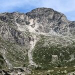
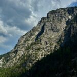
Prima via che vince la vasta bastionata sud del Seguret. Purtroppo le pareti sono prevalentemente di roccia cattiva, un ns. tentativo fatto in prossimità dell’estetico spigolo di sx si è arenato a pochi metri da terra a causa della roccia pessima. La via sfrutta probabilmente una delle pochissime zone dove la roccia è migliore. Comunque anche qui a tratti assolutamente sani e molto belli ne seguono altri su roccia infida. Lo sviluppo di una zona potenzialmente ricca di possibilità rimane così precluso a causa della roccia scadente e della lunga strada sterrata. Il posto è però ambientalmente meraviglioso così come la strada è una vera opera d’arte di ingegneria militare. Storicamente si dice poi che le grotte fossero usate dai Saraceni per portarvi i lebbrosi.
La via è da considerarsi di montagna.
ATTREZZATURA:
friend da 0.3 a 1 Camelot, cordini (uno lungo per la prima sosta) e rinvii. In via 21 fix (di cui 5 alle soste) + la sosta di doppia fuori via.
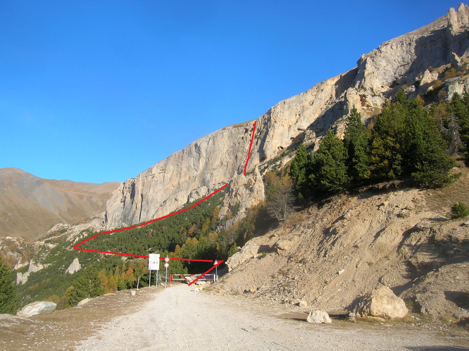
Avvicinamento
La via è da considerarsi di montagna.
ATTREZZATURA:
friend da 0.3 a 1 Camelot, cordini (uno lungo per la prima sosta) e rinvii. In via 21 fix (di cui 5 alle soste) + la sosta di doppia fuori via.
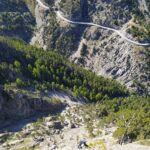
da Susa proseguire sulla SS24, superato Exilles proseguire ancora per i tornanti e quasi al culmine della salita svoltare a dx sulla strada che conduce a Grange della Valle, Eclause, Rif.Levi Molinari. Al primo bivio svoltare a sx seguendo le indicazioni per il Pramand. Dopo un primo breve tratto di asfalto inizia lo sterrato.
La strada militare ha un fondo abbastanza buono anche se nel tratto che segue il vallone dove si trova la cascata del Vallonetto è piuttosto pietroso e sconnesso, consigliabile un fuoristrada o un’auto abbastanza alta. Parcheggiare alla sbarra.
Camminare lungo la strada per circa 10min, dove la vegetazione degrada risalire il canalone fino alla base di un evidentissimo spigolo alla cui dx e sx vi sono placconate grigiastre.
Su quella di dx abbiamo fatto un tentativo, abbandonato per la pessima qualità della roccia: visibili due fix di cui il secondo con piastrina.
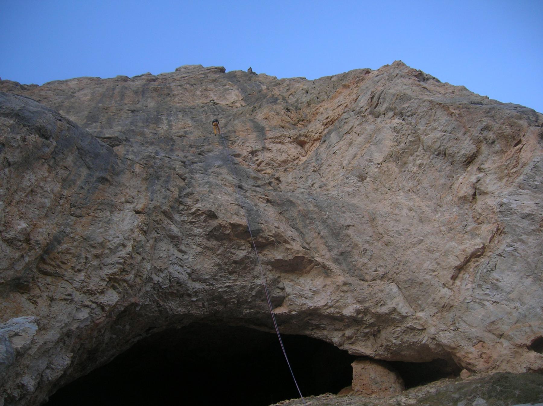
Proseguire costeggiando la parete e, sfruttando una traccia di sentiero che taglia il ghiaione, portarsi verso una grande grotta delimitata a dx da uno spigolo inizialmente strapiombante.
La via attacca sulla parete a sx della grande rientranza dove si trova la grotta.
Descrizione
La strada militare ha un fondo abbastanza buono anche se nel tratto che segue il vallone dove si trova la cascata del Vallonetto è piuttosto pietroso e sconnesso, consigliabile un fuoristrada o un’auto abbastanza alta. Parcheggiare alla sbarra.
Camminare lungo la strada per circa 10min, dove la vegetazione degrada risalire il canalone fino alla base di un evidentissimo spigolo alla cui dx e sx vi sono placconate grigiastre.
Su quella di dx abbiamo fatto un tentativo, abbandonato per la pessima qualità della roccia: visibili due fix di cui il secondo con piastrina.
Proseguire costeggiando la parete e, sfruttando una traccia di sentiero che taglia il ghiaione, portarsi verso una grande grotta delimitata a dx da uno spigolo inizialmente strapiombante.
La via attacca sulla parete a sx della grande rientranza dove si trova la grotta.
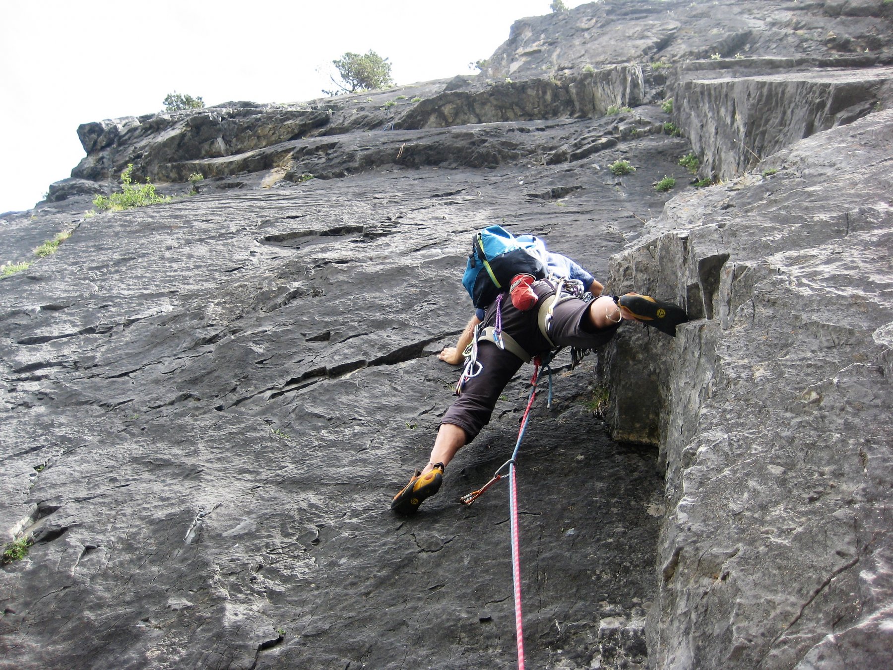
DESCRIZIONE VIA:
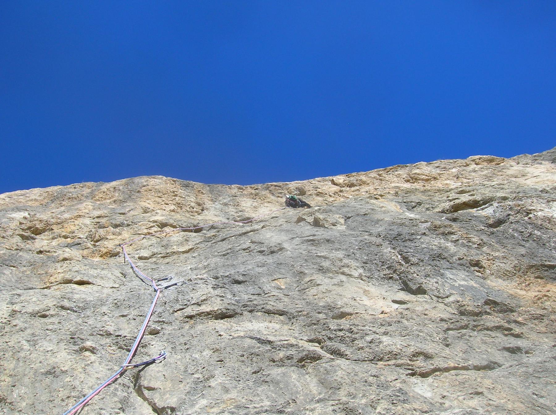
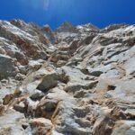
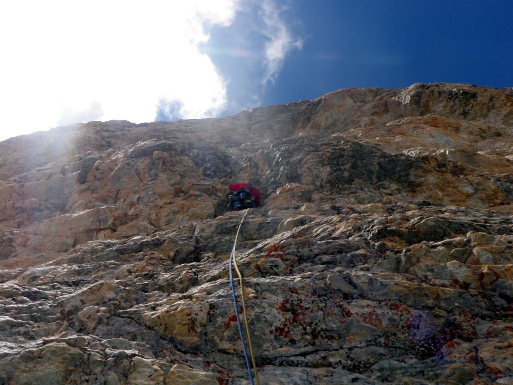
L1: Salire per la bella placca di calcare rosso-nero, alcuni metri a dx di una specie di rampa ascendente da sx a dx . Il primo e unico fix è molto in alto. Si esce su balze detritiche e si sosta sfruttando una clessidra formata da un enorme masso (nel complesso V, la placca nera è stata scalata dai secondi con difficoltà di 6A+). Sosta da attrezzare.
L2: salire a dx per sfasciumi e proseguire quindi direttamente su concrezioni rossastre (friend 0.75) fino alla base del bel muro grigio, superarlo con bella scalata (2 fix, 6A+) fino a un terrazzino. Sosta su 1 fix da integrare con un friend 1.
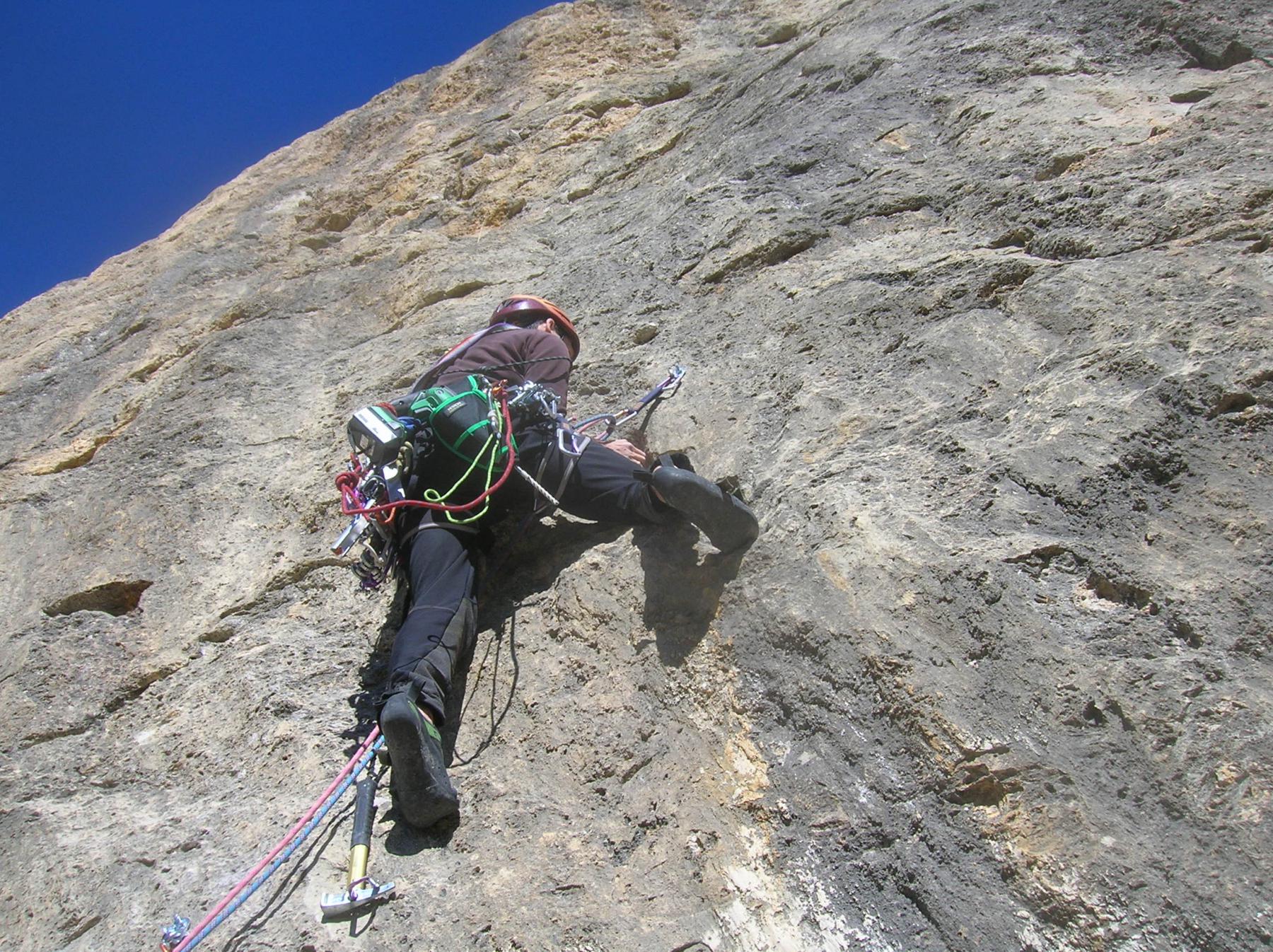
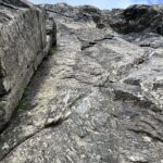
L3: superare direttamente il soprastante muro grigio con bella arrampicata (3 fix) fino a una serie di grandi buchi su roccia rossastra (friend 0.3), seguirli ascendendo verso dx (piazzare cordino su ottima clessidra) fino a raggiungere il successivo fix. Qui traversare sulla placca verso dx puntando a rocce rosse più articolate, salire quindi direttamente (1 fix), prestando attenzione alla roccia, e ribaltarsi su un terrazzino (1fix). Proseguire sulla dx su lame e roccia piuttosto marcia fino al successivo fix. Uscire sfruttando la placca grigia di sx e ribaltarsi su cenge alla base di grandi grotte, ben visibili anche dalla strada. Salire ancora facilmente su roccia rossa a dx fino alla sosta (nel complesso 6B/6B+, lunghezza di quasi 60m) . Sosta con 2 fix utilizzata anche per la discesa.
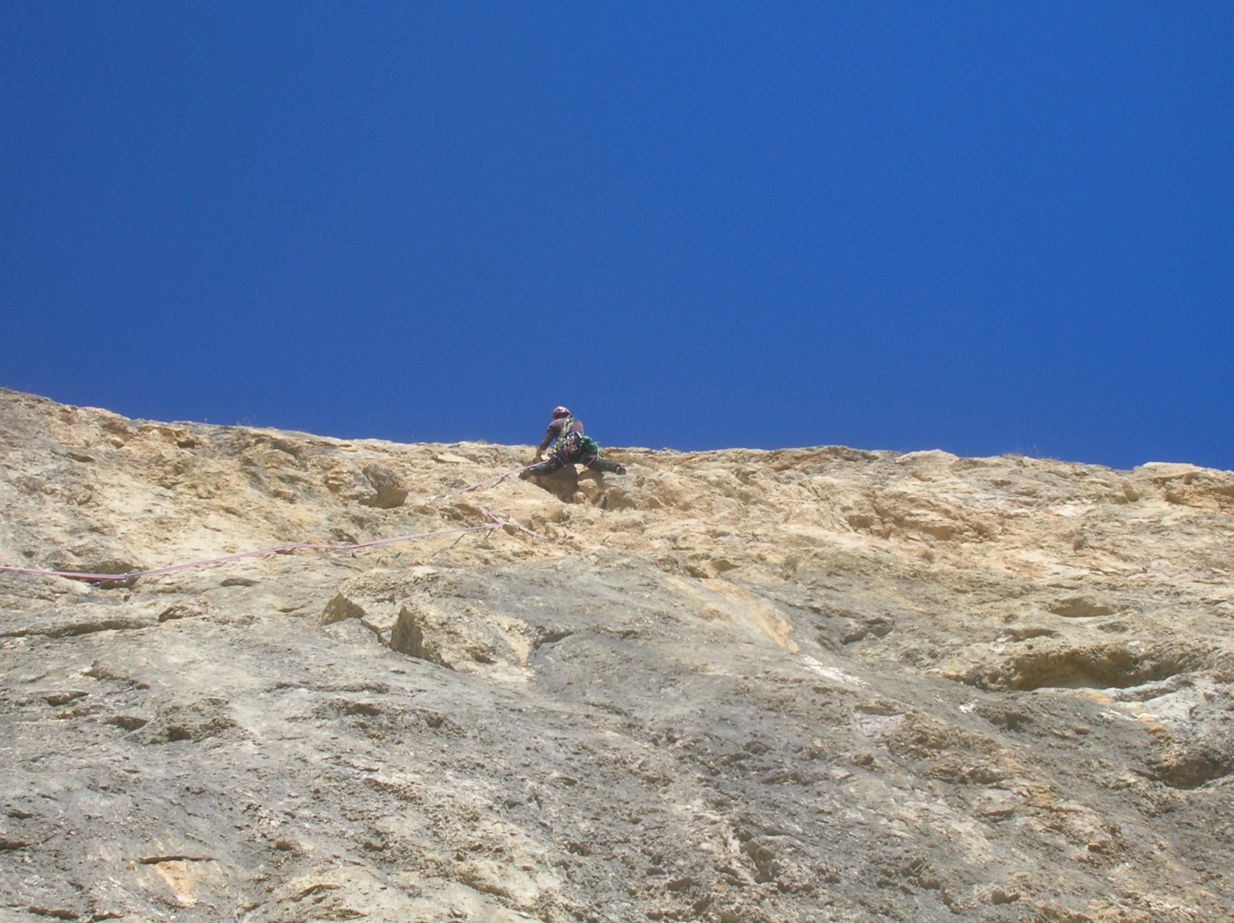
L4: salire verso dx sfruttando una grande lama fessura (friend 1) e salire nel diedrino (2 fix), ribaltarsi quindi su una cornice invasa da arbusti (attenzione, roccia brutta e terrosa, possibilità di passare un cordino su una radice sporgente e poco affidabile) e spostarsi verso sx (1 fix). Traversare ancora a sx e superare il muro grigiastro (3 fix) prestando attenzione alla roccia in uscita. Ribaltarsi su una buona terrazza pochi metri sotto il prato sommitale (6B). Sosta con 2 fix utilizzata anche per la discesa.
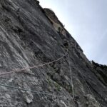
DISCESA:
Dalla L4 scendere alla L3. Da L3 scendere verticalmente per quasi 60m. Sosta di calata fuori via. Da questa si arriva alla base superando la grande grotta.
Via: “LAIKA” , 200m, TD+, max 6B/6B+
Aperta da Luca e Matteo ENRICO, Sergio SIBILLE il 01/11/2014.
Aperta da Luca e Matteo ENRICO, Sergio SIBILLE il 01/11/2014.
- Cartografia:
- Fraternali 1:25000 n.3 Val di Susa Val Cenischia Rocciamelone Val Chisone
Nelle vicinanze Mappa
Itinerari
21/08/2023 TO, Bardonecchia 6c, 6b obbl., a1 Sud-Est
Rognosa d’Etiache – Spigolo Reale
 7.1Km
7.1Km
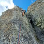
20/07/2025 TO, Exilles 6a+, 6a obbl., a0 Est
Beuri, avancorpo – Via dal Levi (Marco’s Dream)
 7.6Km
7.6Km
28/07/2025 TO, Exilles 6a+, 6a obbl. Est
Beuri, avancorpo – Lilli
 7.6Km
7.6Km
25/08/2013 TO, Bardonecchia 6a+, 6a obbl. Sud-Est
Rognosa d’Etiache – Via Senza Nome
 7.7Km
7.7Km
02/08/2023 Savoie, Val-Cenis 5b, 5b obbl. Nord-Est
Gros Peyron – Le Sale Gosse
 9Km
9Km
05/07/2025 Savoie, Val-Cenis 5c, 5b obbl. Est
Gros Peyron – Les Gros Pères Ronds
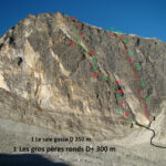 9.5Km
9.5Km
18/07/2026 TO, Cesana Torinese 6a+, 6a obbl. Nord-Ovest
Clarì (Rocca) – Super Calcaire
 15.4Km
28/06/2026 TO, Cesana Torinese 7a, 6a+ obbl. Ovest
Clarì (Punta) – Un Pas Vers le Ciel
 15.4Km
20/08/2024 TO, Cesana Torinese 6c+, 6c obbl., a0 Nord-Ovest
Clarì (Rocca), torre est – Calimero nella Grotta dei Ricordi
 15.4Km
15/07/2026 TO, Cesana Torinese 6a, 5c obbl. Nord-Ovest
Clarì (Rocca) – A 2 Pieds d’Ibarus
 15.9Km
Servizi
4.7Km
4.7Km
paddy mc ginty Ristorante
Sauze d'Oulx
4.7Km
L’Cantun B&B
Sauze D'oulx
4.7Km
Il Covo di nord ovest Ristorante
Salbertrand
5.6Km
La Moretta Ristorante
Oulx
6.2Km
La Chardouse Rifugio
Oulx
7.4Km
Arlaud Rifugio
Salbertrand
8.1Km
Levi Molinari Rifugio
Exilles
8.7Km
L’Eitabl Ristorante
Oulx
9.8Km