 1.7Km
1.7Km
Note
 2.2Km
2.2Km
2.2Km
2.2Km
2.2Km
2.2Km
2.4Km
2.5Km
3.1Km
3.7Km
2.2Km
2.2Km
2.2Km
2.2Km
2.2Km
2.2Km
2.4Km
2.5Km
3.1Km
3.7Km
Itinerario di ampio respiro in una zona selvaggia e solitaria e che permette di toccare due valloni (Arpisson e Comboè )molto belli.
Gita consigliata a escursionisti esperti e allenati in quanto non ci sono punti di appoggio, e l'itinerario è comunque lungo e con dislivello importante pur non presentando difficoltà tecniche rilevanti.
Avvicinamento
Gita consigliata a escursionisti esperti e allenati in quanto non ci sono punti di appoggio, e l'itinerario è comunque lungo e con dislivello importante pur non presentando difficoltà tecniche rilevanti.
Da Pollein si prosegue sulla strada regionale in direzione Brissogne fino all'abitato di Grand Pollein. In mezzo alla frazione si trova un parcheggio dove lasciare l'auto.
Descrizione
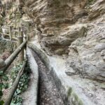
Dal parcheggio dell’abitato di Grand Pollein si prende la strada asfaltata che porta alla frazione Donache e poi a destra su strada sterrata si arriva alla malghe di Ayettes (890 m), dopo la prima casa si prende un sentiero sulla destra della poderale che con una ripida salita porta alla quota di Chately (1100 m).
Da Chately si segue in piano un ruscello che in breve tempo porta all’attraversamento del torrente Arpisson. Il guado va cercato con un po di attenzione in quanto non ci sono ponti.
Attraversato il torrente si prende il sentiero sulla destra che con una breve salita porta nella bella conca e alle baite di Marchaussy (1450 m), dietro all’ultima stalla parte il sentiero (rifatto recentemente) quasi in piano che porta ad attraversare dopo una breve discesa, il vallone del Dard e il torrente Morion che scende dalle pendici della parete nord della Becca di Nona.
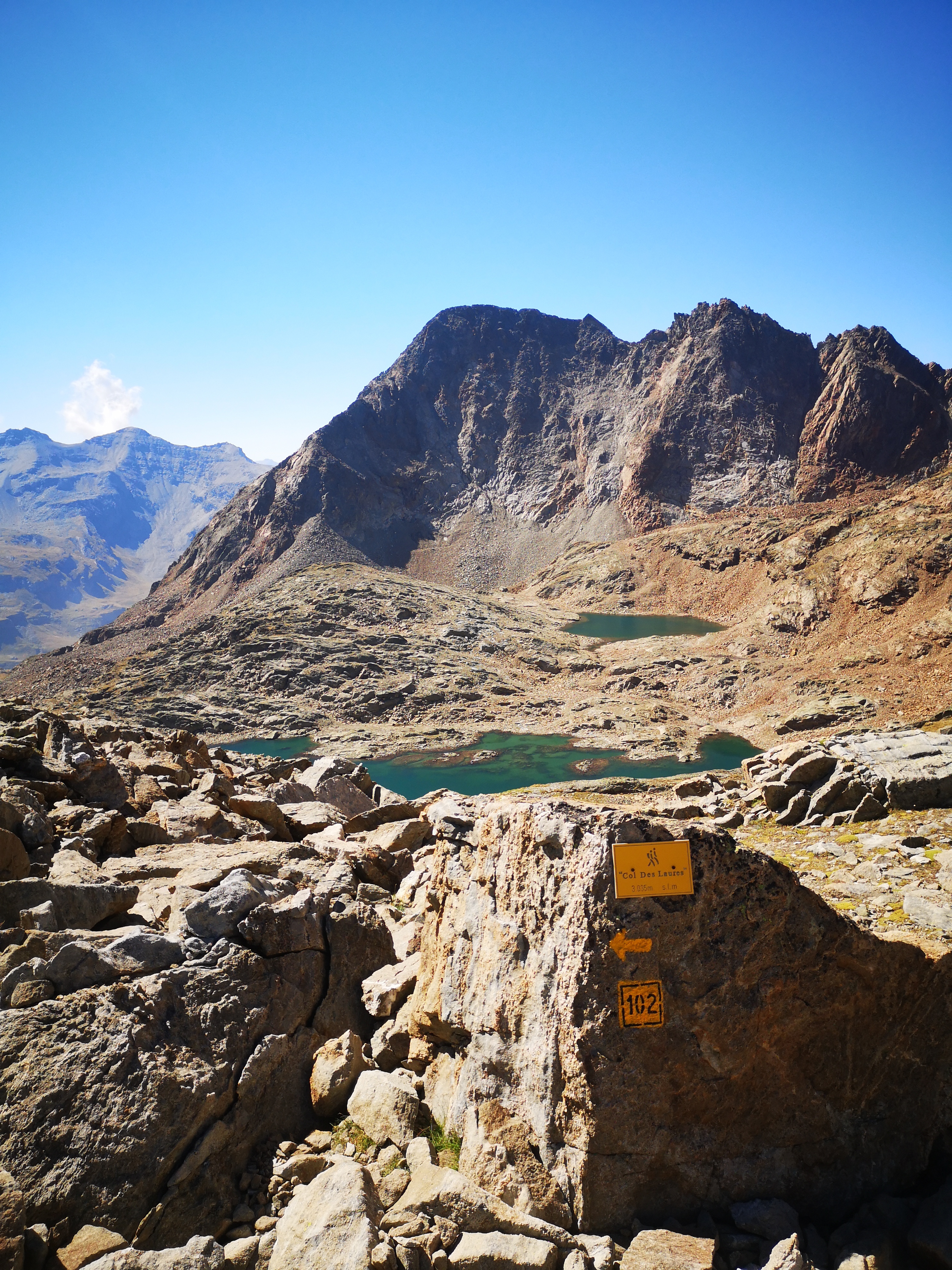
Attraversato il torrente si prende in salita il sentiero che dopo numerose svolte porta nella conca dell’Alpe di Ponteilles (1700 m) posta sulla riva dx. del torrente Comboè che scende dall’omonimo vallone.
La malga è il luogo ideale per una sosta , con bella vista sulle montagne di fronte (Gran Combin, Fallere).
In discesa si prende ,dopo aver attraversato il ponte sul torrente Comboè il sentiero nr. 14 che con una lunga discesa porta al ponte di legno che porta al villaggio di Terre Blanche (1050 m). Fare attenzione, in alcuni punti il sentiero è franato.
Attraversato le poche case di Terre Blanche damon si prende in discesa il sentiero nr.13 che con una breve discesa porta alla frazione di Moulin (629 m), si attraversa il ponte percorrendo un centinaio di metri sulla strada asfaltata e poi a destra su poderale in piano che porta al villaggio di Chateau dove con un breve tratto su asfalto si arriva al parcheggio di partenza.
- Cartografia:
- Carta dei Sentieri Nr.4 - Escursionista editore
Nelle vicinanze Mappa
Itinerari
11/09/2025 AO, Brissogne D+ 2150 m EE Varie
Salè (Becca di) da Grand Brissogne per il Bivacco Menabreaz e Colle di Salé
 2.2Km
2.2Km
06/09/2025 AO, Brissogne D+ 1600 m E Nord
Laures (Laghi di) e Bivacco Menabreaz da Grand Brissogne per il Vallone di Laures
 2.2Km
2.2Km
22/09/2018 AO, Brissogne D+ 3060 m EE/F Varie
Tre Cappuccini (Colle dei) da Grand Brissogne, giro del Monte Emilius
 2.2Km
2.2Km
12/08/2022 AO, Brissogne D+ 2035 m EE Nord
Laures (Colle di) e Bivacco Menabreaz da Grand Brissogne
 2.2Km
2.2Km
16/08/2011 AO, Brissogne D+ 2527 m EE/F Varie
Emilius (Monte) da Grand Brissogne per il Vallone di Laures
 2.2Km
2.2Km
12/09/2025 AO, Brissogne D+ 2060 m EE/F Nord
Leppe (Punta di) da Grand Brissogne per il Bivacco Menabreaz e Colle di Leppe
 2.2Km
2.2Km
24/04/2026 AO, Quart D+ 830 m E Sud
Valsainte (Alpeggio) da Quart per l’oratorio del Beato Emerico
 2.4Km
2.4Km
28/12/2019 AO, Quart D+ 1200 m E Varie
Trois Villes (Frazione) da Quart, anello per la Cappella del Beato Emerico
 2.5Km
2.5Km
30/06/2020 AO, Quart D+ 2000 m EE Sud
Fana (Croce di) dal Castello di Quart per il Col Cornet
 3.1Km
3.1Km
06/04/2026 AO, Saint-Christophe D+ 150 m E Sud-Ovest
Ru Pompillard da Veynes a Valpelline
 3.7Km
3.7Km