550m
550m


Note
 50m
50m
50m
50m
50m
50m
50m
50m
50m
50m
50m
50m
50m
50m
50m
50m
50m
50m
550m
1.3Km
3Km
3.1Km
3.1Km
3.9Km
3.9Km
3.9Km
3.9Km
6.2Km
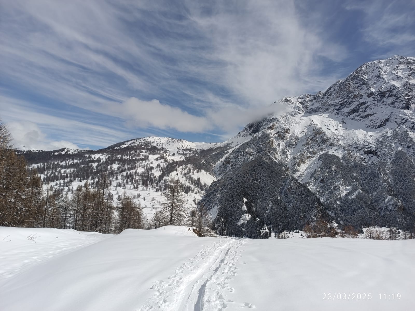
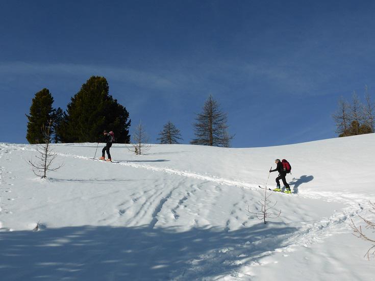
Uno dei possibili anelli della zona. Consigliabile quando le condizioni della neve sono pericolose.
Offre splendidi panorami sul Pic di Rochebrune e montagne limitrofe
Avvicinamento
Offre splendidi panorami sul Pic di Rochebrune e montagne limitrofe
Raggiungere Cesana Torinese e di qui Bousson
Descrizione
Da Bousson si sale a un bivio sulla sinistra dove inizia una strada sterrata con cartelli indicatori dei vari percorsi.
In questo percorso ad anello in pratica si devono sommare i tracciati N. 1,2,3.
Il primo tratto, con poca pendenza porta a Rhuilles 1653m.
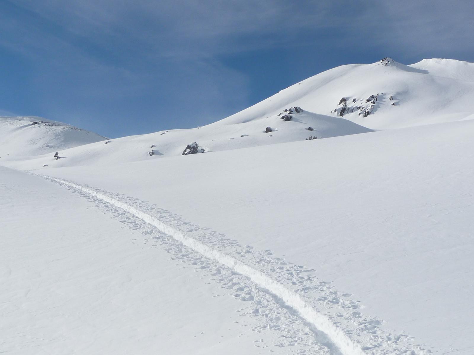
Sulla destra si stacca una mulattiera che con vari tornanti raggiunge la borgata di Chabaud 1918m per poi proseguire sino ai pianori del colle Chabaud a quota 2217m.
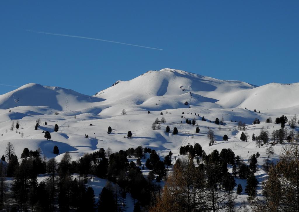
Qui si compie una ampia curva a destra, lasciando sempre sulla destra la cima Fournier e puntando con vari saliscendi al col Bourget 2186m e quindi ai ruderi della caserma dei carabinieri posizionata su di un cocuzzolo appena sopra al colle Bousson 2155m dove si rientra in territorio Italiano.
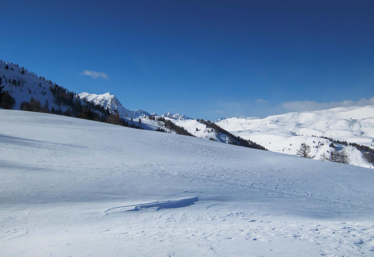
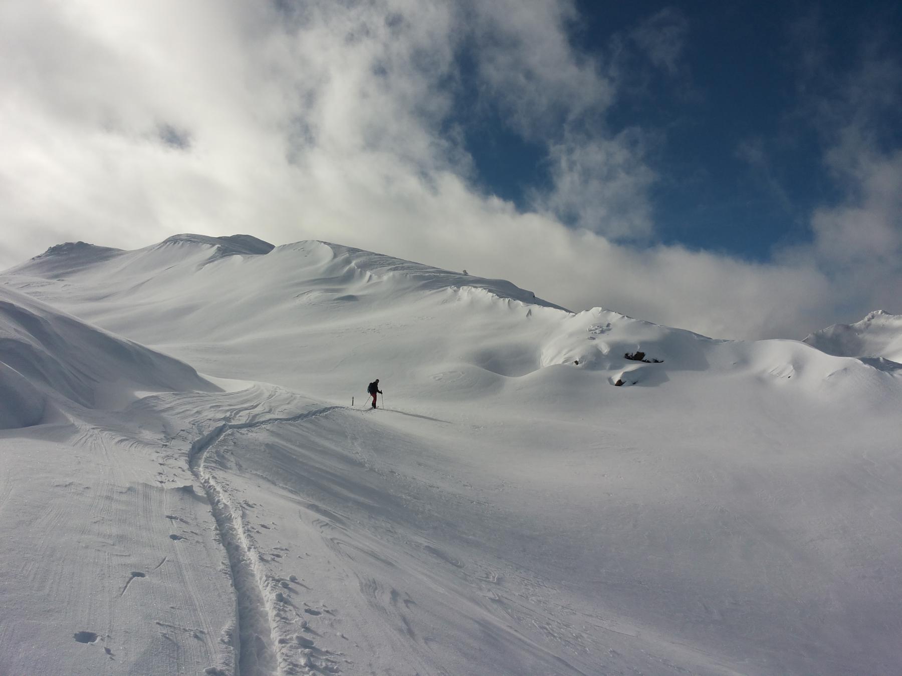
Costeggiare per un tratto la cresta, poi scendere verso destra dove in breve si arriva alla capanna Mautino.
Procedere in discesa lungo una strada che porta al punto di partenza. Volendo accorciare il percorso si può tagliare dalle Grange Dalma, Bonne Maison, attraversare i ruderi di S. Giovanni, arrivando a Bousson dove si chiude l’anello.
- Cartografia:
- Fraternali editore 1:25.000 Alta Valle Susa, Alta Val Chisone n° 2
- Bibliografia:
- A.A.V.V.
Nelle vicinanze Mappa
Itinerari
15/02/2026 TO, Cesana Torinese D+ 961 m MS Sud-Est
Luna (Roc la) da Bousson
 50m
50m
22/12/2020 TO, Cesana Torinese D+ 1550 m BS Varie
Gimont (Monte) o Gran Grand Charvia da Bousson, giro per Colle Bercia
 50m
50m
14/01/2024 TO, Cesana Torinese BS Tutte
Luna (Costa la) da Bousson
 50m
50m
10/11/2019 TO, Cesana Torinese D+ 980 m MS Nord-Est
Vert (Cima le) da Bousson
50m
22/01/2023 TO, Cesana Torinese D+ 850 m MS Ovest
Serra Grossa da Bousson
 50m
50m
25/01/2026 TO, Cesana Torinese D+ 900 m MS Nord
Begino (Colle) da Bousson
 50m
50m
29/12/2025 TO, Cesana Torinese D+ 1300 m BS Varie
Gimont (Mont) o Grand Charvia da Bousson per il Lago dei Sette Colori
 50m
50m
09/04/2025 TO, Cesana Torinese D+ 993 m MS Nord
Begino (Monte) da Bousson
 50m
50m
18/02/2026 TO, Cesana Torinese D+ 960 m MS Nord-Ovest
Fournier (Cima) da Bousson
 50m
50m
28/03/2026 TO, Cesana Torinese D+ 1032 m MS Nord-Est
Saurel (Cima) da Bousson
 50m
50m
Servizi
550m
1.3Km
La Fontana del Thures Rifugio
Cesana Torinese
3Km
La Crota B&B
Cesana Torinese
3.1Km
da Carlo Rifugio
Cesana Torinese
3.1Km
La Tana degli Orsi B&B
Cesana Torinese
3.9Km
L’Ibarus Rifugio
Cesana Torinese
3.9Km
Piergiorgio Frassati B&B
Cesana Torinese
3.9Km
Casa Cesana Bar
Cesana Torinese
3.9Km
Ottima Scelta Ristorante
Cesana Torinese
6.2Km