4.4Km
4.4Km
Note
 2.8Km
3Km
3.4Km
7.2Km
7.4Km
2.8Km
3Km
3.4Km
7.2Km
7.4Km
4.4Km
Breve percorso ad anello, che permette di toccare una delle elevazioni che domina il Col de l'Izoard. Il senso di percorrenza può essere invertito a proprio piacimento.
Il tratto della dorsale ovest tra il Col des Ourdeis e la cima è piuttosto ripido e con alcuni tratti di terreno abbastanza scivoloso.
Possibilità di abbreviare il percorso partendo direttamente dal Col de l'Izoard (in questo caso conviene salire e scendere dal sentiero classico).
Avvicinamento
Il tratto della dorsale ovest tra il Col des Ourdeis e la cima è piuttosto ripido e con alcuni tratti di terreno abbastanza scivoloso.
Possibilità di abbreviare il percorso partendo direttamente dal Col de l'Izoard (in questo caso conviene salire e scendere dal sentiero classico).
Da Torino: risalire la Valle di Susa (SS24 del Monginevro oppure A32 uscita Oulx circonvallazione) e raggiungere il Colle del Monginevro, quindi scendere in Francia verso Briançon. Giunti al semaforo nella parte bassa della cittadina, entrare verso il centro e seguire le indicazioni per il Col de l'Izoard). Si raggiunge e supera Cervieres, quindi si arriva a circa 2100 m dove sulla destra si stacca la pista sterrata per gli Chalets d'Izoard, posteggio a bordo strada.
Da Cuneo: risalire la Val Varaita entrando in Francia attraverso il Colle dell'Agnello. Scendere verso Guillestre fino ad incontrare a destra il bivio per il Col de l'Izoard. Valicare il colle e scendere per 3 km fino al parcheggio dove inizia la sterrata.
Descrizione
Da Cuneo: risalire la Val Varaita entrando in Francia attraverso il Colle dell'Agnello. Scendere verso Guillestre fino ad incontrare a destra il bivio per il Col de l'Izoard. Valicare il colle e scendere per 3 km fino al parcheggio dove inizia la sterrata.
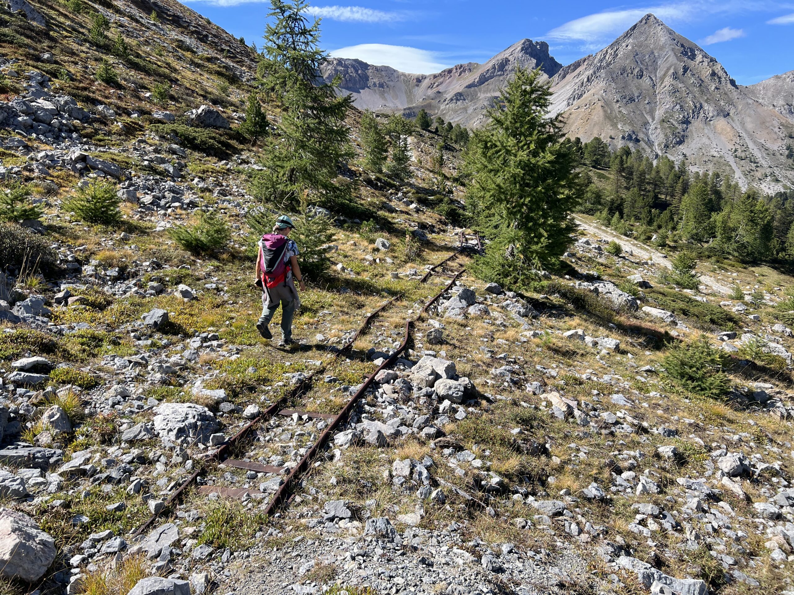
Dal bivio per gli Chalets de l’Izoard si percorre per alcune centinaia di metri la strada asfaltata (ovviamente nel caso si voglia compiere l’anello in senso inverso si sale subito la sterrata per gli chalets) lungo il rettilineo, al termine del quale si incontra il sentiero che permette di evitare la strada. Rapidamente si raggiunge il Refuge Napoleon, e poco dopo il Col de l’Izoard 2360 m.
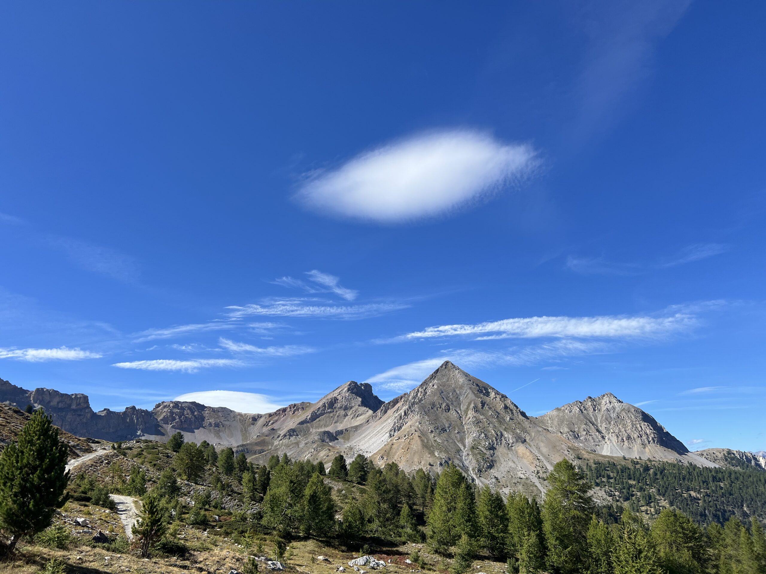
Appena oltre i due negozietti si stacca sulla destra un bel sentiero con indicazioni Clot la Cime. La traccia, ben marcata, attraversa agevolmente tutto il versante est della montagna con un lungo traverso ascendente, si attraversano alcuni colatoi ma il sentiero è ben curato e non ci sono problemi.
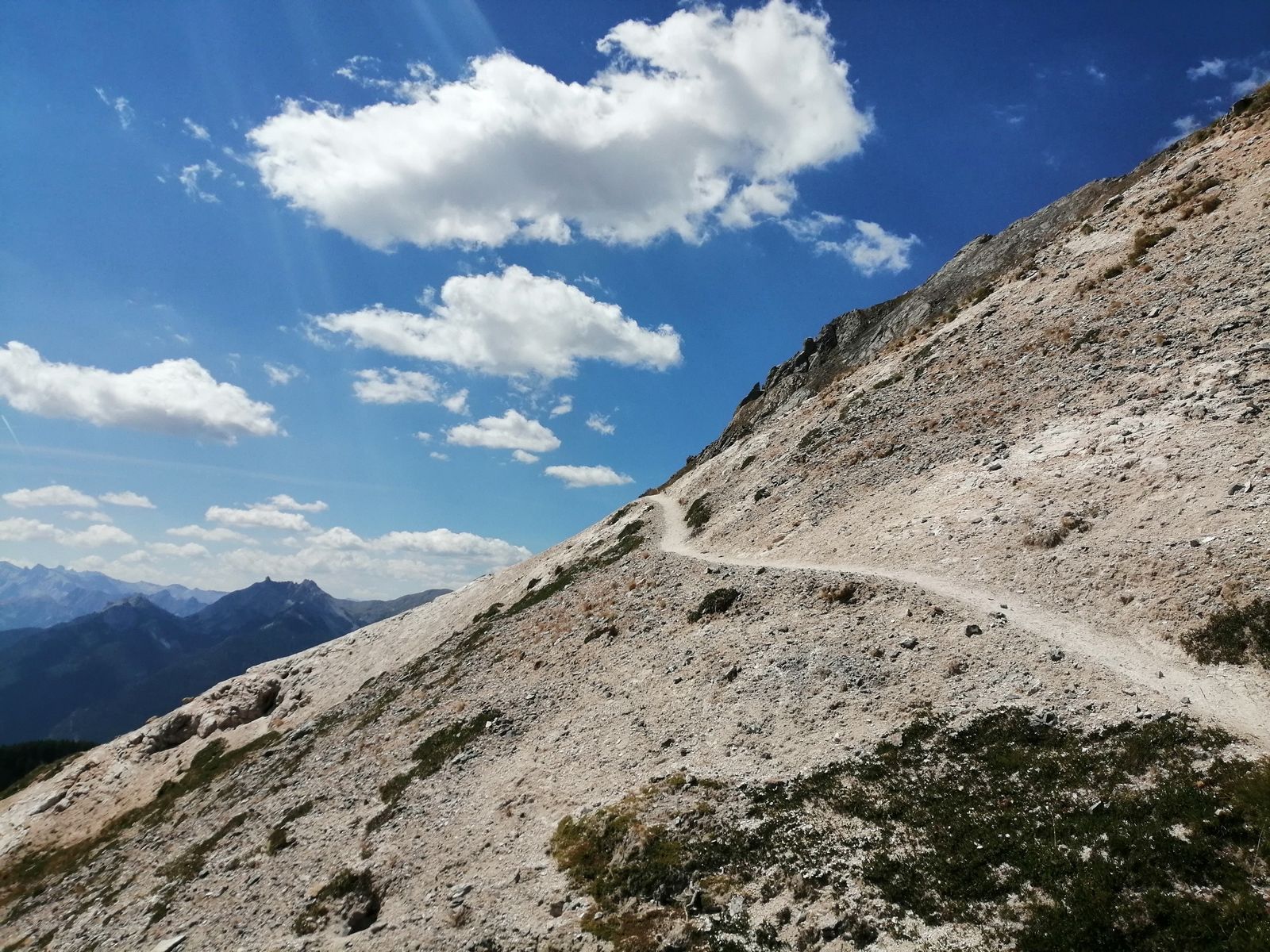
Si passa sul versante meridionale, proseguendo il traverso, dove si incontra un breve tratto attrezzato con un cavo metallico, superfluo in condizioni asciutte (serve più che altro in discesa per la natura sdrucciolevole del terreno, ma non c’è esposizione); poco oltre il terreno da detritico diventa erboso, e si apre una piccola valletta sulla destra che il sentiero consente di salire comodamente.
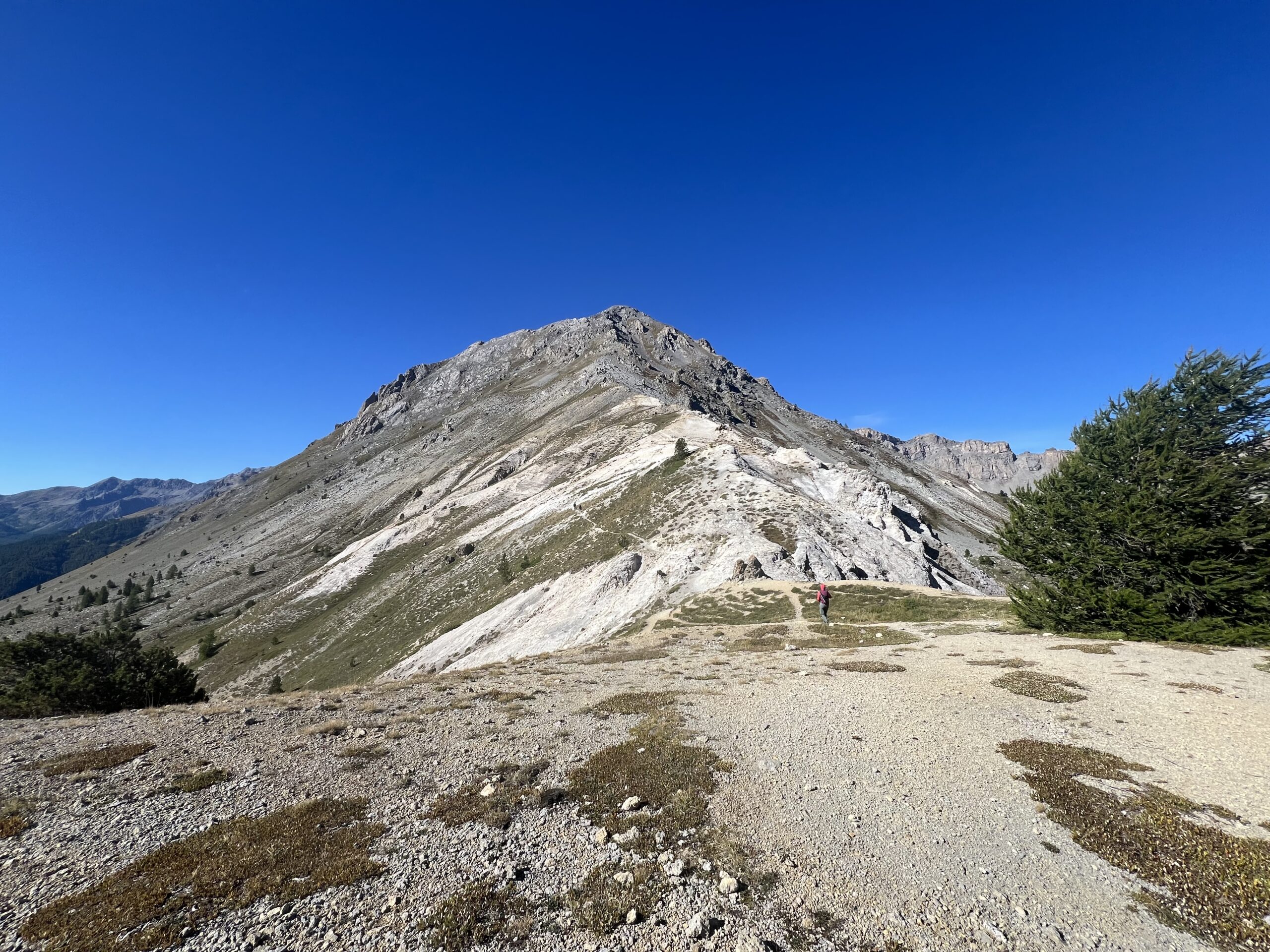
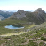
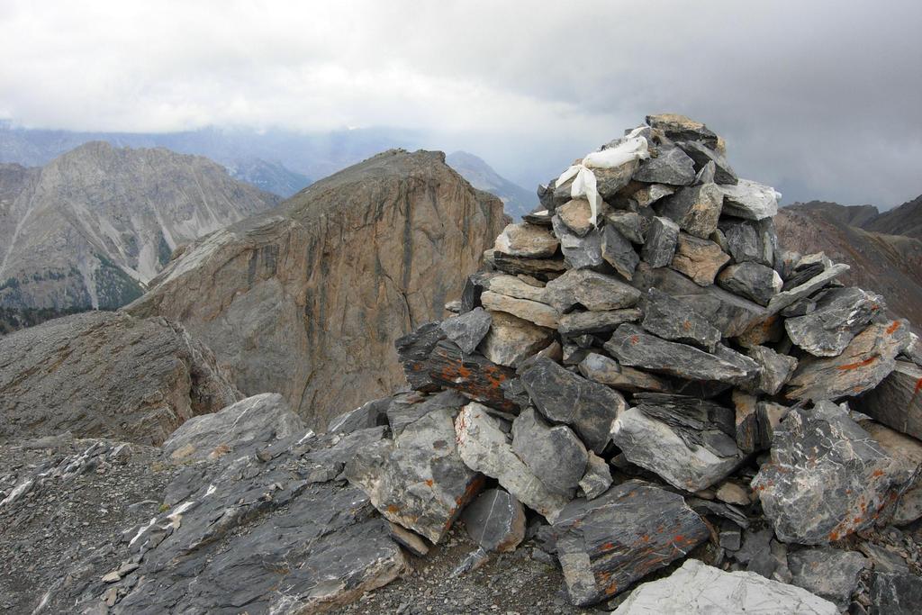
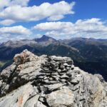
Si raggiunge una selletta a pochi passi dalla cima, caratterizzata da una truna di pietre e da una targa bellica.
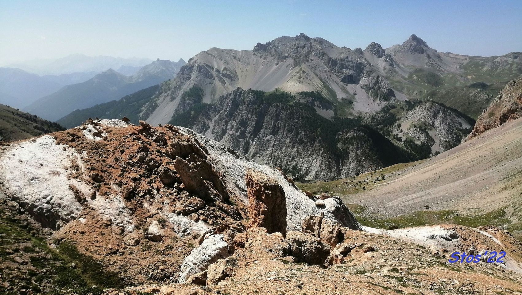
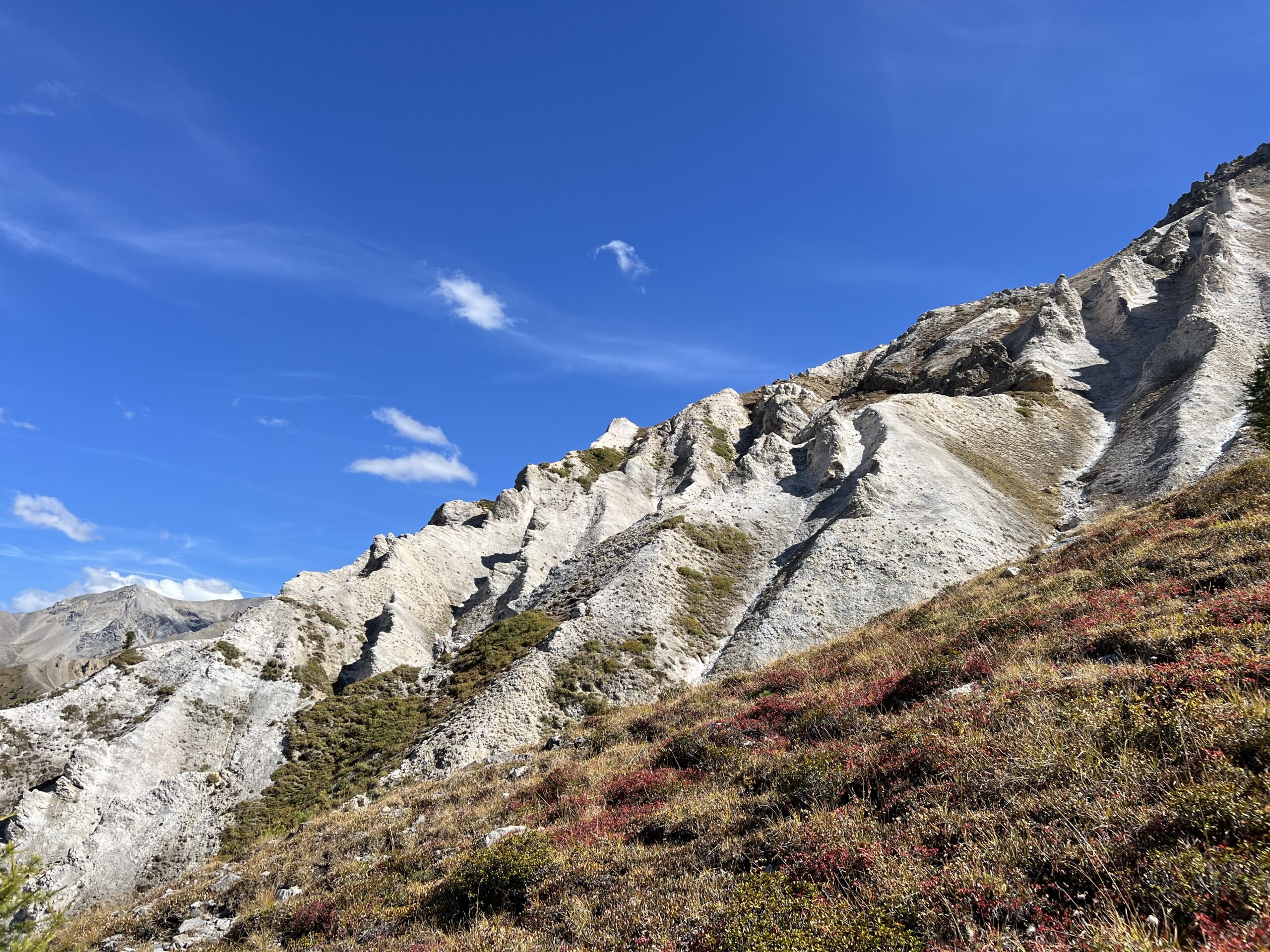
Per chi non volesse cimentarsi nella discesa ripida per il Col des Ourdeis si fa ritorno all’auto lungo il percorso di salita, altrimenti si percorre la dorsale erbosa pianeggiante verso ovest raggiungendo un ometto di pietre, da dove inizia la ripida discesa. La prima parte è su facili ghiaioni, dove una marcata traccia permette di scendere comodamente con qualche serpentine, successivamente il terreno diventa un po’ più ostico, fondo duro con del detrito scivoloso, in ogni caso la dorsale è molto ampia e non ci sono pericoli. Ci si aiuta con qualche zona di pietrame più grosso, ed infine con un altro breve tratto un po’ fastidioso si arriva alla spianata del Col des Ourdeis 2420 m.
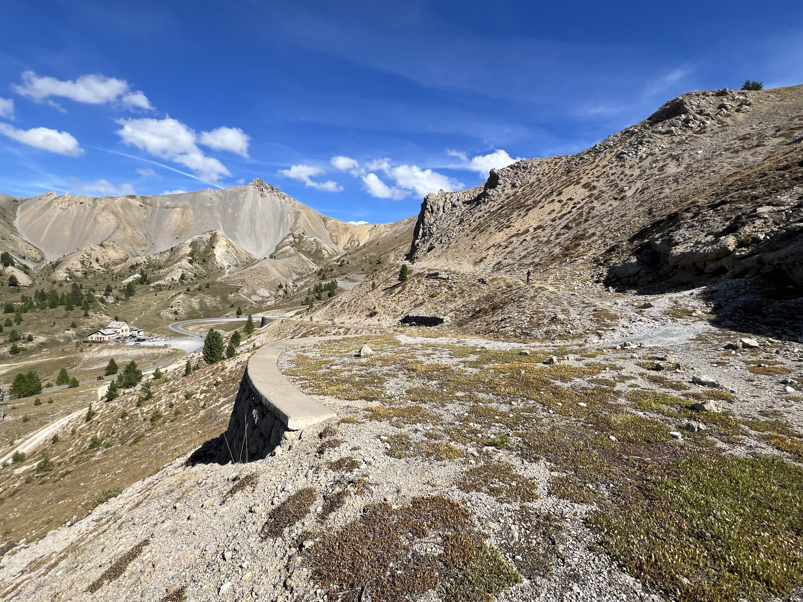
A questo punto si segue la traccia di destra che scende tra i detriti ed affioramenti erbosi verso il vallone degli Chalets de l’Izoard, in estate solitamente adibito a pascolo per le greggi di pecore. Si raggiunge il sentiero principale, diretto al Col de Peygus, seguendolo in discesa toccando gli chalets e quindi seguendo la sterrata si fa rapidamente ritorno all’auto.
- Cartografia:
- Briancon IGN
- Bibliografia:
- Barbier-Campana Scialpinismo
Nelle vicinanze Mappa
Itinerari
11/07/2010 Hautes-Alpes, Cervières D+ 671 m E Sud
Grand Peygu dagli Chalets de l’Izoard
50m
09/08/2013 Hautes-Alpes, Cervières D+ 1320 m EE Nord-Ovest
Turge de la Suffie da le Laus
2.8Km
29/07/2015 Hautes-Alpes, Cervières D+ 900 m EE Tutte
Peygus (Col des) da le Laus, anello
2.8Km
08/07/2025 Hautes-Alpes, Cervières D+ 1280 m EE Nord-Est
Escalinade (l’) e Turge de la Suffie da les Chalps per il Lac des Cordes, anello per il Col de Marsailles
 2.8Km
2.8Km
09/10/2011 Hautes-Alpes, Arvieux D+ 382 m E Sud-Ovest
Tronchet (Sommet) dal Col de la Platriere per il Lac de Souliers
3Km
22/09/2024 Hautes-Alpes, Arvieux D+ 732 m EE Sud
Cote Belle (Pic Ouest de) dal Col de la Platriere per il Lac de Souliers
 3Km
3Km
30/07/2023 Hautes-Alpes, Arvieux D+ 900 m EE Varie
Maravoise (Pic de) da Brunissard
 3.4Km
3.4Km
01/09/2007 Hautes-Alpes, Arvieux D+ 1000 m EE Varie
Esparges Fines (Pic des) da le Coin d’Arvieux
6.6Km
26/07/2023 Hautes-Alpes, Villar-Saint-Pancrace D+ 1150 m EE Sud-Ovest
Beaudouis (Pic de) dagli Chalets des Ayes
 7.2Km
7.2Km
29/07/2023 Hautes-Alpes, Arvieux D+ 1000 m E Varie
Barre Noire da Arvieux, anello per il Col de Fountouse
 7.4Km
7.4Km
Servizi
4.4Km