 2.2Km
2.2Km
Note
 600m
900m
1.3Km
6.3Km
8.1Km
8.5Km
8.5Km
600m
900m
1.3Km
6.3Km
8.1Km
8.5Km
8.5Km
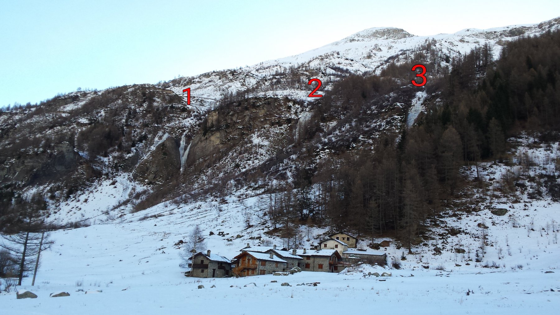
Inizio stagione , con poca neve. In direzione dell'alpe Omonima, dopo la cascata ad Y.
Avvicinamento
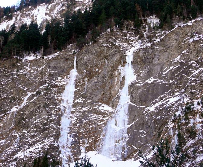
Seguire la pista di fondo della Val Ferret più o meno sino a metà tracciato, sulla dx si nota la cascata, che si trova dopo quella a Y.
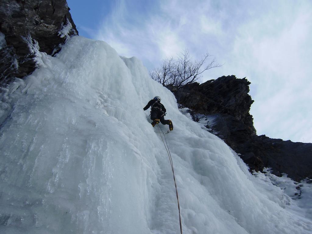
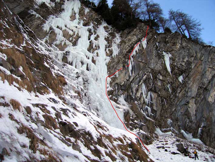
Descrizione
Non è attrezzata. Servono 6 – 7 viti da ghiaccio . Calate su clessidre.
- Bibliografia:
- Matteo Giglio - Effimeri Barbagli - 2014 Tipografia Valdostana
Nelle vicinanze Mappa
Itinerari
31/12/2018 AO, Courmayeur 70 m II, 3 Nord-Ovest
Val Ferret – Y (Cascata)
 600m
600m
20/12/2015 AO, Courmayeur 100 m III, 3 Nord-Ovest
Val Ferret – Mayencet (Cascata di)
 900m
900m
26/12/2015 AO, Courmayeur 180 m III, 2 Nord-Ovest
Val Ferret – Tapa Ice (Cascata)
 1.3Km
1.3Km
26/01/2011 AO, Courmayeur 100 m III, 4 Nord-Est
Curmayeur – Esse (Cascata)
 6.3Km
6.3Km
26/12/2005 AO, Pré-Saint-Didier 80 m II, 5 Nord-Est
Champex – Happy Birthday (Cascata)
 8.1Km
8.1Km
25/01/2003 AO, Pré-Saint-Didier 90 m II, 5 Nord-Est
Champex – Chougnagawa (Cascata)
8.2Km
01/02/2009 AO, Pré-Saint-Didier 160 m I, 5 Ovest
Pré Saint Didier – Au Bout des Thermes (Cascata)
8.4Km
07/01/2011 AO, Morgex 120 m I, 5 Nord
Morgex – Vacherie de gauche (Cascata)
 8.5Km
8.5Km
08/01/2011 AO, Morgex 120 m I, 5+ Nord
Morgex – Grande Vacherie (Cascata)
 8.5Km
8.5Km
01/03/2003 AO, Pré-Saint-Didier 150 m II, 5 Varie
Pré Saint Didier – Alexandra (Cascata)
9Km