2.3Km
2.3Km


Note
Storico
 600m
900m
1.1Km
2.5Km
4.1Km
4.7Km
4.9Km
5.7Km
5.7Km
600m
900m
1.1Km
2.5Km
4.1Km
4.7Km
4.9Km
5.7Km
5.7Km
2.3Km
6Km
6.4Km
7.8Km
7.8Km
8.2Km
9.2Km
9.3Km
9.3Km
9.3Km
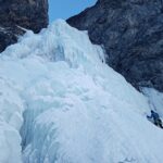
Le cascate:
- n.171 Cascata di Pisse Neire (Cascatone della Banchetta)
- n.172 Il cilindro dei magnifici sette
- n.173 Cascata della Guglietta
- n.174 Cascata della Grande
- n.175 Cascata la Piccola
sono vietate dato che è zona di nidificazione dell'aquila. I guardiaparco del Parco Val Troncea non mancheranno di controllarvi. Le sanzioni sono molto pesanti. Informarsi c/o i guardiaparco per eventuali variazioni ai divieti.
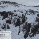
Avvicinamento
- n.171 Cascata di Pisse Neire (Cascatone della Banchetta)
- n.172 Il cilindro dei magnifici sette
- n.173 Cascata della Guglietta
- n.174 Cascata della Grande
- n.175 Cascata la Piccola
sono vietate dato che è zona di nidificazione dell'aquila. I guardiaparco del Parco Val Troncea non mancheranno di controllarvi. Le sanzioni sono molto pesanti. Informarsi c/o i guardiaparco per eventuali variazioni ai divieti.
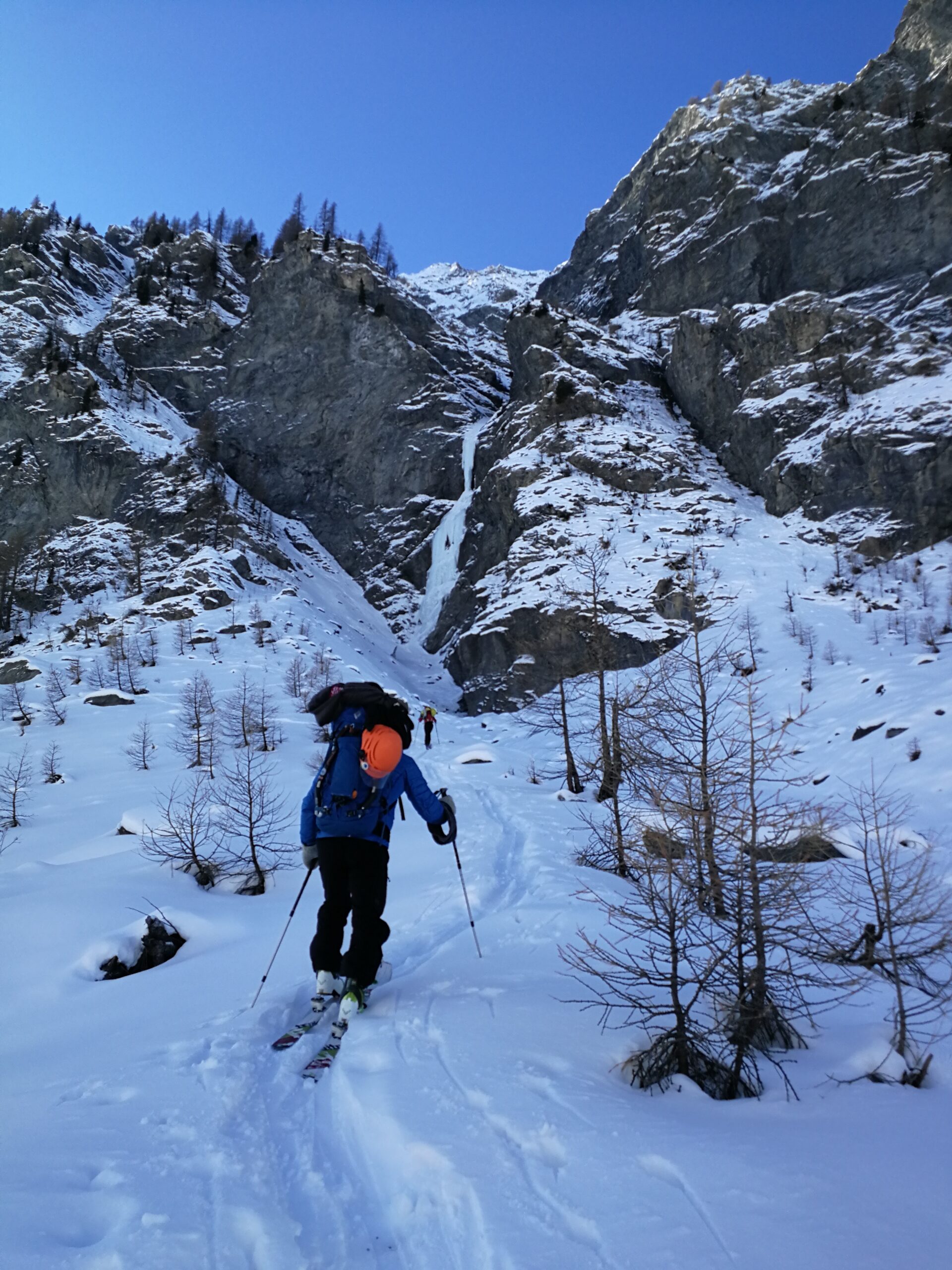
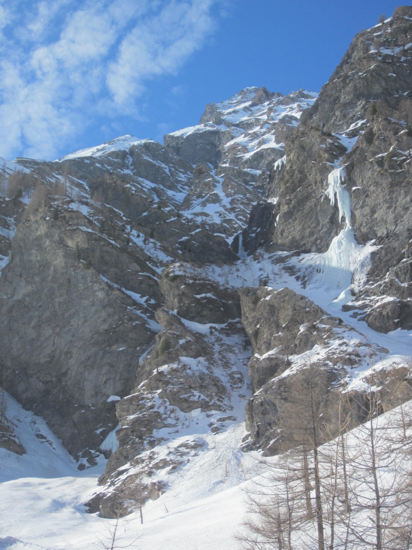
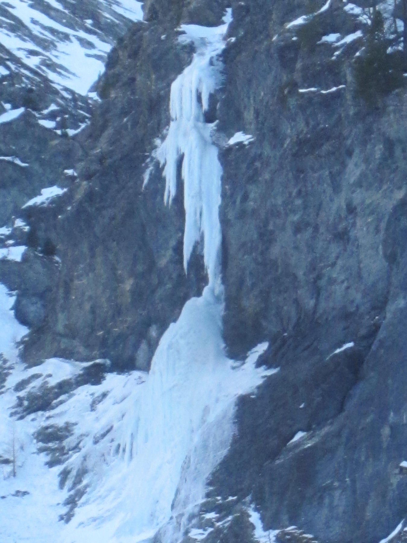
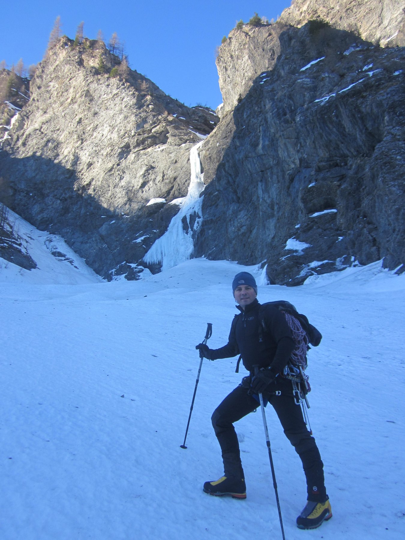
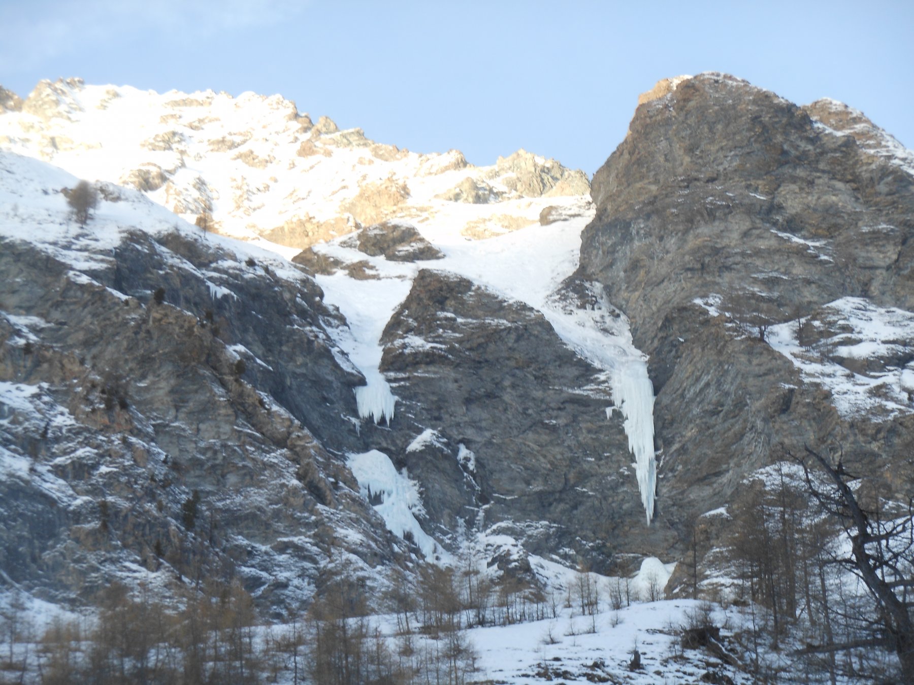
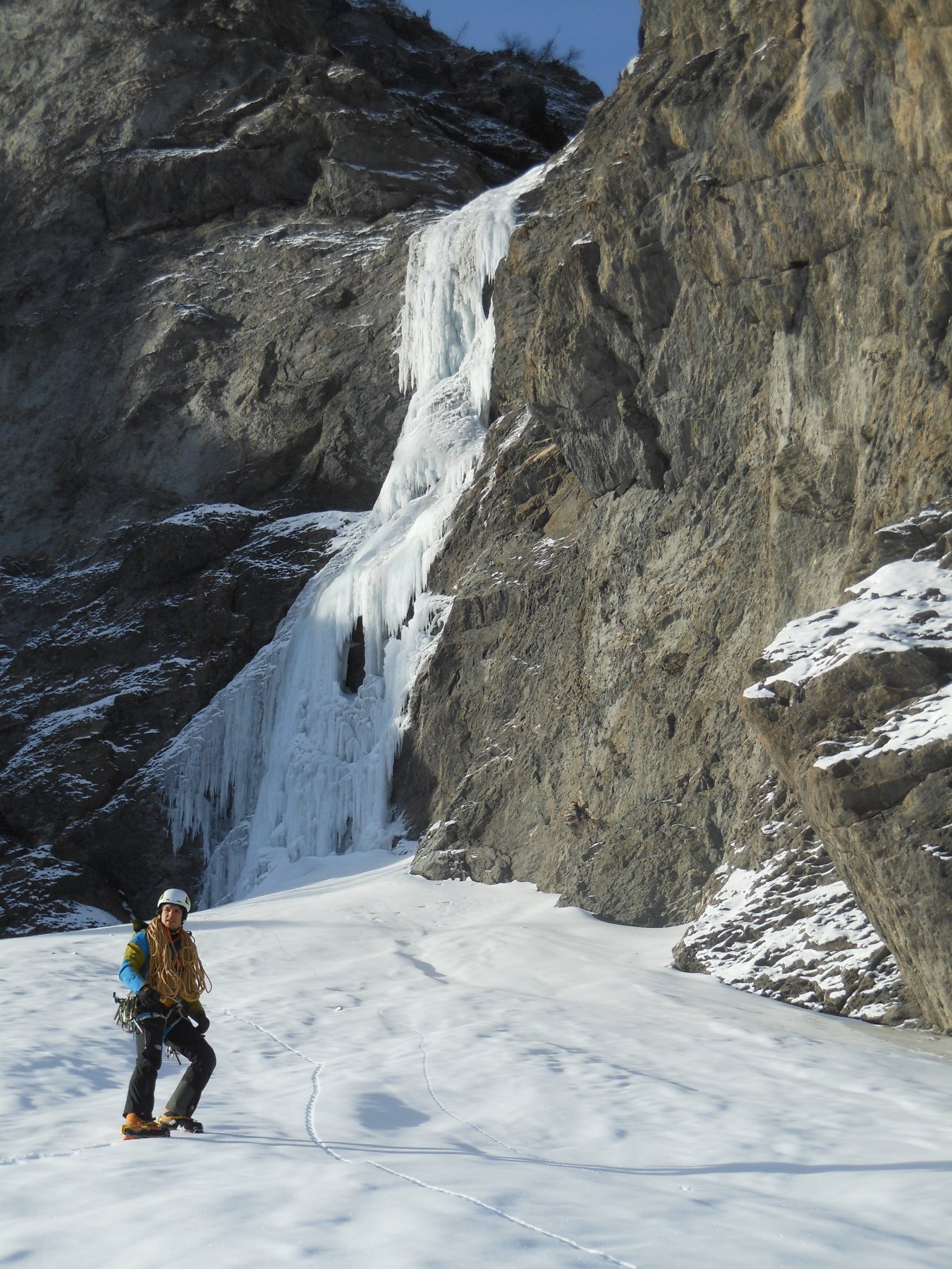
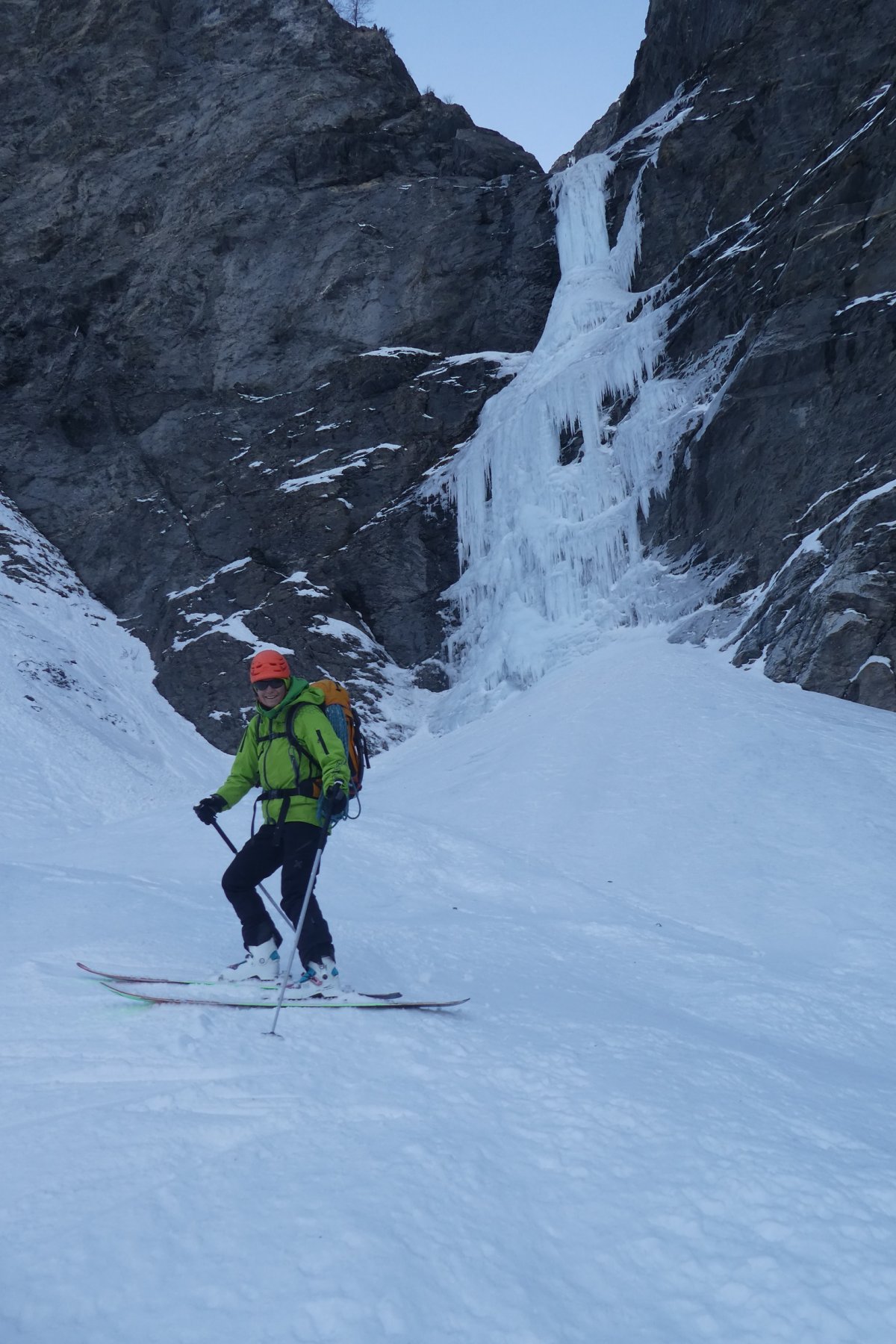
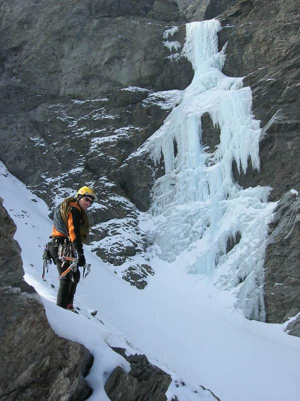
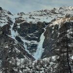
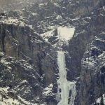
Risalire la val Troncea. Superare il bivio per il rifugio rimanendo sulla pista principale. Passata la "strettoia" della Lendiniera (dove appare evidente il cascatone del Rouit), proseguire lungo la valle e attraversare il Chisone. Dopo una breve salita la cascata diventa evidente sulla dx e la si raggiunge abbandonando la strada (2h dal Park).
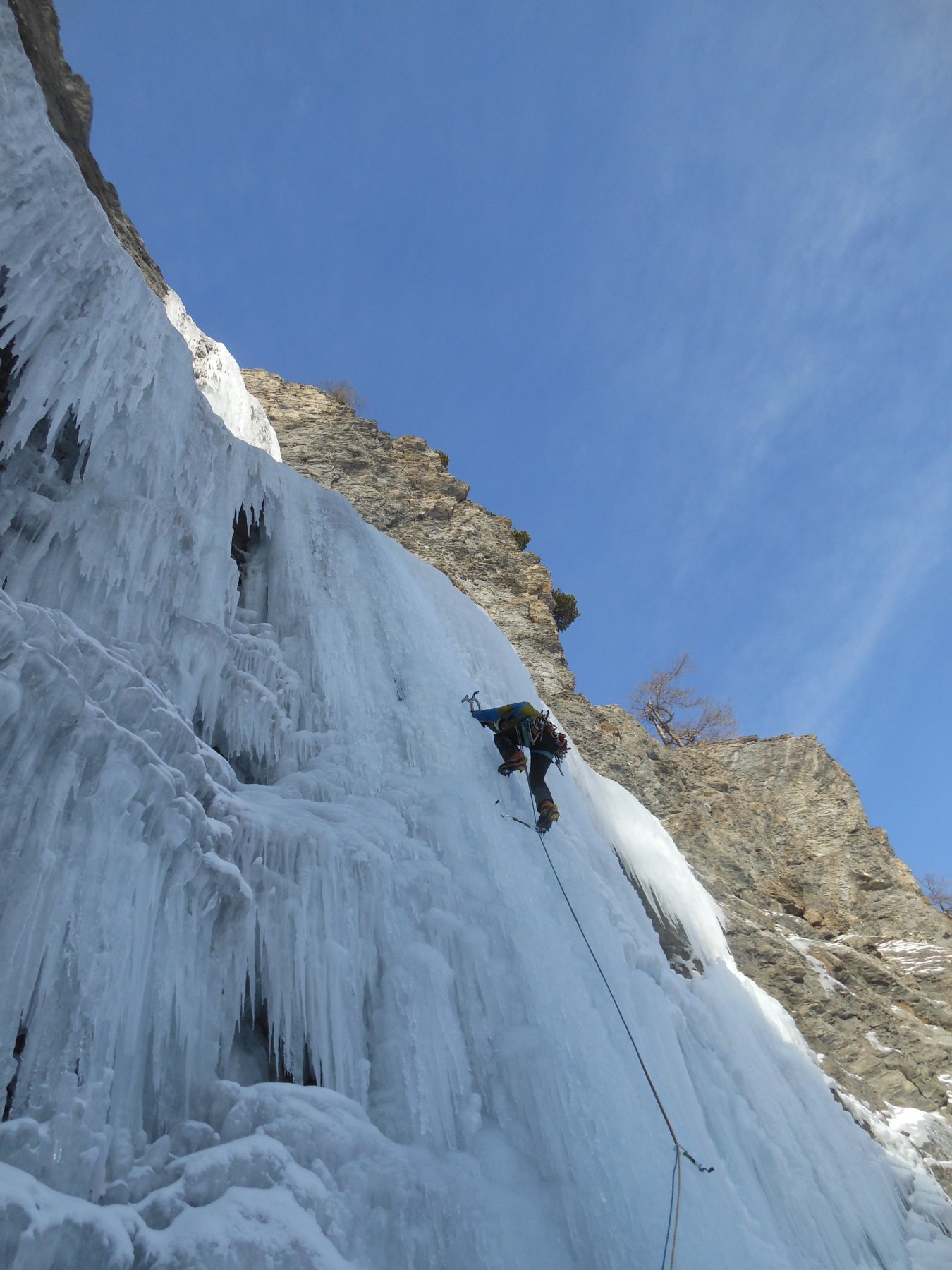
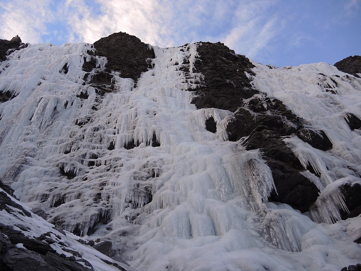
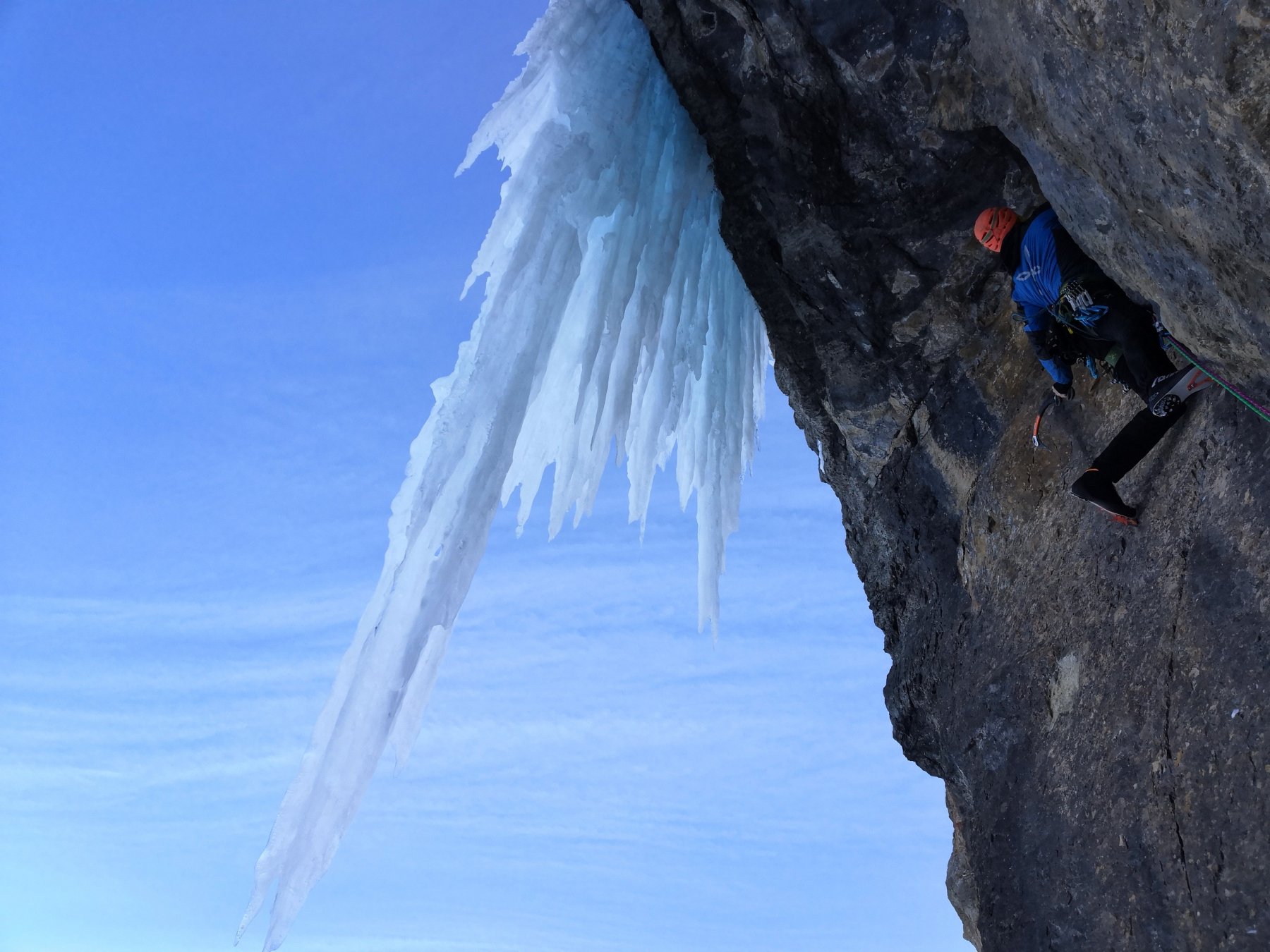
Descrizione
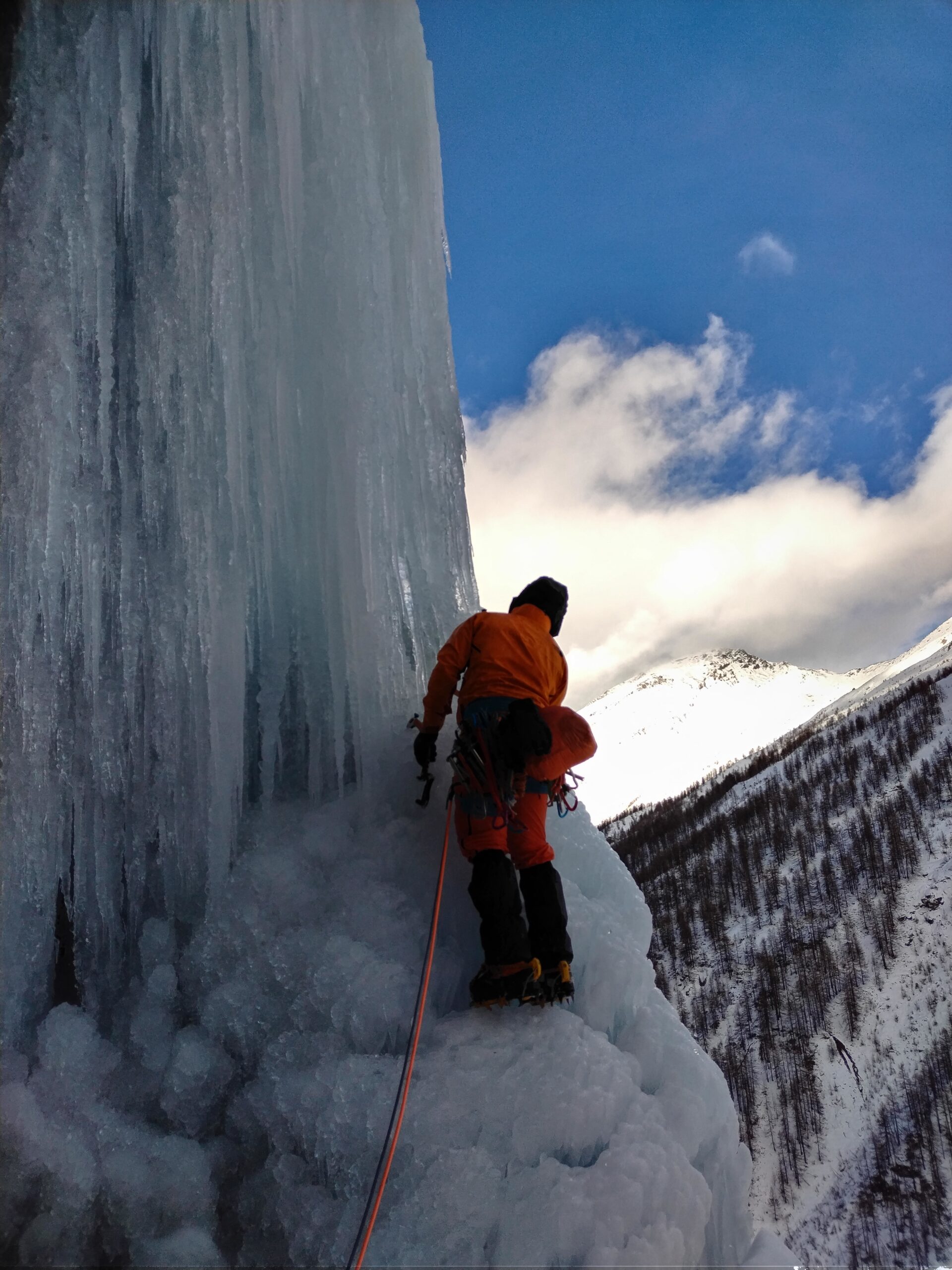
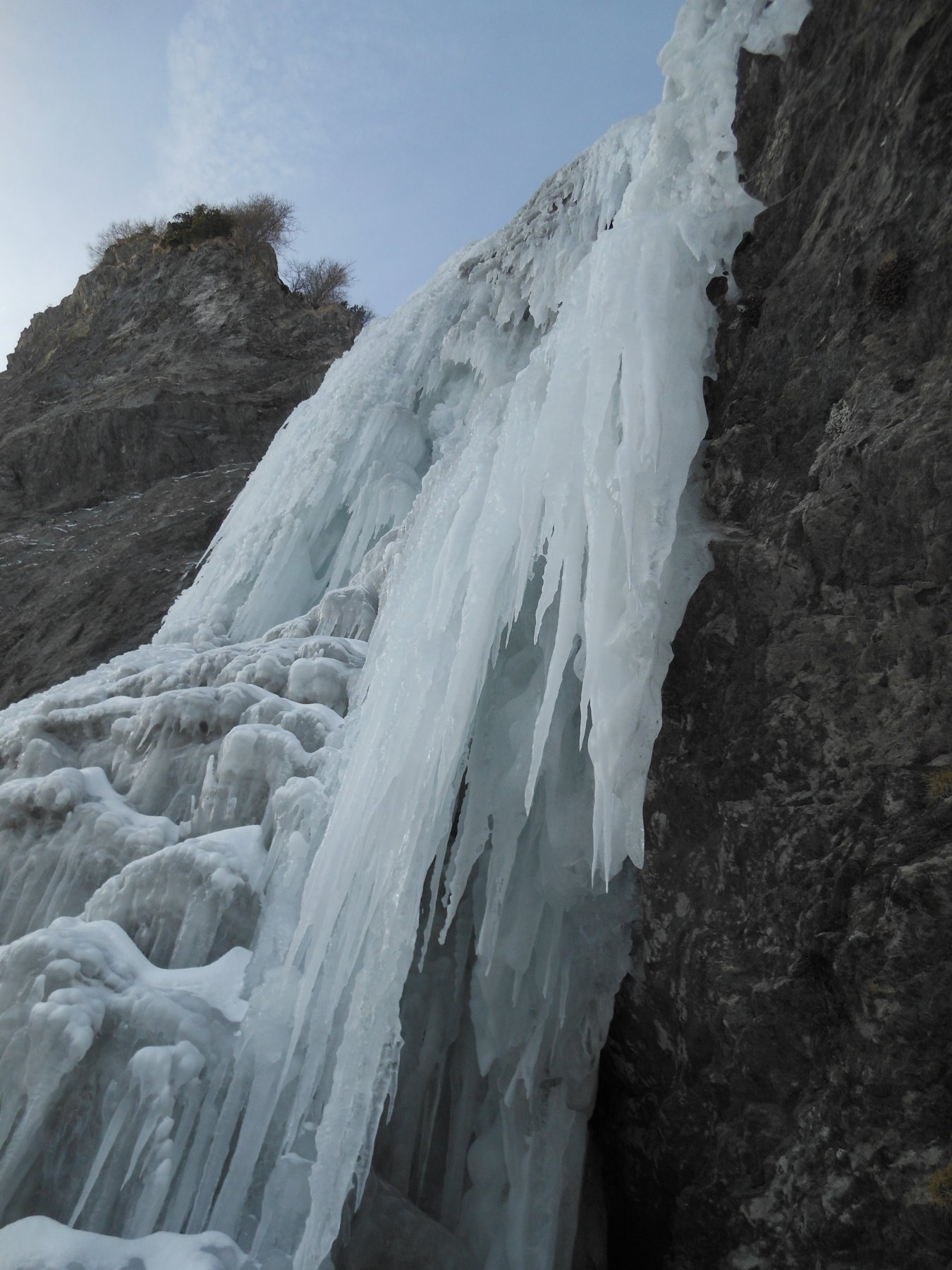
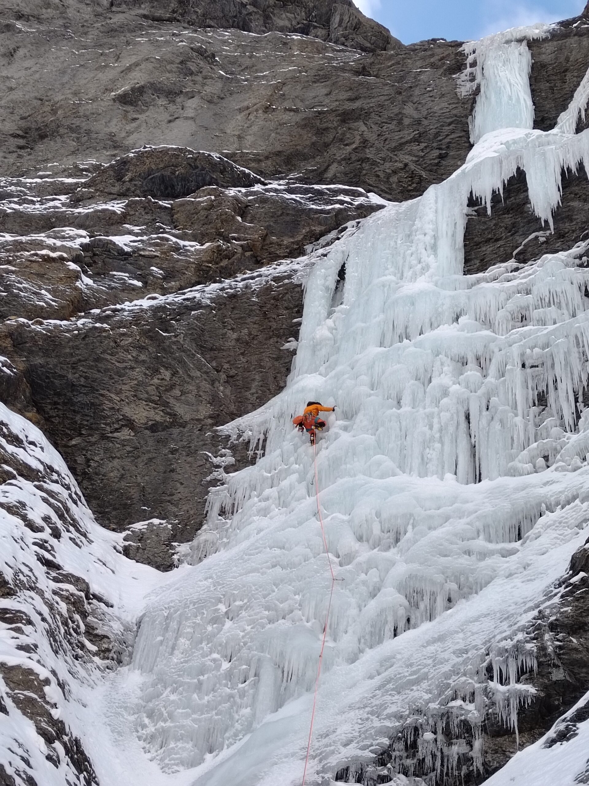
- L1: salire il primo salto stalattitico a sinistra, raggiunto il ripiano mediano andare a destra contro le rocce. Sosta su viti (45m, 15m a 90°).
- L2: afrontare la seconda colonna a destra dove è meno alta fino all’uscita in piano. Sosta un cordone. (30m, 10m a 90°).
- L3: facile uscita con muretto.
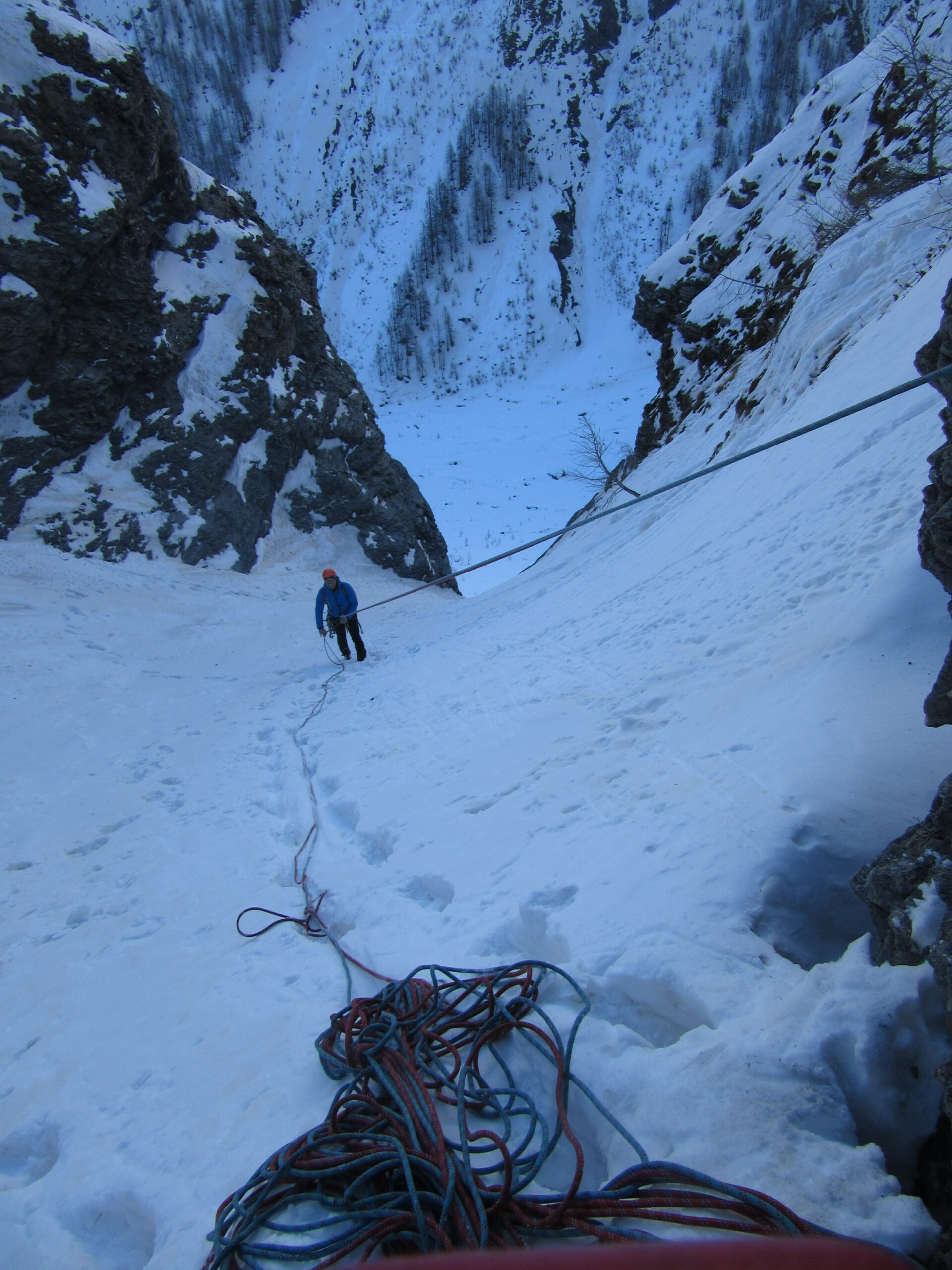
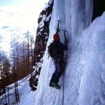
Discesa: dall’uscita si prende un canale obliquo verso destra che ripassa alla base della cascata. Traverso su cenge friabili.
In alternativa si scende in doppia su abalakov.
N. Margaira, F. Girodo e W. Giorda nel febbraio 1987
- Bibliografia:
- Ghiaccio dell'ovest
Nelle vicinanze Mappa
Itinerari
15/12/2024 TO, Pragelato 100 m IV, 5 Est
Val Troncea – Lacrime Ibernate (Cascata)
 600m
600m
10/01/2026 TO, Pragelato 130 m III, 4 Est
Val Troncea – Rouit (Cascatone del)
 900m
900m
05/01/2025 TO, Pragelato 120 m III, 4 Sud-Est
Val Troncea – Paretone del Rio Faurì (Cascate)
 1.1Km
1.1Km
04/01/2011 TO, Pragelato 100 m II, 5+ Est
Val Troncea – Dies Irae (Cascata)
1.2Km
27/02/1994 TO, Pragelato 150 m III, 4+ Nord-Est
Val Troncea – Guglietta (Cascata della) VIETATA
 2.5Km
2.5Km
21/02/1995 TO, Pragelato 120 m IV, 5 Nord-Est
Val Troncea – Pisse Neire (Cascata) VIETATA
 4.1Km
4.1Km
31/12/2018 TO, Sestriere 65 m III, 5+, M8 Nord
Banchetta (Monte) – Alla Bellemmeglio (Cascata)
 4.7Km
4.7Km
16/12/2023 TO, Sestriere 180 m III, 2 Ovest
Chisonetto (Vallone del) – Principiante e dei Tre (Cascate)
 4.9Km
4.9Km
11/01/2025 TO, Sauze di Cesana 50 m III, 3+ Nord
Valle Argentera – Rio Adriet (Cascata del)
 5.7Km
5.7Km
11/01/2025 TO, Sauze di Cesana 100 m III, 4 Nord-Est
Valle Argentera – Stalattite di Fumo (Cascata)
 5.7Km
5.7Km
Servizi
2.3Km
6Km
Mulino di Laval Rifugio
Pragelato
6.4Km
Refugium – ex. Rif. Belotte Rifugio
Pragelato
7.8Km
La capanna del sole Ristorante
Pragelato
7.8Km
Al Mulino Ristorante
Pragelato
8.2Km
Misun La Font Ristorante
Sauze di Cesana
9.2Km
Casa degli Escartons Alex Berton B&B
Pragelato
9.3Km
Casa Alpina Rifugio
Pragelato
9.3Km
Passet Ristorante
Pragelato
9.3Km