5.5Km
5.5Km


Note
 650m
2.3Km
2.3Km
3.6Km
4.4Km
5.5Km
6.7Km
650m
2.3Km
2.3Km
3.6Km
4.4Km
5.5Km
6.7Km
5.5Km
6.7Km
6.7Km
6.7Km
8.2Km
8.3Km
8.9Km
8.9Km
8.9Km
9.3Km
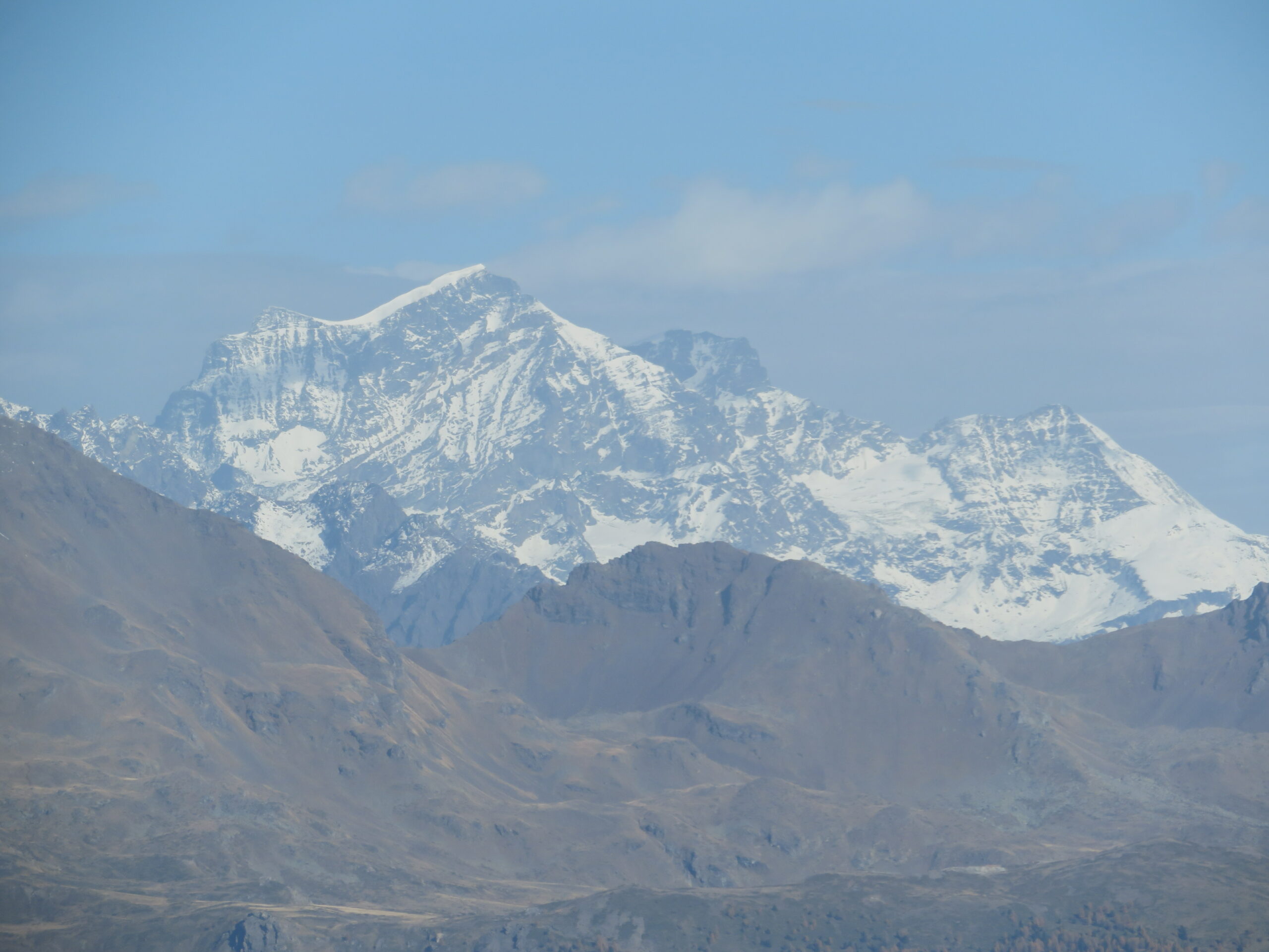
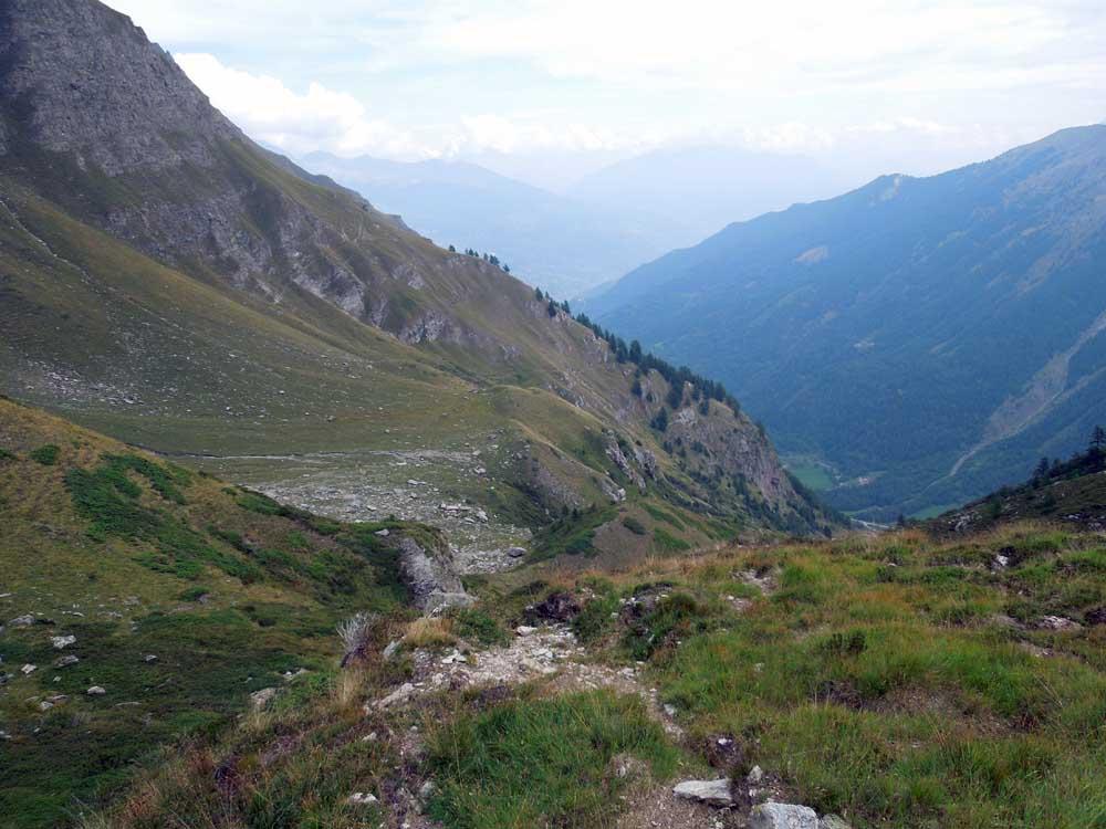
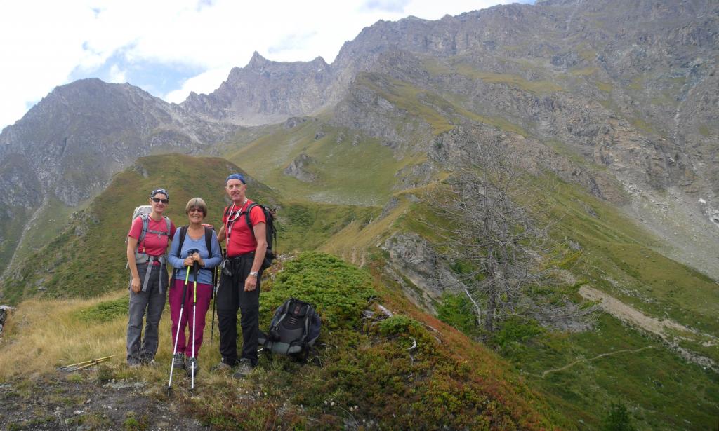
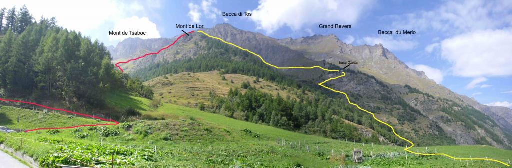
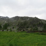
Questa escursione ad anello presenta un dislivello non eccessivo ed un percorso relativamente breve (poco più di 8.5 km) ma attraversa, una volta abbandonata la poderale, ambienti selvaggi e poco frequentati che, dopo una salita faticosa e senza praticamente indicazioni, ci porta sui grandi e ripidi pendii erbosi che sono l’habitat caratteristico della la fauna alpina di alta montagna. La traccia si perde tra la vegetazione appena dopo la poderale ma il percorso risulta logico sulla risalita del canalone erboso; dal punto in cui, quasi al culmine del pendio, si devia a destra l’itinerario risulterà sempre evidente con qualche traverso un po’ esposto. Gli ambienti di discesa poi sono veramente belli attraversando grandi pascoli sormontati dalle alte bastionate rocciose dominate dalla becca di Tos. Il giro si consiglia di effettuarlo nel senso descritto per evitare la ripida discesa verso la poderale di Lor damon che presenta difficoltà di progressione per la fitta vegetazione ed erba scivolosa. Dalla cima il panorama verso sud è molto bello e ravvicinato sulla cresta delle Punte Chamoussiére, Ran e Bioula sino alla Cima di Entrelor mentre, dal versante opposto, è imponente per le alte bastionate rocciose che dalla Punta Feluma arrivano sino al Grand Revers.
Avvicinamento
.
Descrizione
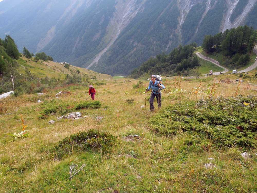
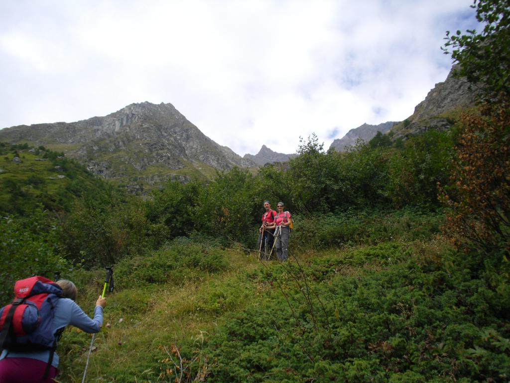
Da Courthoud si sale con la poderale sino al tornante sotto l’alpeggio di Lor damon e da qui si prende un sentiero che, indirizzandosi nel canalone erboso, si perde quasi subito nell’erba.
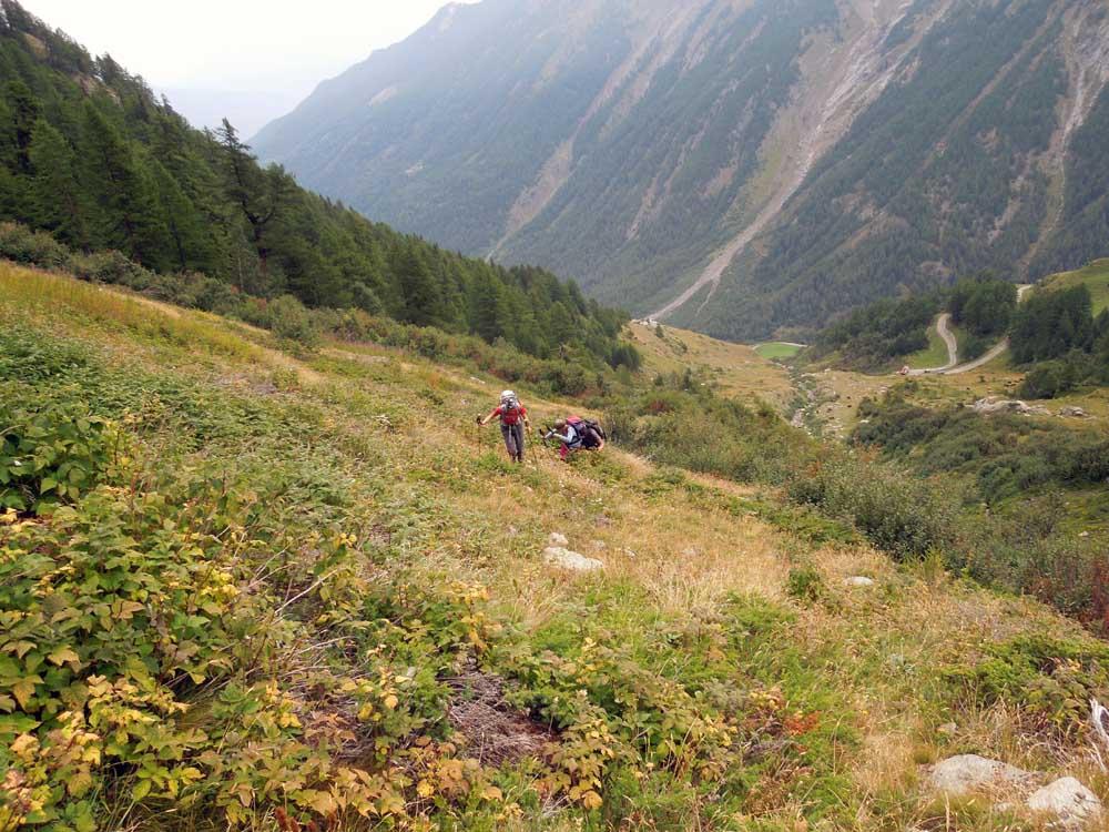
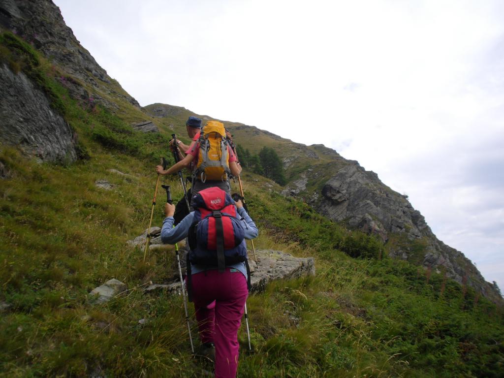
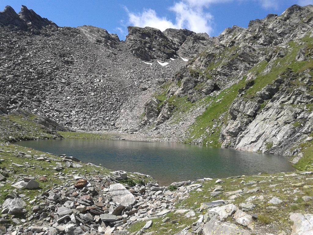
Attraversato il torrente nel suo punto migliore si deve individuare una labile traccia che costeggia sulla destra (sinistra orografica) il corso d’acqua ed inizia a salire direttamente il ripido pendio. Si sale molto faticosamente camminando, oltre che su terreni ripidi, anche tra la fitta vegetazione sia alta che bassa e che nasconde completamente la traccia; intuendone il percorso logico ma poco evidente ci si allontana di poco dal torrente Courthoud per poi riavvicinarsi passando un piccolo ruscello ed arrivare ad una quota di circa 2140 m da dove, nei pressi di una bassa balza rocciosa un po’ nerastra, si prende la traccia ora evidente che devia decisamente sulla destra.
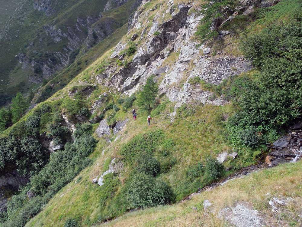
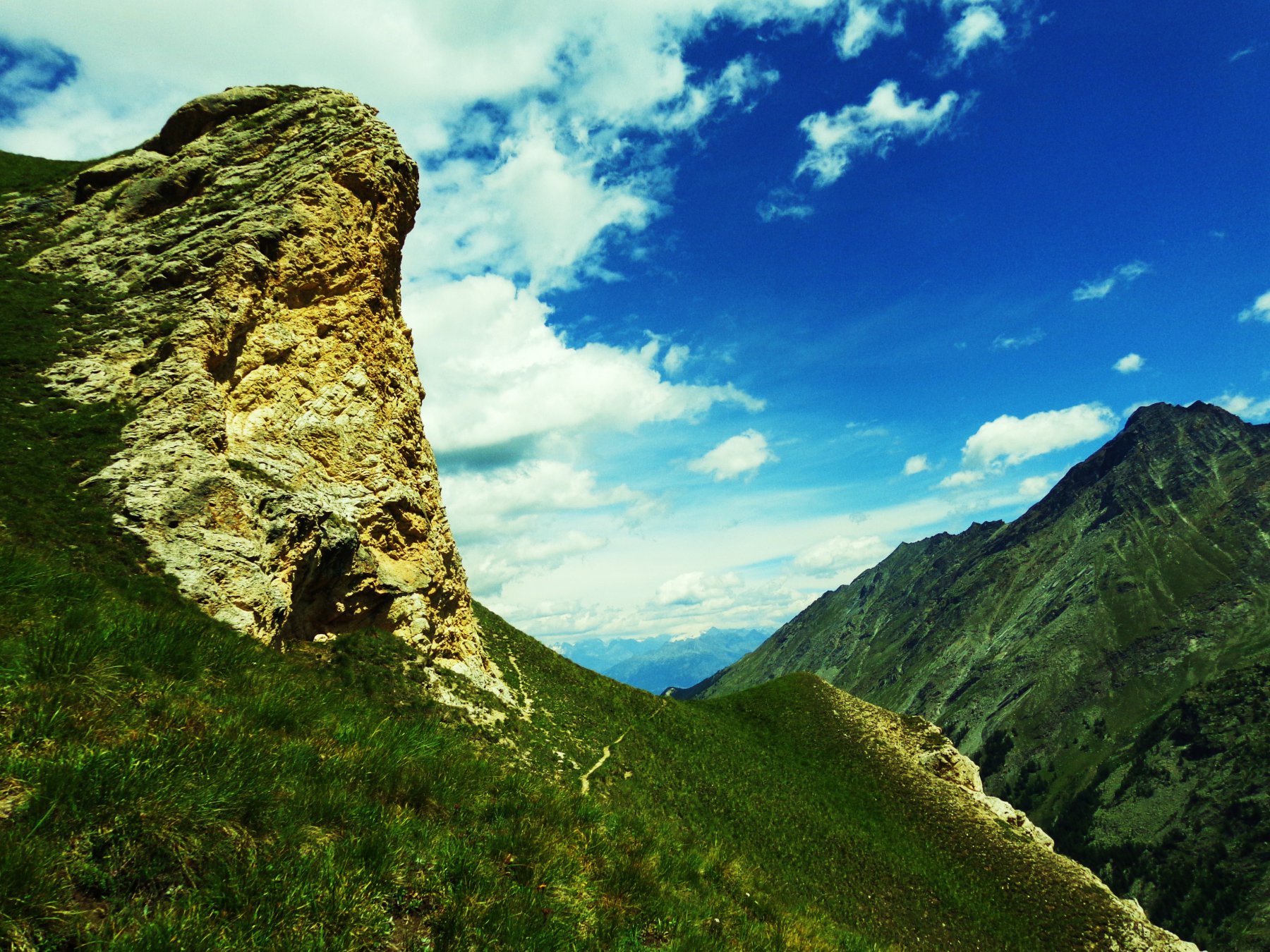
Si inizia ora a traversare su terreno erboso in leggera salita superando dapprima un piccolo promontorio con un ometto di pietra (2197 m) e poi, superato un breve tratto di fitta vegetazione, arrivando ad una spalletta da cui si traversa su terreno un po’ esposto.
Ora si guada un altro torrentello e si sale nuovamente col sentiero su terreno ripido arrivando nei pressi di una crestina erbosa dalla quale si taglia il pendio giungendo così al Col du Mont de Lor (2328 m); dall’insellatura si devia a destra e, percorsa qualche decina di metri si giunge sulla panoramica punta.
Per la discesa si prende il sentiero che scende alla destra del colle e, attraversato il largo vallone erboso sottostante, si dirige verso un boschetto dopo il quale si arriva alla baita di Dzette.
Poco prima della costruzione si scende per una traccia erbosa che attraversa un ripido pendio ed arriva al torrente poco al di sotto del guado precedente; riattraversato il torrente si continua scendendo alla sua destra e, contornato il costone, si arriva nuovamente ad un torrentello dove si trova una corda che ne facilita il superamento.
Passati accanto ad un rudere si trova un bivio al quale si scende a sinistra (1817 m) e, percorsi alcuni tornanti, il sentiero si trasforma in comoda mulattiera percorsa brevemente la quale si giunge ad incrociare la strada asfaltata in prossimità di una palina; risalitala sulla destra per alcuni minuti si arriva nuovamente alla partenza chiudendo così l’anello.
Nelle vicinanze Mappa
Itinerari
05/06/2016 AO, Rhemes-Saint-Georges D+ 316 m EE Est
Zette (Alpeggio) da Mugnoz a Rhemes Saint Georges
 650m
650m
03/07/2011 AO, Rhemes-Saint-Georges D+ 1493 m EE Nord
Nequedè (Passo) da Creton
750m
11/07/2023 AO, Rhemes-Saint-Georges D+ 1063 m EE Sud-Ovest
Changier (Laghi di) da Melignon
 2.3Km
2.3Km
02/09/2025 AO, Rhemes-Saint-Georges D+ 1152 m EE/F Nord
Changier (Becca di) da Melignon
 2.3Km
2.3Km
04/07/2025 AO, Rhemes-Saint-Georges D+ 1200 m E Ovest
Paillasse (Mont) e Mont Blanc da Coveyrand
 3.6Km
3.6Km
30/06/2024 AO, Rhêmes-Notre-Dame D+ 650 m T Nord-Est
Pechoud (Casotto) da Carrè, anello per Alpe Chaussettaz e Chanavey
 4.4Km
4.4Km
30/07/2023 AO, Rhêmes-Notre-Dame D+ 1000 m EE Sud
Changier (Laghi di) da Chanavey, giro dei Valloni di Cussuna e Feluma
 5.5Km
5.5Km
26/09/2014 AO, Rhêmes-Notre-Dame D+ 1189 m EE Sud
Cussunaz o Cussuna (Colle di) da Chanavey
5.5Km
15/08/2025 AO, Rhêmes-Notre-Dame D+ 1105 m EE Varie
Gollien (Cime di), spalla 2837 m da Rhêmes Notre Dame
 6.7Km
6.7Km
20/08/2023 AO, Rhêmes-Notre-Dame D+ 400 m E Ovest
Marmotte (Rifugio delle) da Rhemes Notre Dame
6.7Km
Servizi
5.5Km
6.7Km
Tanini Ristorante
Rhemes-Notre-Dame
6.7Km
Lo Sabot Albergo
Rhemes-Notre-Dame
6.7Km
Galisia Albergo
Rhemes-Notre-Dame
8.2Km
La Tana delle Volpi Ristorante
Valgrisenche
8.3Km
Paramont Albergo
Arvier
8.9Km
Chalet de L’Epée Rifugio
Valgrisenche
8.9Km
Lo Fourquin Bar
Valsavarenche
8.9Km
Abro de la Leunna Ristorante
Valsavarenche
9.3Km