 3.7Km
3.7Km
Note
 0m
0m
50m
50m
50m
50m
50m
50m
50m
50m
0m
0m
50m
50m
50m
50m
50m
50m
50m
50m
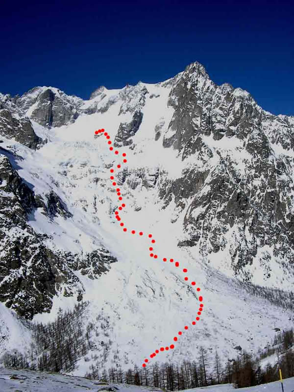
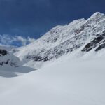
Splendida gita che conduce al bacino di Freboudze, ingiustamente non frequentato d'inverno.
Nella zona son possibili gite che valgono molto di più di classiche della zona iperaffolate e di scarsa soddisfazione. Anche limitarsi alla salita al rifugio permette una discesa di grande soddisfazione.
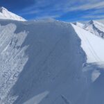
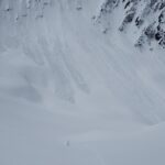
Attenzione: durante gran parte della gita si è sotto il tiro di grandissime seraccate!!!
Descrizione
Nella zona son possibili gite che valgono molto di più di classiche della zona iperaffolate e di scarsa soddisfazione. Anche limitarsi alla salita al rifugio permette una discesa di grande soddisfazione.
Attenzione: durante gran parte della gita si è sotto il tiro di grandissime seraccate!!!
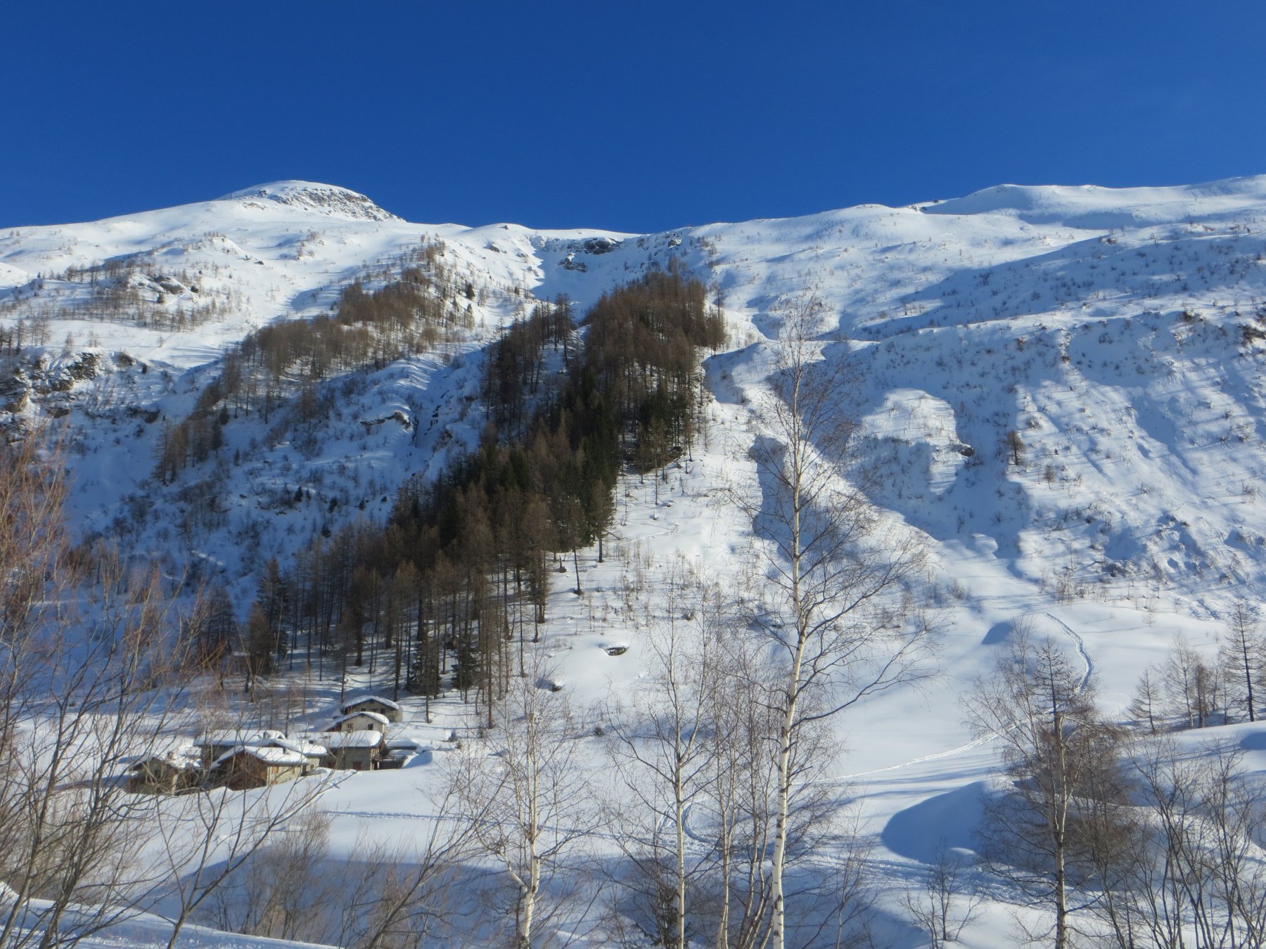
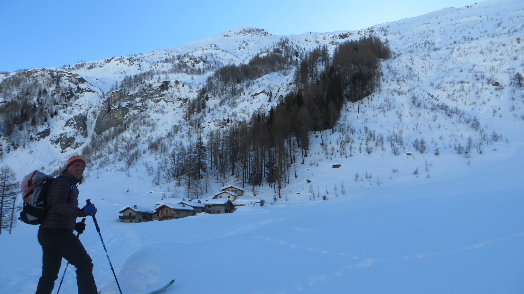
da Planpincieux (1564m) si segue la pista di fondo (tenersi sulla parte pedonale!!) fino a La Vachey (1642m, ristoranti, circa 5 km). prima del tornante della strada superare la Doire Ferret su un ponte (cartello per Freboudze, 1650m) e raggiungere Freboudze (bar).
A tarda stagione si arriva fin qui in auto.
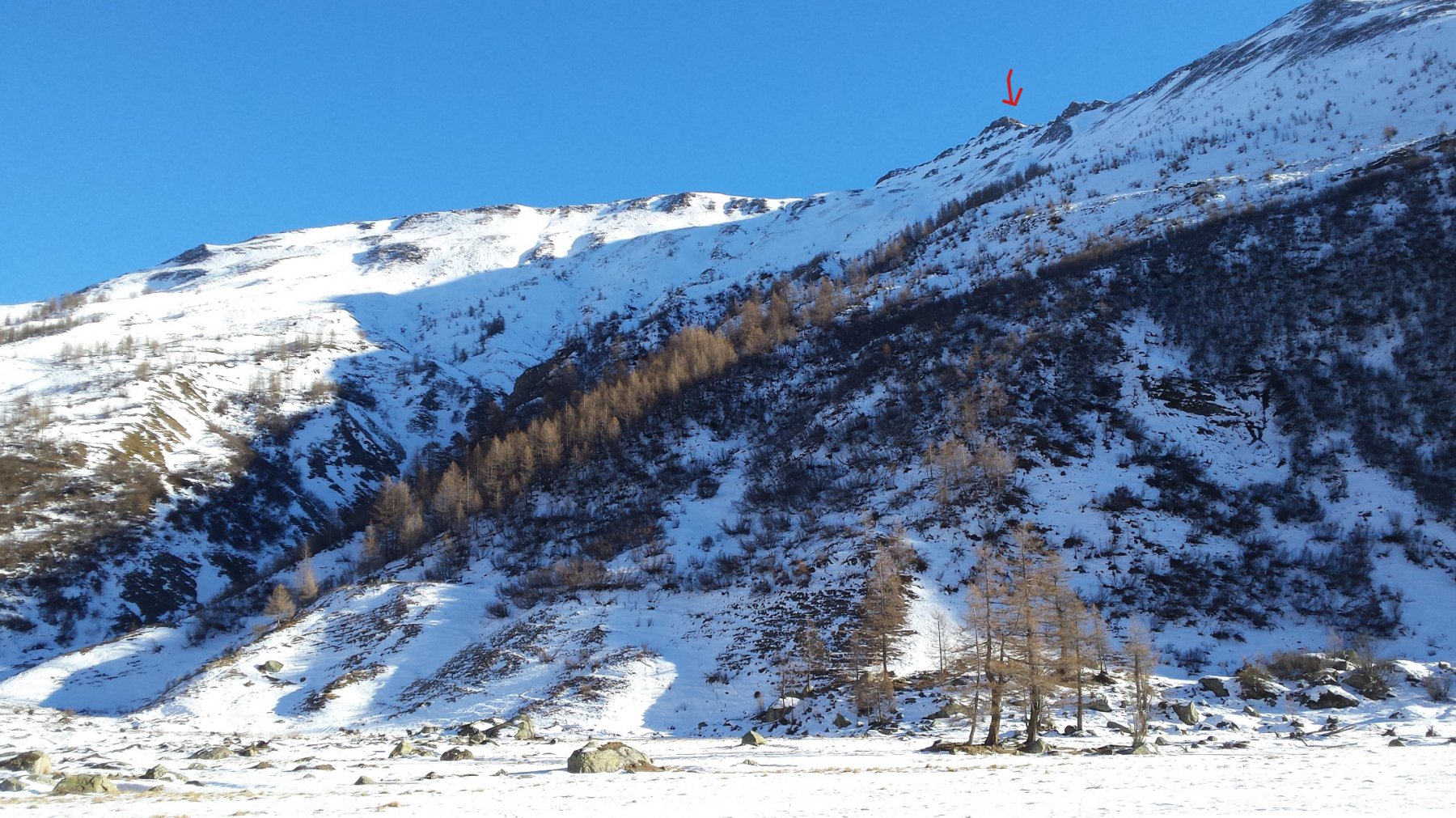
Da qui voltare a destra (cartello per il sentiero estivo) e salire per il rado bosco puntando all’evidente vallone di Freboudze.
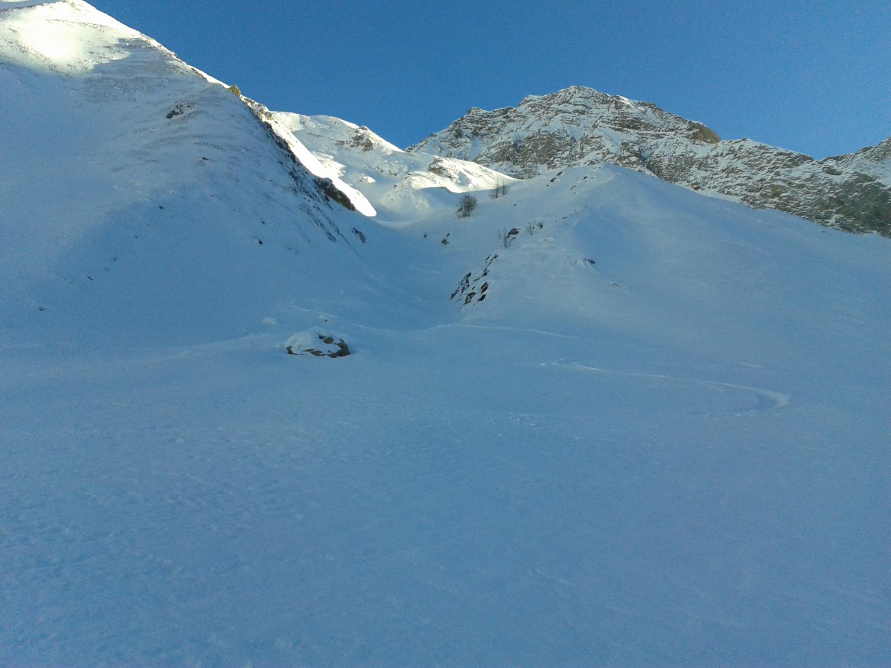
Si esce dal bosco verso i 1900m, si entra nel vallone morenico e ci si porta alla base della fascia rocciosa (2100m circa).
Si cerca di individuare il passaggio meno astioso tra le rocce e i seracchi e si supera l’ostacolo. Verso i 2300 m si apre una conca sotto i seracchi del ghiacciaio di Greutta.
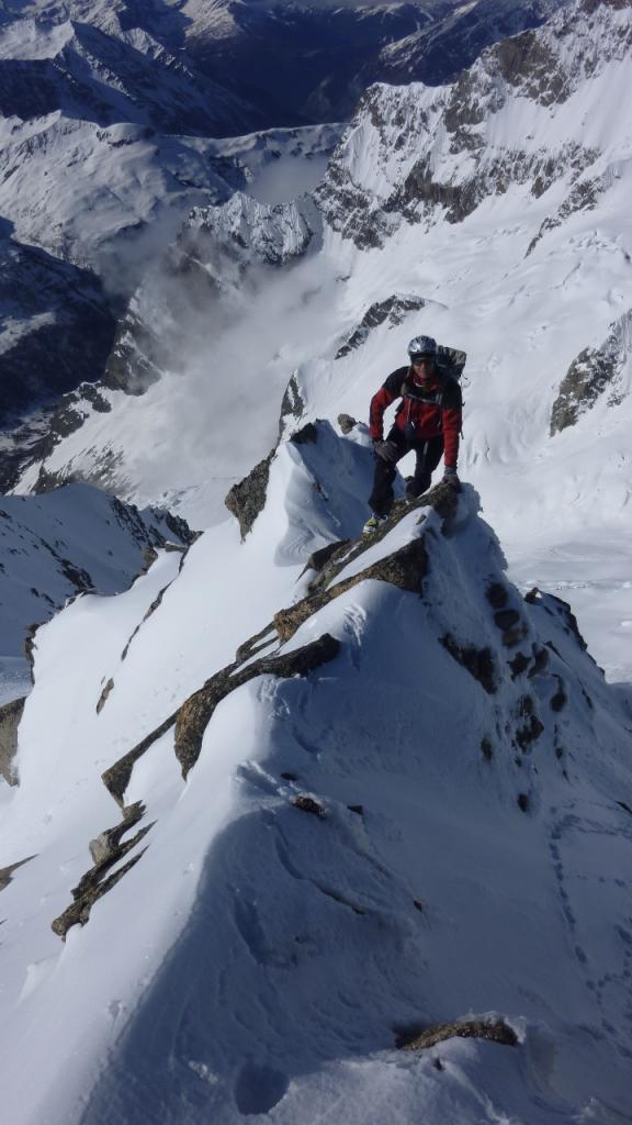
Si punta allora verso sinistra, su pendii sostenuti, a prendere un valloncello a sinistra di un evidente sperone. Si sale ad un colletto, da dove la capanna è visibile, si supera l’ultima seraccata salendo ad un pianetto dal quale si scende, sci ai piedi, all’isolotto roccioso del rifugio che si raggiunge dall’alto (2833m, 5h).
- Cartografia:
- Guida Vallot
- Bibliografia:
- Guida Vallot
Nelle vicinanze Mappa
Itinerari
20/04/2026 AO, Courmayeur D+ 1150 m BS Nord-Ovest
Entre Deux Sauts (Tète) da Planpincieux, giro dei Valloni Malatrà e Armina
 0m
0m
02/01/2026 AO, Courmayeur D+ 975 m BS Nord-Ovest
Bernarda (Testa) da Plampincieux
 0m
0m
27/05/2021 AO, Courmayeur D+ 1300 m OSA, F Nord
Battaglione Aosta (Colle) da Planpincieux
 50m
50m
17/02/2024 AO, Courmayeur D+ 1240 m BSA, F Nord-Ovest
Chéarfière (Mont) da Planpincieux
 50m
50m
18/01/2022 AO, Courmayeur D+ 1000 m MS Nord-Ovest
Tronche (Testa della) e Testa Bernarda da Planpincieux per il Vallone di Arminaz
 50m
50m
27/05/2021 AO, Courmayeur D+ 1200 m OSA, F Nord
Chambave (Colle di) da Planpincieux
 50m
50m
12/12/2015 AO, Courmayeur D+ 1120 m BSA Ovest
Bellecombe (Mont) o Bella Comba da Planpincieux
 50m
50m
27/05/2021 AO, Courmayeur D+ 1200 m OSA, F Varie
Curru (Tête du), anticima nord da Planpincieux
 50m
50m
11/05/2013 AO, Courmayeur D+ 2005 m OSA Sud-Ovest
Greuvetta o Gruetta (Mont) da Planpincieux
 50m
50m
18/02/2020 AO, Courmayeur D+ 770 m MS Nord-Ovest
Saxe (Mont de la) da Planpincieux
 50m
50m