2.2Km
2.2Km

Note
 0m
50m
4.5Km
4.9Km
4.9Km
7.6Km
8.7Km
8.7Km
10.3Km
0m
50m
4.5Km
4.9Km
4.9Km
7.6Km
8.7Km
8.7Km
10.3Km
Gita su terreno misto sentiero, pietraia, ghiaioni, e per alcuni tratti mancanza sentiero.In solitaria alla ricerca di valli e luoghi poco conosciuti.
Descrizione
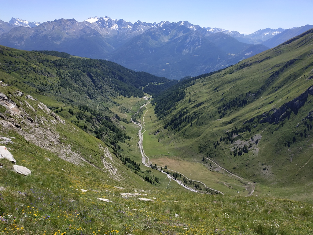
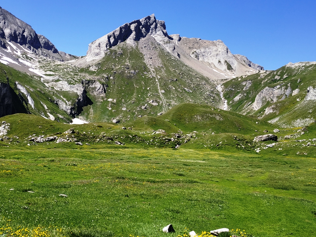
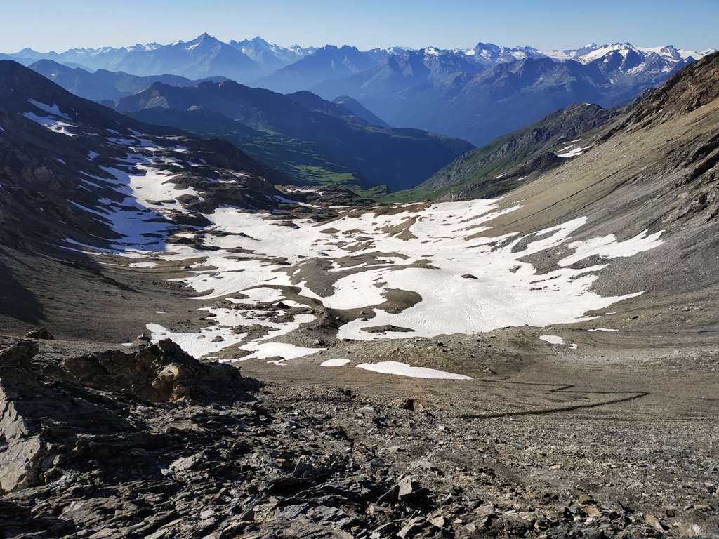
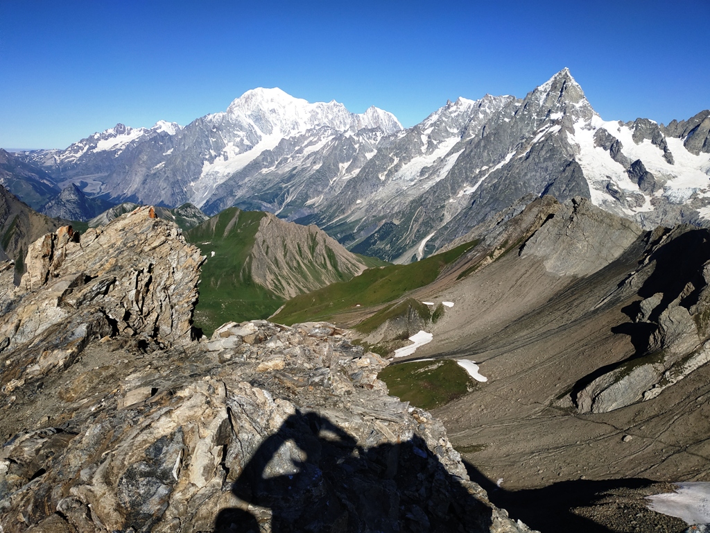
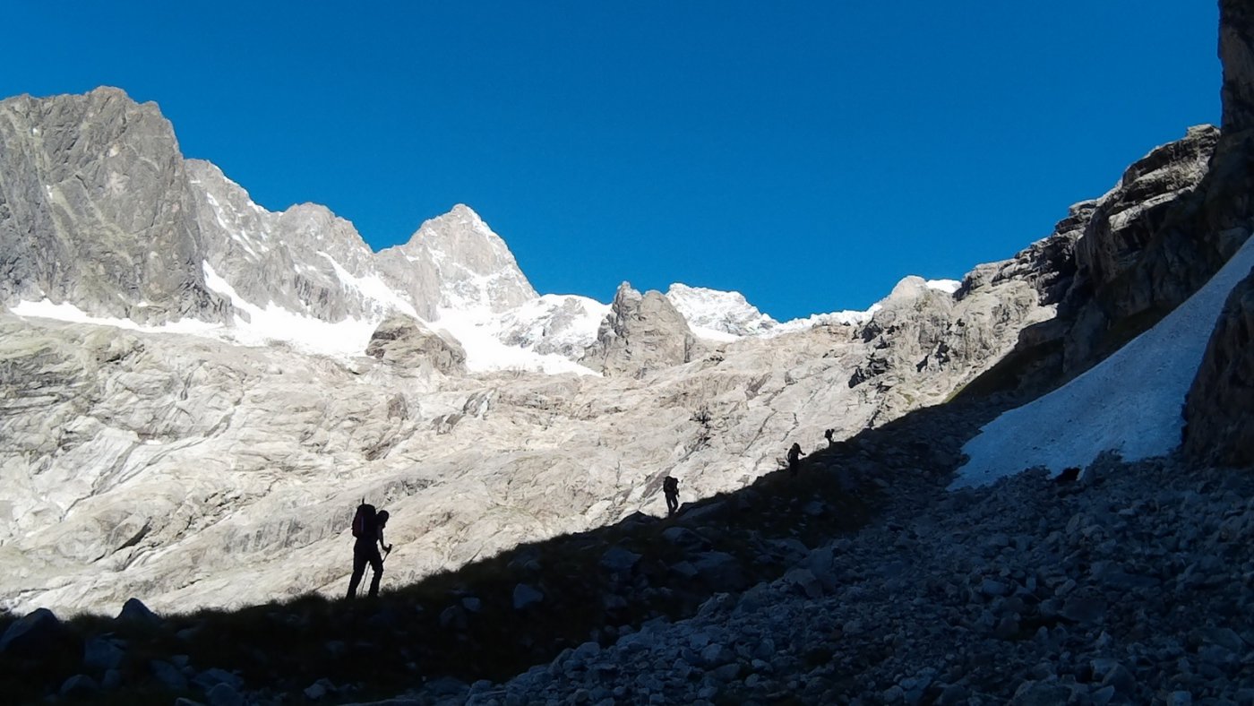
Da Planaval seguire strada sterrata che porta al alpe Les Ecules (1880) attraversare ponte di legno sulla dx e proseguire lungo sentiero ben marcato che conduce alla Capanna Bonalè (2340), proseguire tenendosi sulla dx del vallone in direzione del torrente che scende dal lac Bonalè(traccia di trattore poi sentiero appena marcato),raggiunto il torrente si sale la sponda (sx idrografica) per una cinquantina di metri per poi attraversare (ometti) e proseguire sulla sponda (dx idrografica) superare il ripido tratto che porta al ripiano superiore dove inizia la pietraia.
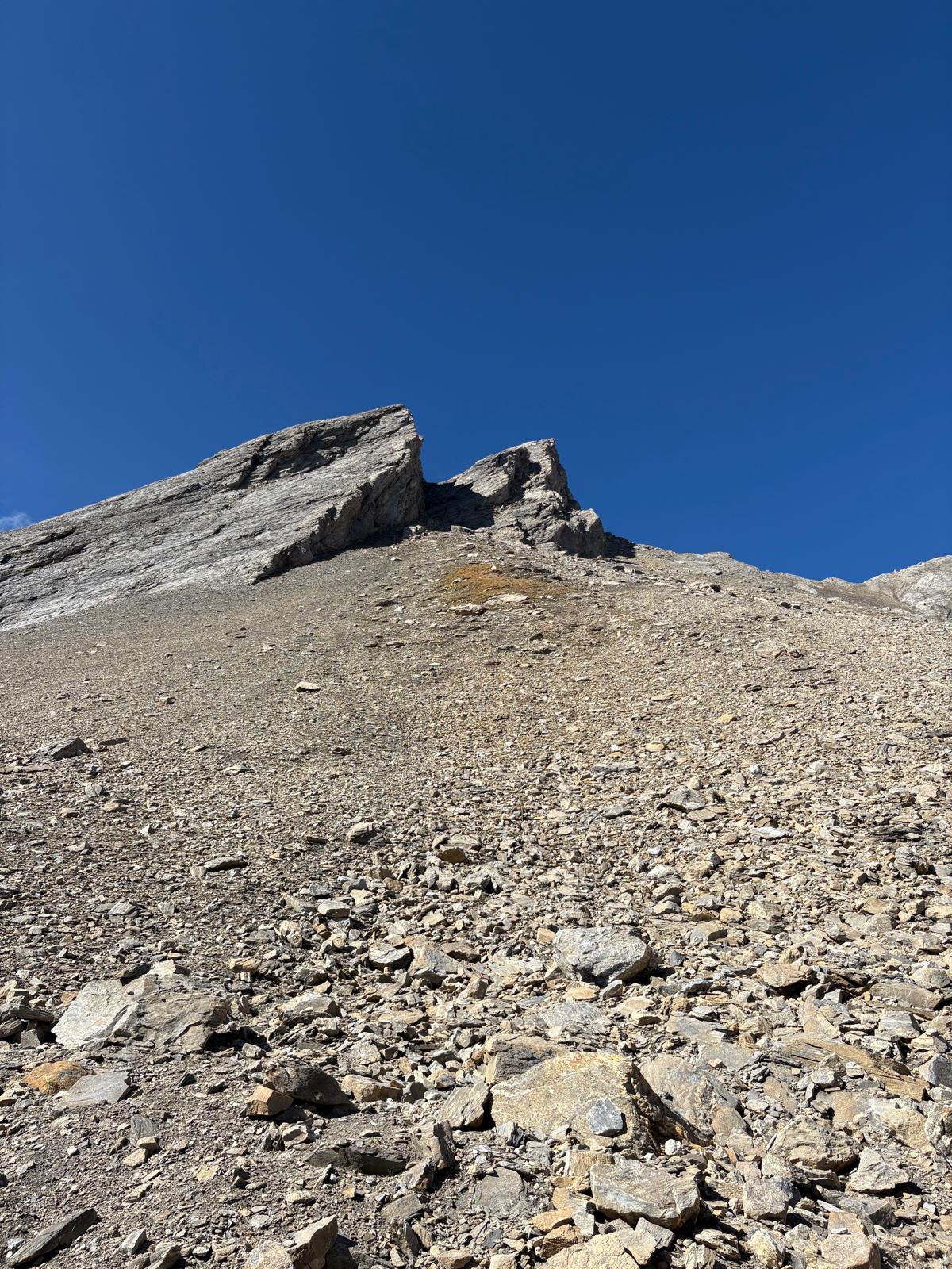
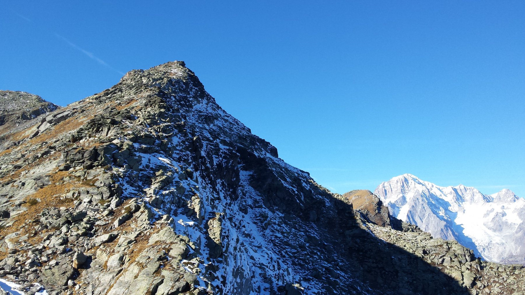
Stare sulla sx ogni tanto ometti fino al successivo ripiano da dove si scorge la guglia di Artanavaz, puntare in direzione dell’evidente sentiero che zigzagando porta alla cima,circa 3.00 ore 3.30.
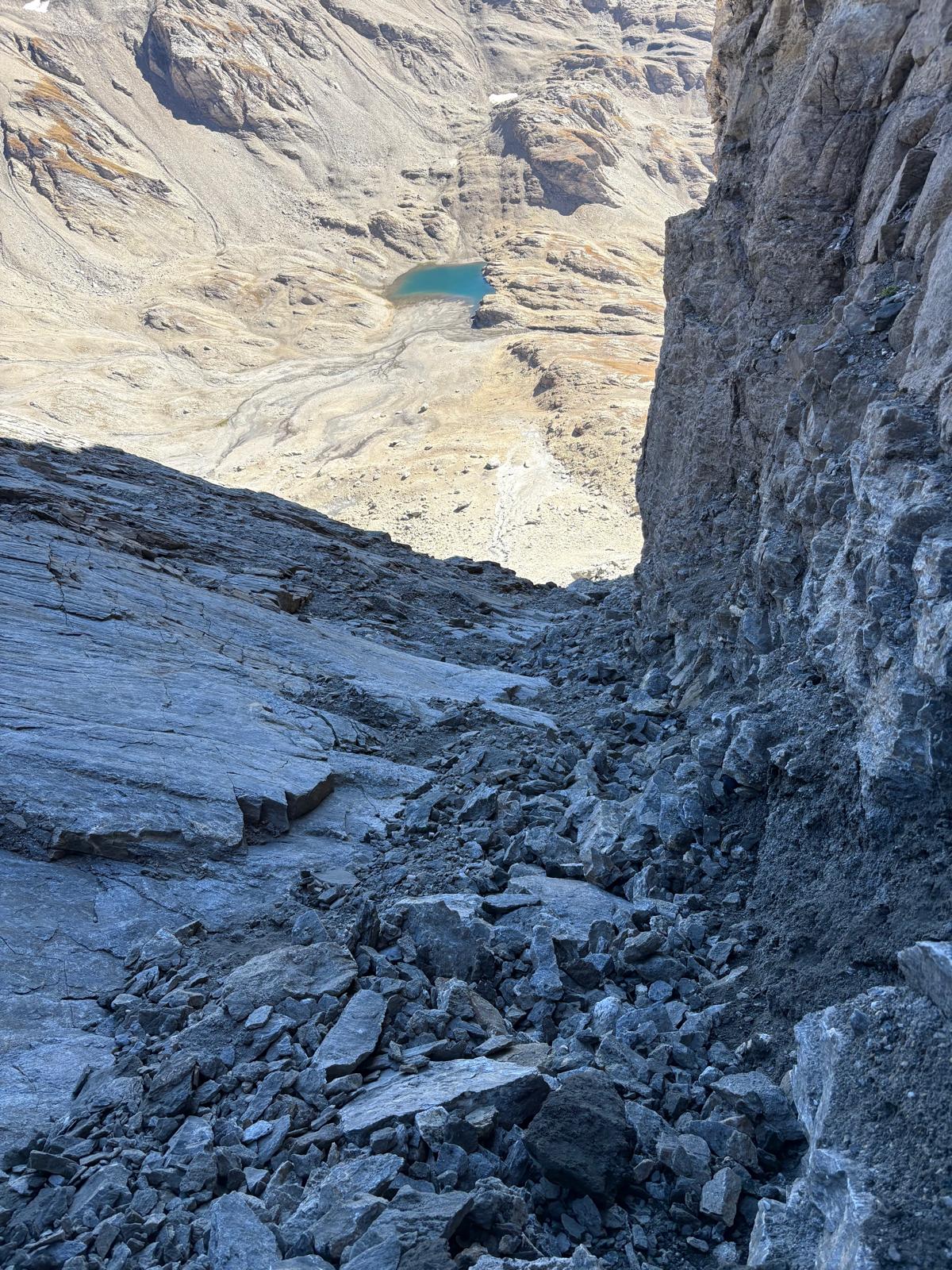
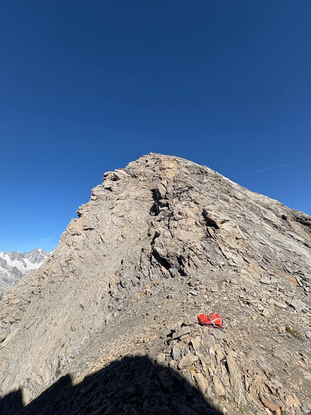
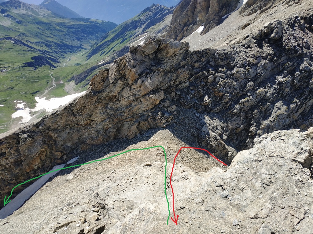
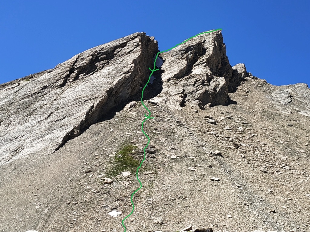
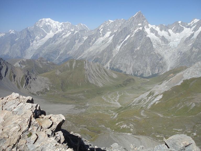
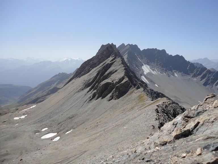
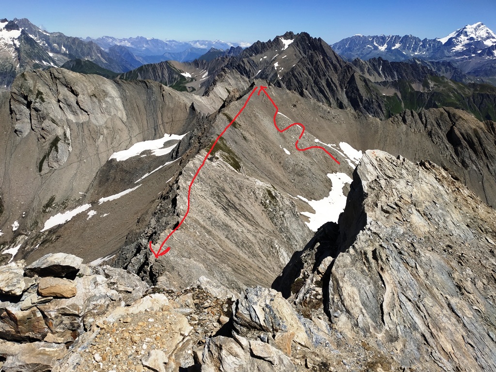
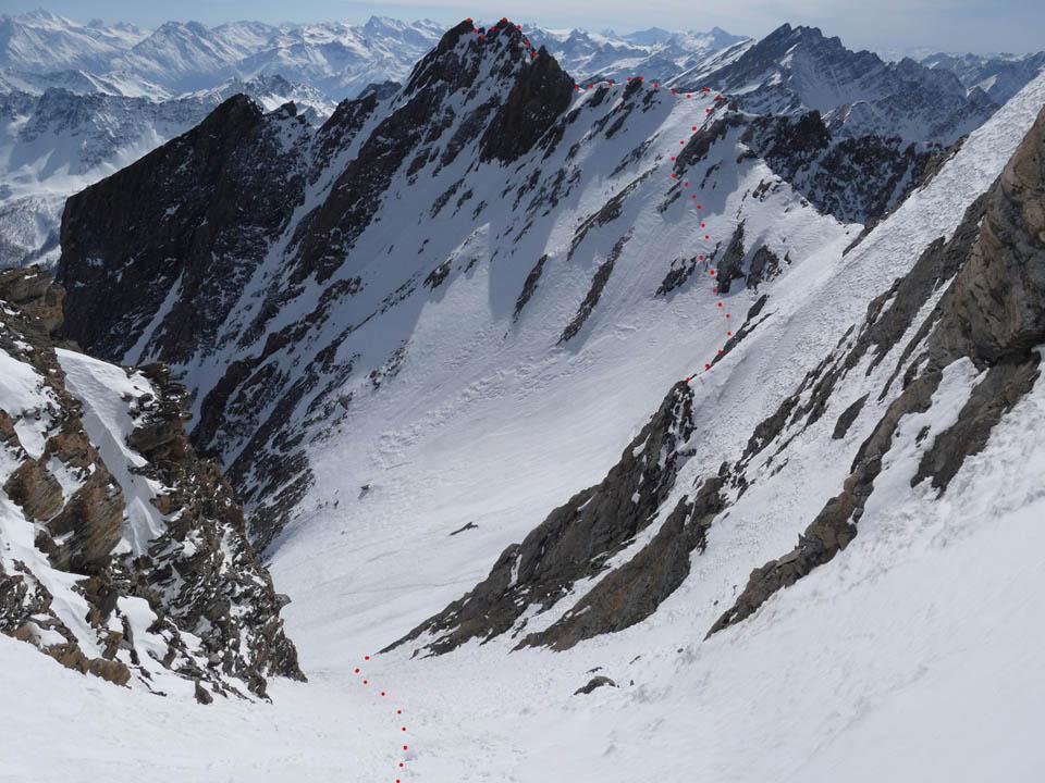
Da quì inizia il tratto più impegnativo, seguire la cresta in direzione sud superando brevi tratti di arrampicata fino sotto la guglia di Malatrà, aggirarla sulla dx perdendo un pò di quota, fino ad incontrare canalone che scende nel vallone di Malatrà (prestare attenzione tratto ripido e mobile un poco esposto). Risalire il canale fino alla sommità, proseguire sulla sx per placche inclinate o cresta fino alla cima. Il ritorno dalla stessa via oppure scendendo il ripido versante in direzione lac Bonalè fino a ricongiungere la via.
- Cartografia:
- igc monte bianco
Nelle vicinanze Mappa
Itinerari
11/07/2022 AO, La Salle D+ 1400 m F Sud
Chambave (Aiguille de) traversata creste NO-SE da Planaval
 0m
0m
11/10/2025 AO, La Salle D+ 1451 m F+ Sud-Ovest
Bonalè o Bonalex (Aiguille de) Via Normale da Planaval
 50m
50m
07/09/2024 AO, La Salle D+ 2700 m F Varie
Paramont (Becca Bianca del) da La Salle per il Passo Alto
 4.5Km
4.5Km
15/08/2011 AO, La Salle D+ 2500 m F+ Nord
Paramont (Mont) Via Normale da La Salle
4.9Km
11/09/2025 AO, La Salle D+ 2157 m F Varie
Paramont (Testa del) da Chabodey per il Passo Alto
 4.9Km
4.9Km
07/11/2015 AO, La Salle D+ 2000 m F+ Est
Pouegnenta o Pougnenta (Becca) da Chabodey per Monte Charvet e Croce Folliet
 4.9Km
4.9Km
12/07/2019 AO, La Salle D+ 767 m AD Nord-Est
Tor (Becca della) Via Abandonnée
 7.6Km
7.6Km
07/03/2012 AO, Saint-Rhemy-En-Bosses D+ 1700 m PD+ Varie
Grand Golliaz e Petit Golliaz da Mottes per Canale Sud del Petit Golliat e traversata
 8.7Km
8.7Km
19/06/2025 AO, Saint-Rhémy-En-Bosses D+ 1700 m PD Varie
Grand e Petit Golliat da Crevacol, anello per i colli di Belle Combe e Ceingles
 8.7Km
8.7Km
07/06/2026 AO, Courmayeur D+ 1230 m F+ Est
Gervasutti Giusto (Bivacco) da Lavachey
 10.3Km