350m
350m


Note
Storico
 1.7Km
1.8Km
1.9Km
1.9Km
1.9Km
1.9Km
2.3Km
2.3Km
2.3Km
1.7Km
1.8Km
1.9Km
1.9Km
1.9Km
1.9Km
2.3Km
2.3Km
2.3Km
350m
750m
900m
2.9Km
2.9Km
2.9Km
3.7Km
7.6Km
8.2Km
9.3Km
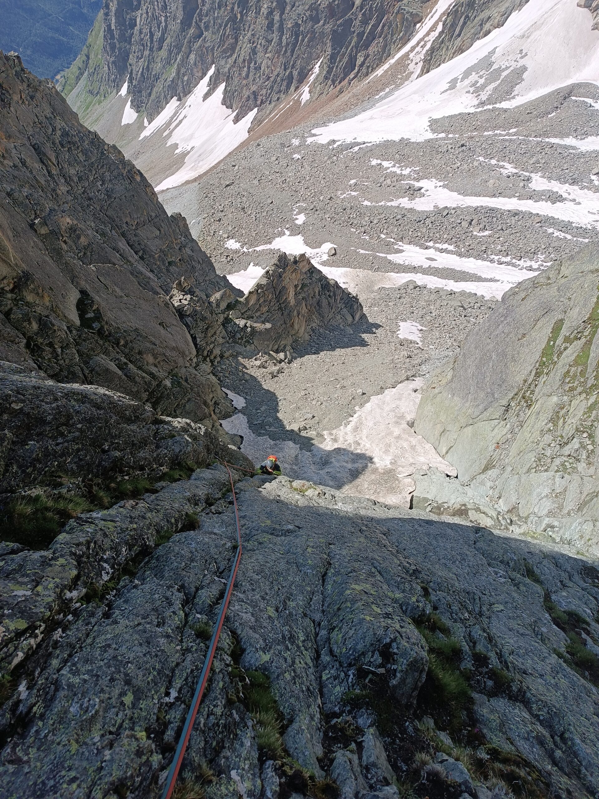
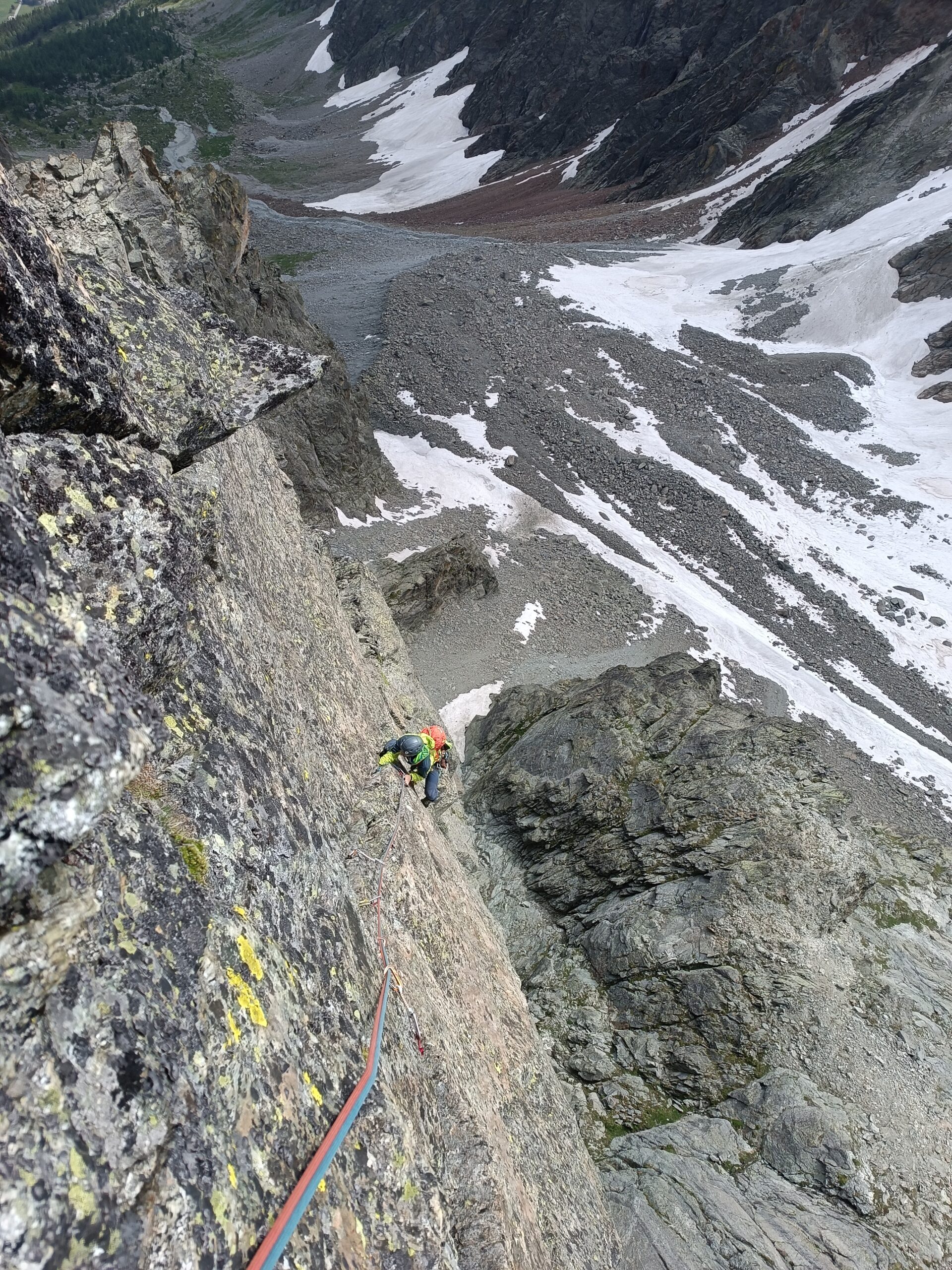
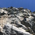
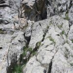
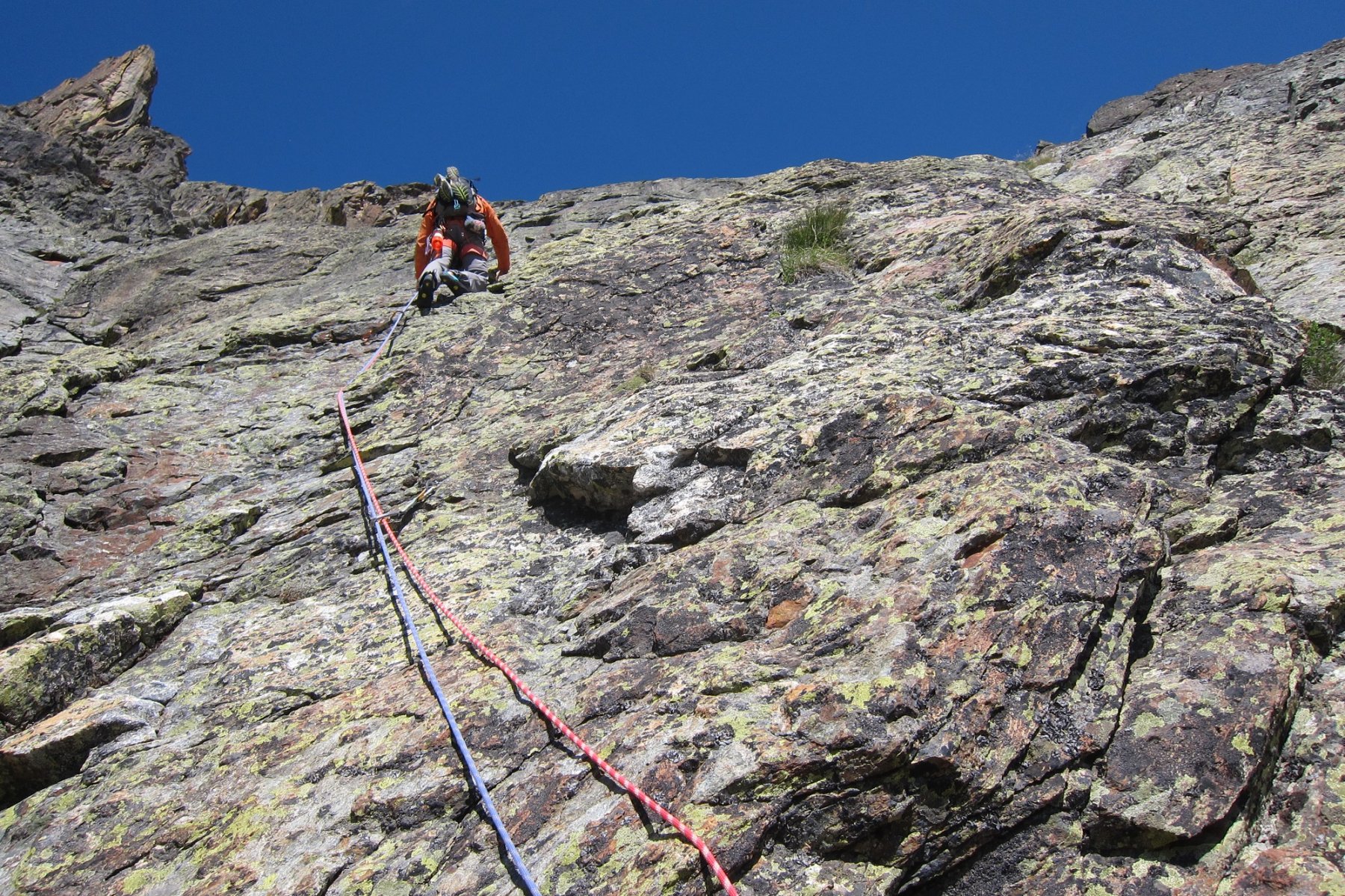
via di roccia aperta in stile tradizionale con difficoltà di 6a. Arrampicata in ambiente selvaggio e mai banale, a tratti esposta e verticale. Discesa facile sul versante opposto (lato Crête Sèche). Non sono state attrezzate le doppie sulla via.
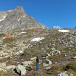
Avvicinamento
.
Descrizione
Da Ruz si sale nella selvaggia valle di Faudery seguendo il sentiero n. 1. Si prosegue oltre la fine del sentiero in direzione del colle di Faudery fino raggiungere i piedi della parete dell’ Aroletta Inferiore (sx orografica) a quota 2750 m. (3 ore ). In alternativa si può salire al rifugio Crête Sèche e poi si sale al colle dell’ Aroletta ( 1 ora e un quarto ) per poi scendere sul versante di Faudery con due doppie (50 m e 40 m) e attraversare sulla destra una spalla rocciosa per raggiungere così i piedi della parete della via.
La via è lunga 320 m con dei passaggi di 6a obbligatorio. Sono sette tiri e il primo e l’ ultimo sono da 60 m. Si svolge in prevalenza su roccia buona e spesso verticale.
C’è anche una variante diretta che alla fine del quarto tiro (due chiodi)invece di attraversare la cengia sulla destra prosegue lungo il diedro che obliqua sinistra per 25 m su difficoltà di 5 grado. Alla fine del diedro si può installare una sosta con una fettuccia su un’ evidente spuntone per ripartire poi due metri a sx lungo un nuovo diedro per lasciarlo subito e proseguire verticali su un piccolo strapiombo con scaglie instabili (1 chiodo). Proseguire lungo un diedro verticale uscendo sulla destra per fare la sosta (5 c) (25 m) (1 chiodo). Da questo punto si segue l’ estetica fessura che obliqua verso sinistra con passaggi in dulfer su roccia ottima e verticale che porta su una grande terrazza dove si può fare un’ altra sosta (6 a) (25 m) (2 chiodi). Portarsi alla fine della terrazza e passare sulla cresta dell’ Aroletta Inferiore, qui si trova l’ ultimo passaggio delicato della via (5 b) (due chiodi) e poi proseguire sulle facili placche che portano alla cima.
Discesa: dalla cima si scende verticalmente in conserva per circa 15 m lungo un evidente diedro. In questo modo si raggiunge una terrazza dove si trovano due chiodi dai quali si può fare una doppia di 60 m e appoggiare i piedi sulla traccia del sentiero che scende dalla via normale all’ Aroletta superiore. Seguire gli ometti fino al Plan de la Sabla e scendere al rifugio lungo il sentiero n 2. Non sono mai state fatte delle doppie dalla via.
La via è stata aperta il 07-09-'09 da Bernard Marnette e Daniele Pieiller.
- Cartografia:
- l' escursionista editore
- Bibliografia:
- Ardennes et Alpes di B. Marnette gennaio 2010 n. 163 / La Rivista della Montagna di D. Pieiller luglio 2010
Nelle vicinanze Mappa
Itinerari
03/08/2025 AO, Bionaz 5c, 5a obbl. Sud-Est
Giordy (Pilastrino) Cédric
 1.7Km
1.7Km
21/08/2022 AO, Bionaz 6b+, 6a+ obbl. Sud
Crête Sèche (Mont), Pilier Petey – Noah
 1.8Km
1.8Km
09/09/2023 AO, Bionaz 6b+, 6a+ obbl. Sud-Est
Crête Sèche (Mont), Falesia Berier – Baroni Volanti
 1.9Km
1.9Km
18/08/2023 AO, Bionaz 6b, 6a+ obbl. Sud
Crête Seche (Mont), Pilier Petey – Via Rattevoladzo
 1.9Km
1.9Km
01/08/2024 AO, Bionaz 6b+, 6a obbl. Sud-Est
Aroletta (Aiguille de l’) – Fantascienza
 1.9Km
1.9Km
18/07/2021 AO, Bionaz 6b+, 6a+ obbl. Sud-Est
Aroletta (Aiguille de l’) – Tatone
 1.9Km
1.9Km
24/08/2025 AO, Bionaz 5c, 4 obbl. Sud-Est
Aroletta (Vierge de l’) – Oriana
 2.3Km
2.3Km
16/08/2025 AO, Bionaz 6a+, 6a obbl. Sud
Crete Seche (Mont), contrafforti – Gipeto
 2.3Km
2.3Km
03/07/2022 AO, Bionaz 6a, 5c obbl. Sud-Est
Aroletta (Vierge de l’) – Cono Rovesciato
 2.3Km
2.3Km
19/08/2012 AO, Bionaz 6b, 6a obbl. Sud-Ovest
Crête Sèche (Mont) – Gola Seche
2.3Km
Servizi
350m
750m
Crête Sèche Rifugio
Bionaz
900m
La Maison d’Antan Albergo
Bionaz
2.9Km
Clé du Paradis B&B
Bionaz
2.9Km
Valentino Albergo
Bionaz
2.9Km
Betemps B&B
Bionaz
3.7Km
Alpe Rebelle B&B
Bionaz
7.6Km
Vecchio Suisse Ristorante
Valpelline
8.2Km
Lievre Amoureux Albergo
Valpelline 9.3Km
9.3Km