100m
100m
Note
Storico
 100m
100m
100m
100m
1.8Km
3.1Km
3.7Km
5.4Km
5.9Km
5.9Km
100m
100m
100m
100m
1.8Km
3.1Km
3.7Km
5.4Km
5.9Km
5.9Km
100m
1.6Km
1.8Km
1.8Km
1.8Km
5.1Km
5.1Km
5.1Km
5.1Km
6.5Km
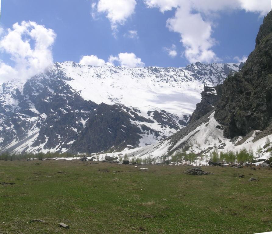
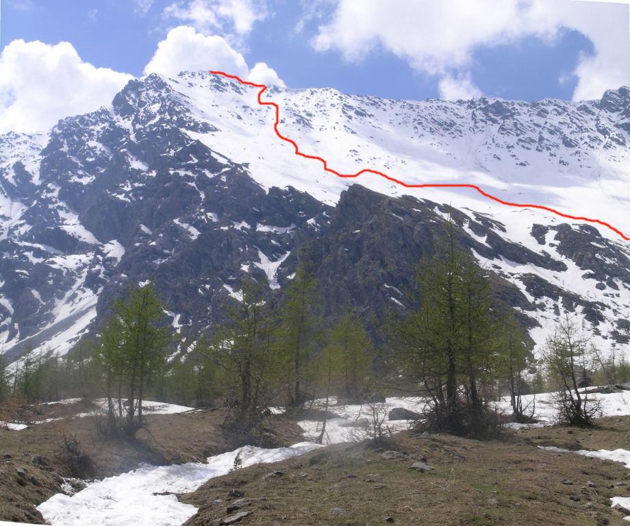
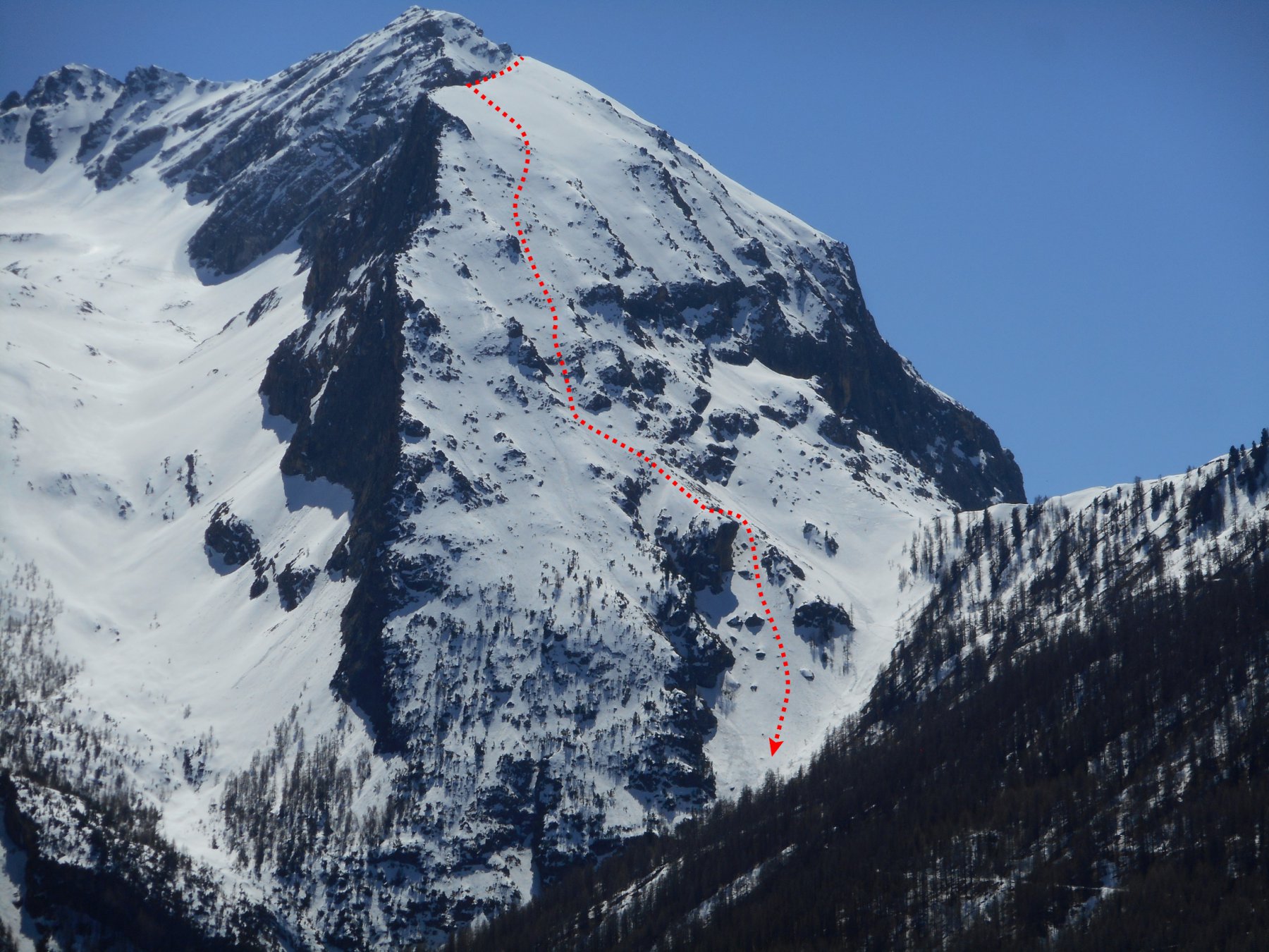
Questa parete presenta diversi itinerari ed è indicata in modo molto diversi su varie guide. Corrisponde in realtà al n. 31 di "Ripido!" (Costiera Clausi-Merciantaira) e al n. 642 del Grilli - Alpi Liguri - Valle Susa, che lo chiama, e dovrebbe essere la dizione più corretta, "Cresta di Terrarossa" m.3265, infatti Cima Clausi è più bassa (3211) e un chilometro più a ovest.
Comunque tutta la costiera, da cresta Terrarossa sino a Cima Clausi, presenta caratteristiche simili, anche se entra più difficilmente in condizioni.
Avvicinamento
Comunque tutta la costiera, da cresta Terrarossa sino a Cima Clausi, presenta caratteristiche simili, anche se entra più difficilmente in condizioni.
.
Descrizione
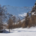
Da Thures si raggiunge lungo la stradina del fondovalle Ruilles, quindi sempre seguendo la vallata si ariva dopo un lungo percorso alle Grange Thuras Inferiori e Superiori.
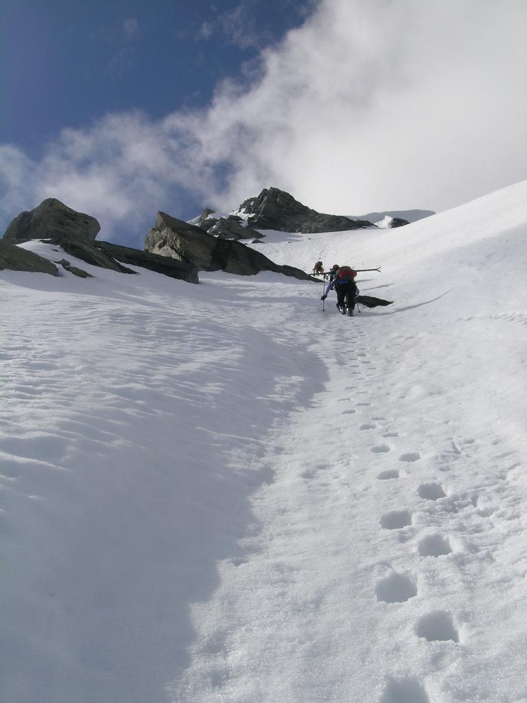
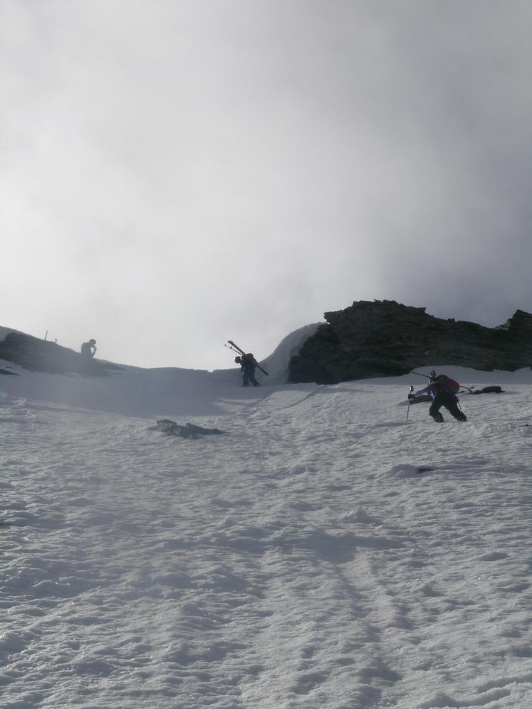
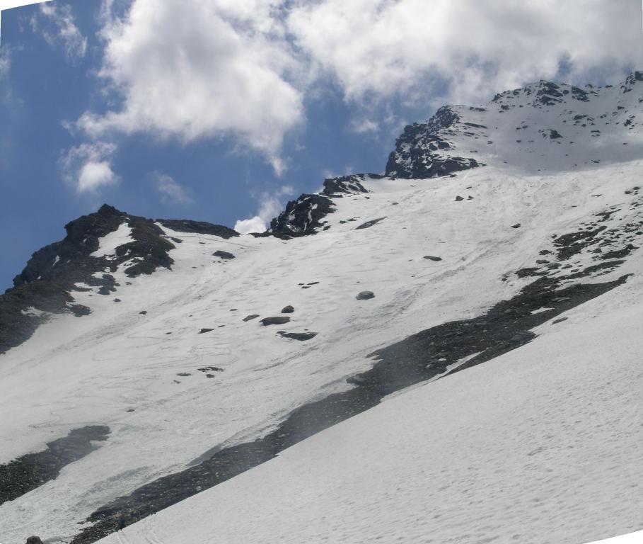
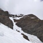
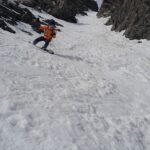
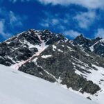
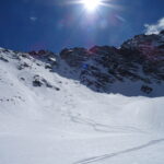
Dopo aver proseguito lungo la valle per altri 30-40 minuti, salire a destra per un evidente conoide che si origina dal vallone compreso fra Terra Nera e Cresta di Terra Rossa. Superato un tratto più ripido, voltare a sinistra e dirigersi verso l’evidente parete della cresta di Terrarossa da cui si originano diverse costole rocciose e canalini. I più seguiti sono il primo a sinistra (vedi “Ripido!”) e il successivo, cioè il secondo da sinistra. Usciti in cresta, in pochi minuti a piedi si raggiunge seguendo la cresta a sinistra, la cima 3265 m.
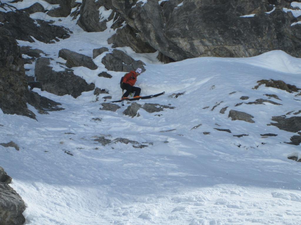
In discesa, nella parte alta, alcuni massi sporgenti richiedono attenzione, poi il pendio si allarga.
Prima discesa Maurizio Bovo - Marco Pitet 15.6.1980
- Bibliografia:
- Grilli (Alpi Liguri-Valle Susa 642) -
Nelle vicinanze Mappa
Itinerari
18/12/2016 TO, Cesana Torinese D+ 1650 m III, 4.2, E3 Ovest
Boucher (Roc del) Versante O/NO
 100m
100m
06/04/2023 TO, Cesana Torinese D+ 1650 m II, 4.3, E4 Ovest
Boucher (Roc del) versante Ovest
 100m
100m
26/12/2021 TO, Cesana Torinese D+ 1200 m 4.2, E2 Varie
Furgon (Monte) Canale SO
 100m
100m
19/03/2026 TO, Cesana Torinese D+ 1317 m II, 4.1, E1 Nord
Clausi (Cima) o Cime de Clausis Parete Nord
 100m
100m
24/04/2024 TO, Cesana Torinese D+ 1500 m II, 3.3, E1 Sud
Terra Nera (Monte) versante Sud
 1.8Km
1.8Km
26/04/2026 TO, Cesana Torinese D+ 1565 m II, 4.2, E2 Nord-Est
Merciantaira (Punta) o Grand Glaiza Canale obliquo E/NE
 3.1Km
3.1Km
16/04/2017 TO, Sauze di Cesana D+ 1230 m 4.3, E3 Nord-Ovest
Furgon (Monte) Parete NO
 3.7Km
3.7Km
01/04/2021 TO, Cesana Torinese D+ 1485 m IV, 4.3, E4 Nord-Est
Boucher (Roc del) parete NE
 5.4Km
5.4Km
23/05/2025 TO, Sauze di Cesana D+ 1620 m II, 4.2, E2 Nord-Est
Pelvo (Cima del) Canale Morandini
 5.9Km
5.9Km
08/04/2023 TO, Sauze di Cesana D+ 1625 m III, 5.1, E2 Nord-Est
Serpentiera (Punta) Canale NE
 5.9Km
5.9Km
Servizi
100m
1.6Km
Centro Ristorante
Cesana Torinese
1.8Km
La Crota B&B
Cesana Torinese
1.8Km
da Carlo Rifugio
Cesana Torinese
1.8Km
La Tana degli Orsi B&B
Cesana Torinese
5.1Km
L’Ibarus Rifugio
Cesana Torinese
5.1Km
Piergiorgio Frassati B&B
Cesana Torinese
5.1Km
Casa Cesana Bar
Cesana Torinese
5.1Km
Ottima Scelta Ristorante
Cesana Torinese
6.5Km